Storm on deck for B.C. could swing through with impactful winds, alpine snow
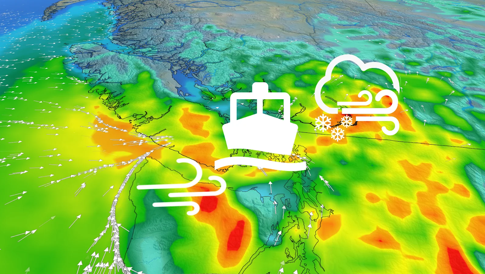
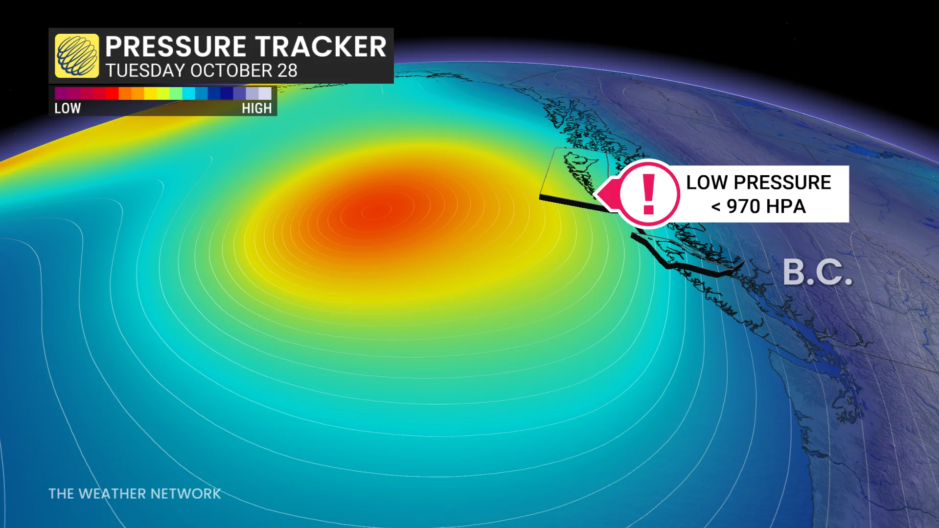
A vigorous low approaching the B.C. coast on Tuesday will generate intense, possibly damaging winds and waves, alongside heavy alpine snow for the mountain passes. Ferry interruptions and difficult travel are possible
B.C. can expect more stormy weather this week as an active pattern sticks around, with unsettled conditions anticipated in the days up to and on Halloween, too--and beyond.
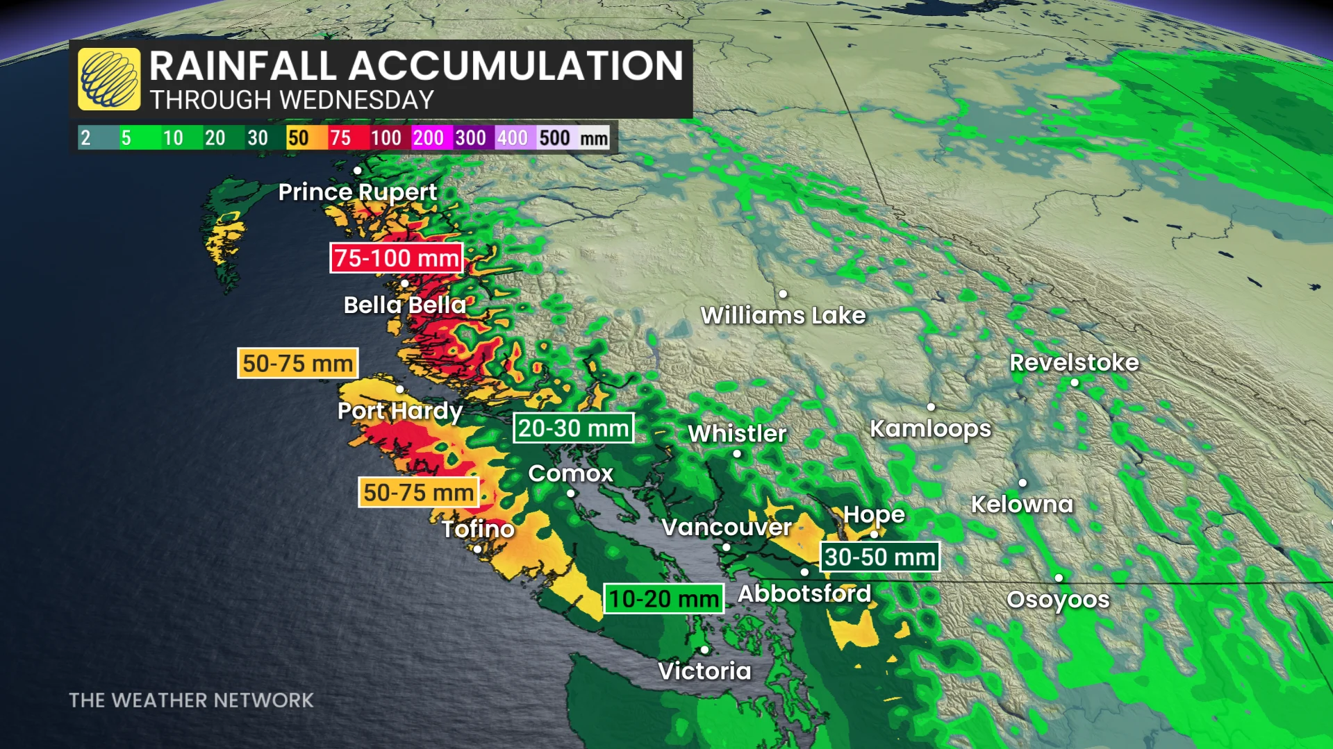
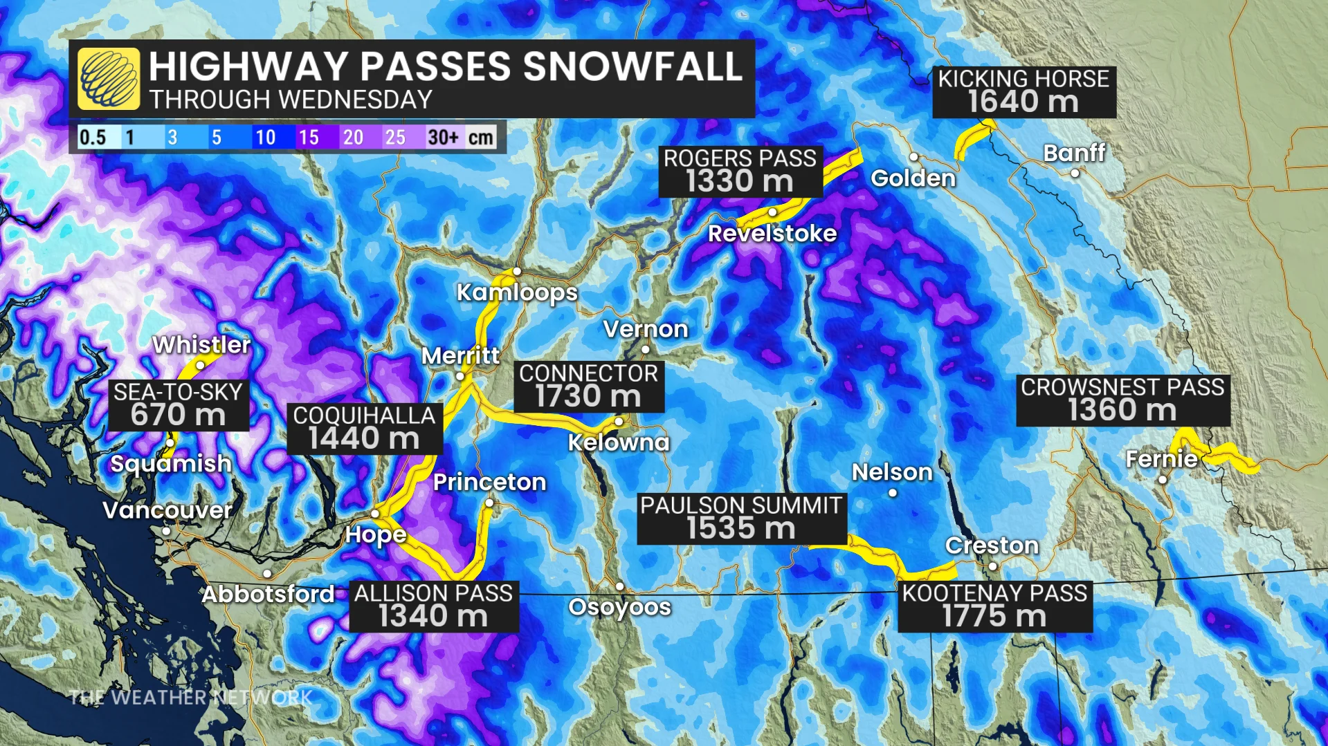
A powerful Pacific storm will track in on Tuesday, with wind warnings in effect for the coast ahead of its arrival. Widespread, heavy rain will develop across the South Coast. Alpine snow will impact travel through the higher mountain passes as heavy amounts are expected.
DON'T MISS: Blue jays love to steal paint chips off houses. Here's why
In addition to the snow and rain, potent wind gusts will be an issue with the incoming system on Tuesday. With gusts of 70-100+ km/h in some areas, expect difficult travel on the mountain passes and possible ferry delays and/or cancellations.
There will be some breaks between systems, but it looks like a potent and soggy storm, possibly an atmospheric river, will impact the region for Halloween. The wet pattern will continue into the early days of November, as well.
Heavy mountain snow, rain, blustery winds teeing up on the B.C. coast for Tuesday
Don't put away the rain gear just yet. Another storm system will approach the coast on Tuesday.
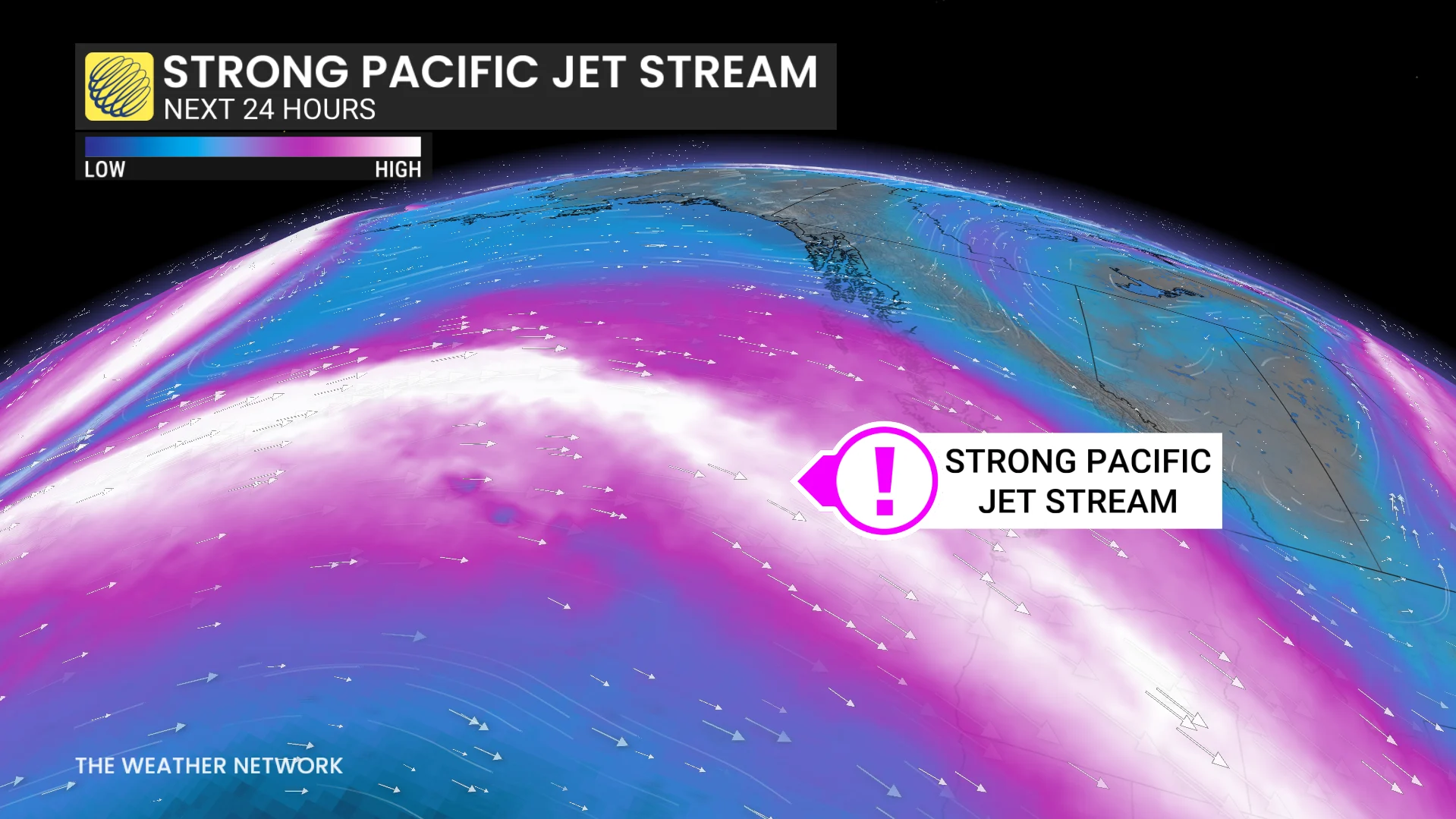
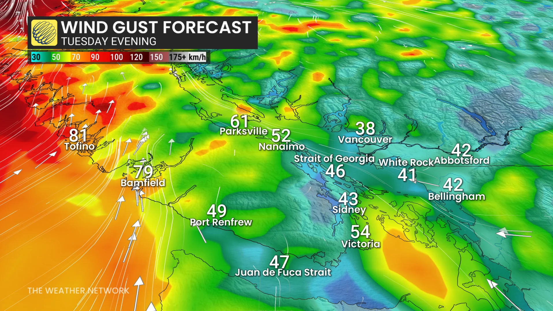
A new wave of strong winds hits the northern and central coasts by early Tuesday afternoon. Coastal sections could see gusts exceeding 100 km/h.
Wind gust projections:
Haida Gwaii: 110 km/h
Bella Bella:90-110 km/h
Northern Gulf Islands: 80-90 km/h
Campbell River: 70 km/h
Comox:80 km/h
Tofino: 80 km/h
Port Hardy: 70 km/h
Greater Victoria (near water): 70 km/h
Greater Victoria (general): 40-60 km/h
Southern Gulf Islands: 50-70 km/h
Vancouver airport: 60 km/h
The forecast of the wind gusts is enough to prompt wind warnings from Environment and Climate Change Canada (ECCC). Extended power outages, branch damage and ferry disruptions and/or cancellations are possible.
"Loose objects may be tossed by the wind and cause injury or damage. High winds may result in power outages and fallen tree branches," ECCC warns.
Strong, southeasterly winds ahead of the low-pressure system will peak Tuesday evening as the system lifts towards the North Coast.
Showers and high-elevation snow begins early Tuesday along the edge of the warm front, with another pulse of moisture arriving in the evening and overnight as the cold front crosses the South Coast.
More than 30 cm of snow is likely above 1800 metres in the alpine, with locally more than 50 cm of snow for the northern portions of the Coast Mountains.
Scattered showers and high-elevation snow-showers linger into Wednesday.
A brief break is expected late Wednesday and Thursday, but the next storm will bring another widespread soaking rain on Friday--potential low end atmospheric river event-–but the heaviest rain could diminish towards the evening. Another system is expected to bring periods of rain for Saturday.
A wet pattern is expected to continue through at least the first 10 day of November with above-normal precipitation totals. Temperatures will be cooler than seasonal during this first half of this week.
WATCH: Why driving in rain can be more dangerous than snow
Stay with The Weather Network for the latest across British Columbia