Hello summer? Starting the season with some 'substantial' snow totals
Friday marks the start of summer, but in parts of B.C. and Alberta, the weather will feel more like mid-spring, with chilly temperatures and even some snow in the forecast
Nothing says the start of a Canadian summer quite like some significant snow totals.
Summer officially begins on Friday, and right on cue is some high elevation snowfall expected for the central and southern Rockies this weekend.
DON'T MISS: Weather pattern flips hit Canada's summer for July and August
"Substantial snow totals are expected along some of the high elevations hiking trails," says Dr. Doug Gillham, Senior Meteorologist at The Weather Network.
What's contributing to the June snow?
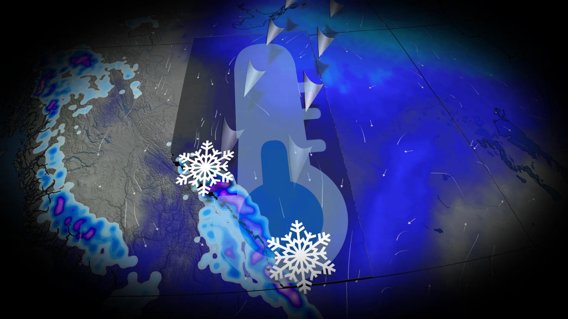
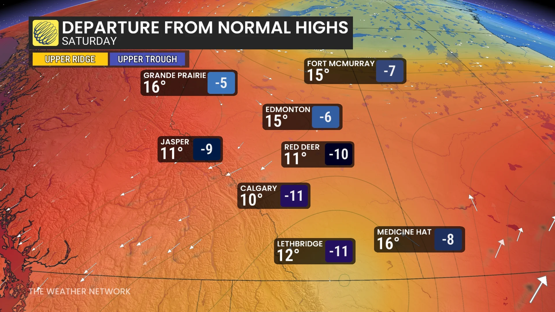
A deep trough over B.C. and Alberta is paving the way for colder northeastern air to move into the region beginning Friday. Temperatures will drop significantly, ranging 5–12°C below seasonal averages by Saturday.

Perspective: The last time Calgary hit 10°C in the month of June was back on June 17, 2010.
SEE ALSO: Potential flooding weekend rain in Alberta
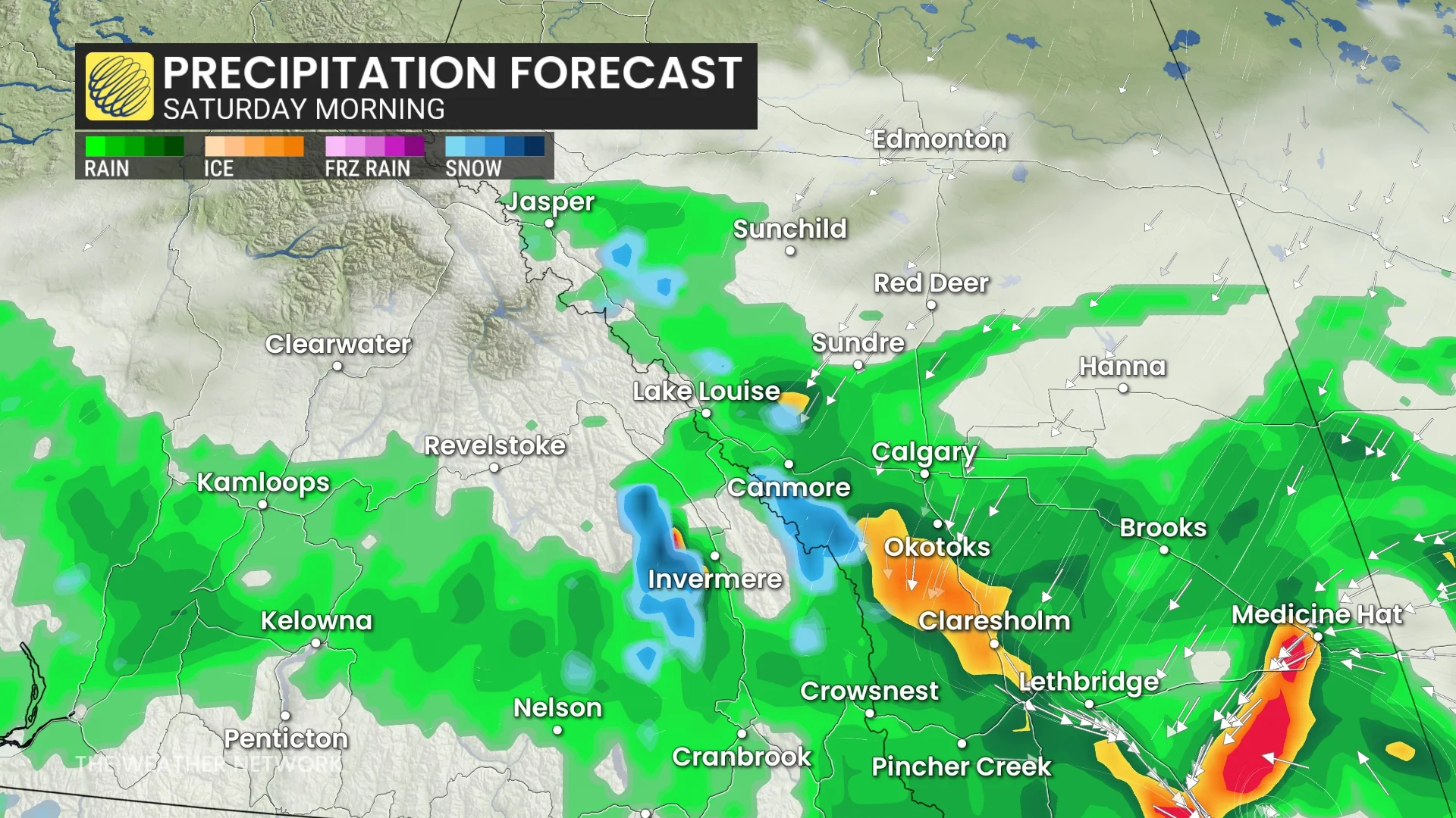
As this cooler air settles in, freezing levels will lower, accompanied by gusty winds. A slow-moving low-pressure system lingering south of the border in Montana will stall over the area. It brings rainfall to the southern foothills on Friday, which is expected to persist through Sunday.

How much snow are we talking?
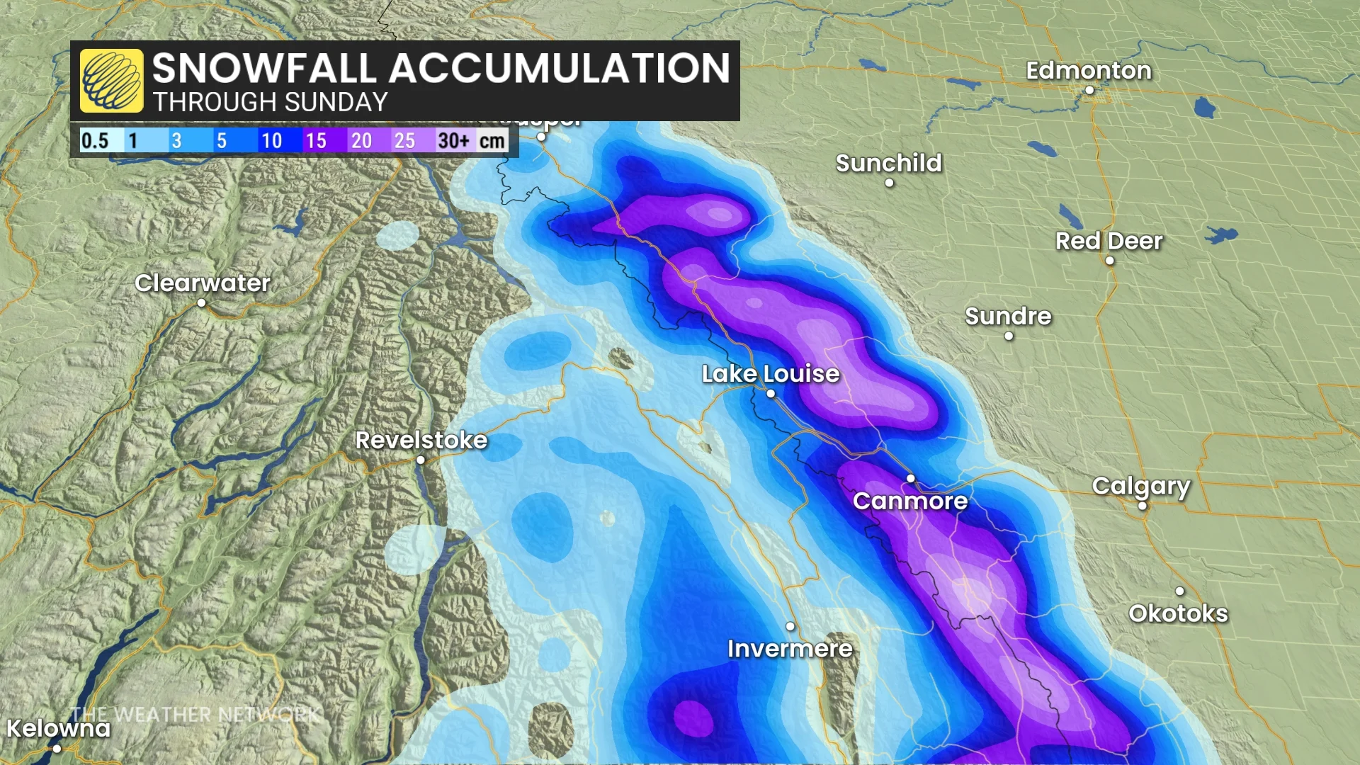
As temperatures fall on Friday night, rain will transition to snow in higher elevations. Freezing levels are forecast to drop to around 2,000 m, with significant snowfall likely in mountainous terrain.
Accumulations of up to 20 cm are possible over the highest elevations.

Major travel disruptions are anticipated for Highwood Pass and southern sections of Highway 93. Travelers should prepare for challenging driving conditions over the weekend.
