10-30+ cm: Calgary, other locales on the Prairies face major spring snowstorm
Winter has returned to the Prairies with a vengeance. A messy, cold storm is set to blast the region with a swath of heavy snow, potentially hitting 10-30+ cm of snow for some areas, including Calgary
A significant mid-April snowfall is set to impact the Prairies this week.
Hazardous travel is expected on the Trans-Canada and Yellowhead highways across Alberta, Saskatchewan, and Manitoba through Thursday. Blowing and drifting snow could reduce visibility, with 10-30+cm possible in some areas, including in Calgary, Alta. Locally, some areas could even see up to 40 cm of snow.
Be sure to check the road conditions before heading out.
Weather Highlights:
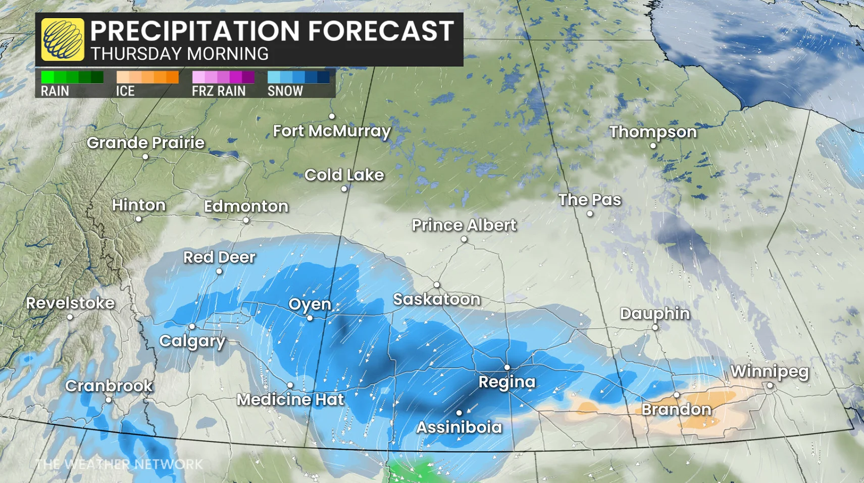
Heaviest snowfall for southern Alberta expected Wednesday overnight into Thursday morning, will then push across Saskatchewan and Manitoba Thursday with strong winds
A large swath of 10-30+cm of snow is forecast through Friday, including in Calgary
Travel hazards with blowing snow and reduced visibility is likely
Snowy and messy conditions could disrupt Thursday commutes
DON'T MISS: Summer Sneak Peek: El Niño may split Canada’s summer in two
Brace for difficult travel as rounds of spring snow hit the Prairies
The second and stronger system, developing over Montana, will combine with high pressure sinking in from the north.
Snowfall across central and southern Alberta will continue Wednesday overnight and into Thursday, as a more organized band spreads across southern regions of the province, as well as Saskatchewan and Manitoba.

The heaviest snow is expected Wednesday overnight into Thursday morning for communities in southern Alberta and along the QE2, including Calgary.
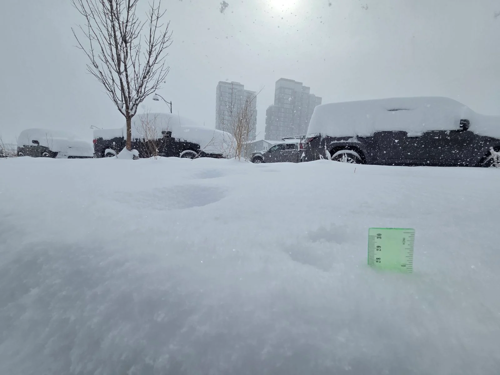
Local bands of heavy snow will dump significant snowfall rates over parts of southern Alberta into Thursday morning. Snowfall totals have increased for Calgary and surrounding regions, with 20-30 cm possible.
Local snowfall totals of 30-40 cm is possible in parts of eastern Alberta.

Milder air could lead to icy precipitation in Assiniboia to Brandon Thursday morning, with rain possible near the U.S. border.
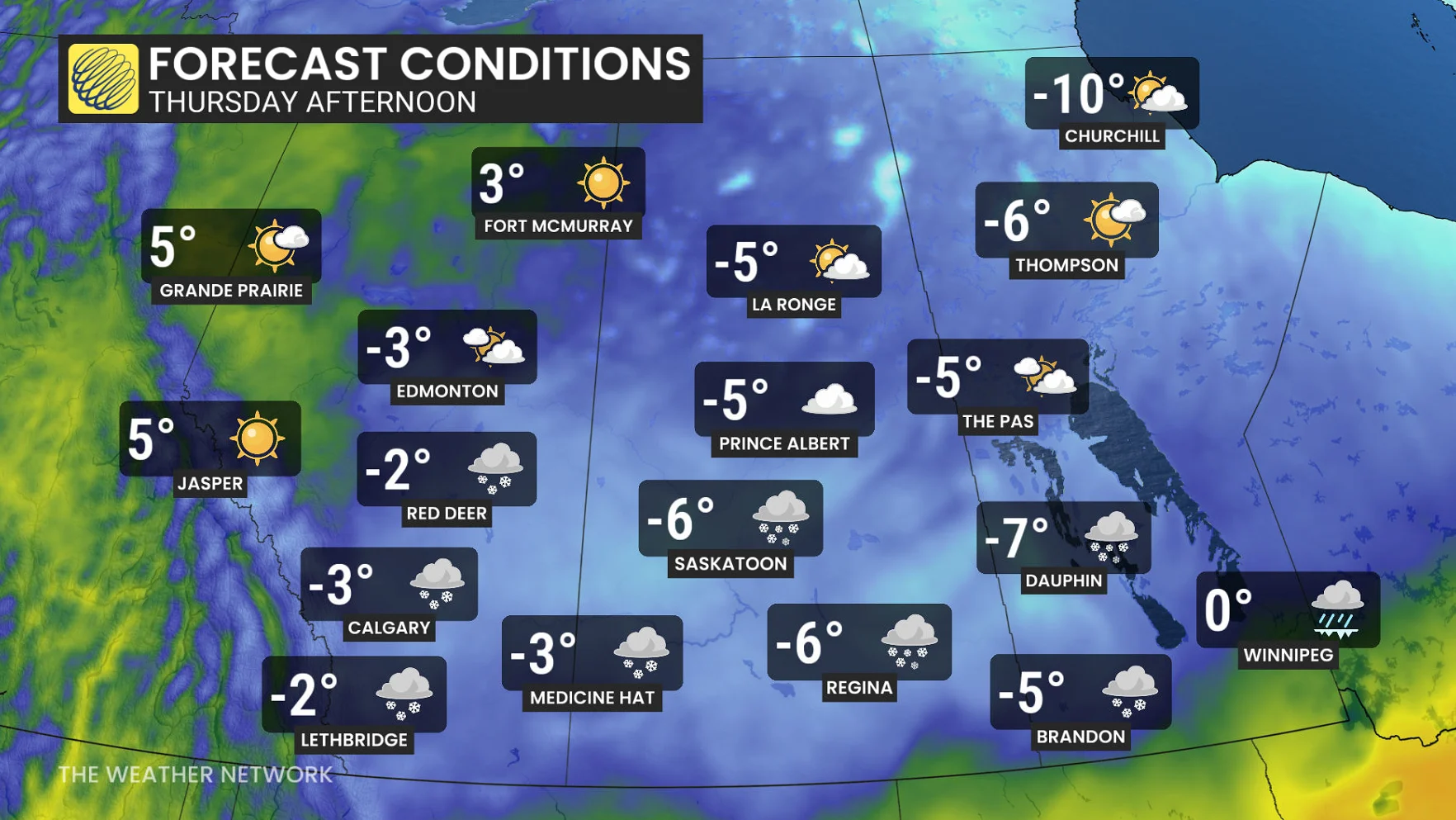
Gusty winds between 30-60 km/h could further reduce visibility.
RELATED: Canada’s snow season turns historic as multiple cities top 500 cm
Hazardous travel is expected on the Trans-Canada and Yellowhead highways due to blowing and drifting snow. Temperatures will drop quickly Thursday, creating slick roads.
Snowfall amounts of 10-20+ cm are forecast, with localized totals nearing 30 cm. Red Deer is expecting 20 cm, Calgary around 12 cm, and Regina over 20 cm.
Flood concerns as another system, warmer weather targets Manitoba
A third system may bring another round of mixed precipitation to Winnipeg on Thursday night, although details regarding amounts and impacts remain uncertain. Residents should prepare for potential commuting delays on Friday morning.
Additionally, in the first flood bulletin of the season issued on Tuesday, Manitoba Transportation and Infrastructure’s Hydrologic Forecast Centre stated that it continues to monitor the potential for spring flooding.
"With warmer weather forecasted for this week, there is an increased flood risk in the Interlake region, including the Icelandic River and Fisher River basins, as well as an elevated risk of overland flooding in the Parkland region," the statement read. "Flood risk remains moderate to low elsewhere in the province."
The latest flood forecast information can be found on the Manitoba River Conditions and Forecasts Web Map.