
Spring-like thunderstorm and tornado risks pop up on Thursday
Don’t be surprised if you hear additional rumbles of thunder across parts of southern Ontario through the Thursday evening commute
A spring-like risk for thunderstorms exists across portions of the Great Lakes on Thursday as an active pattern draws instability into the region.
Thursday’s renewed risk arrives just one day after a rare bout of thunderstorms that produced freezing rain in southern Ontario on Wednesday.
DON’T MISS: Don’t fall victim to these seven dangerous tornado myths
Thunderstorm risk grows over the Great Lakes on Thursday
A touch of instability moving into the Great Lakes region triggered a thunderstorm that produced pea-size hail in southwestern Ontario earlier Thursday afternoon.
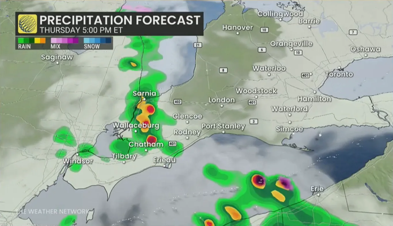
We may see additional scattered thunderstorms push into the region heading into Thursday evening, possibly arriving just as folks head home from work.
Ontario’s thunderstorms will remain below severe limits. The most favourable dynamics for severe weather exist south of the border.
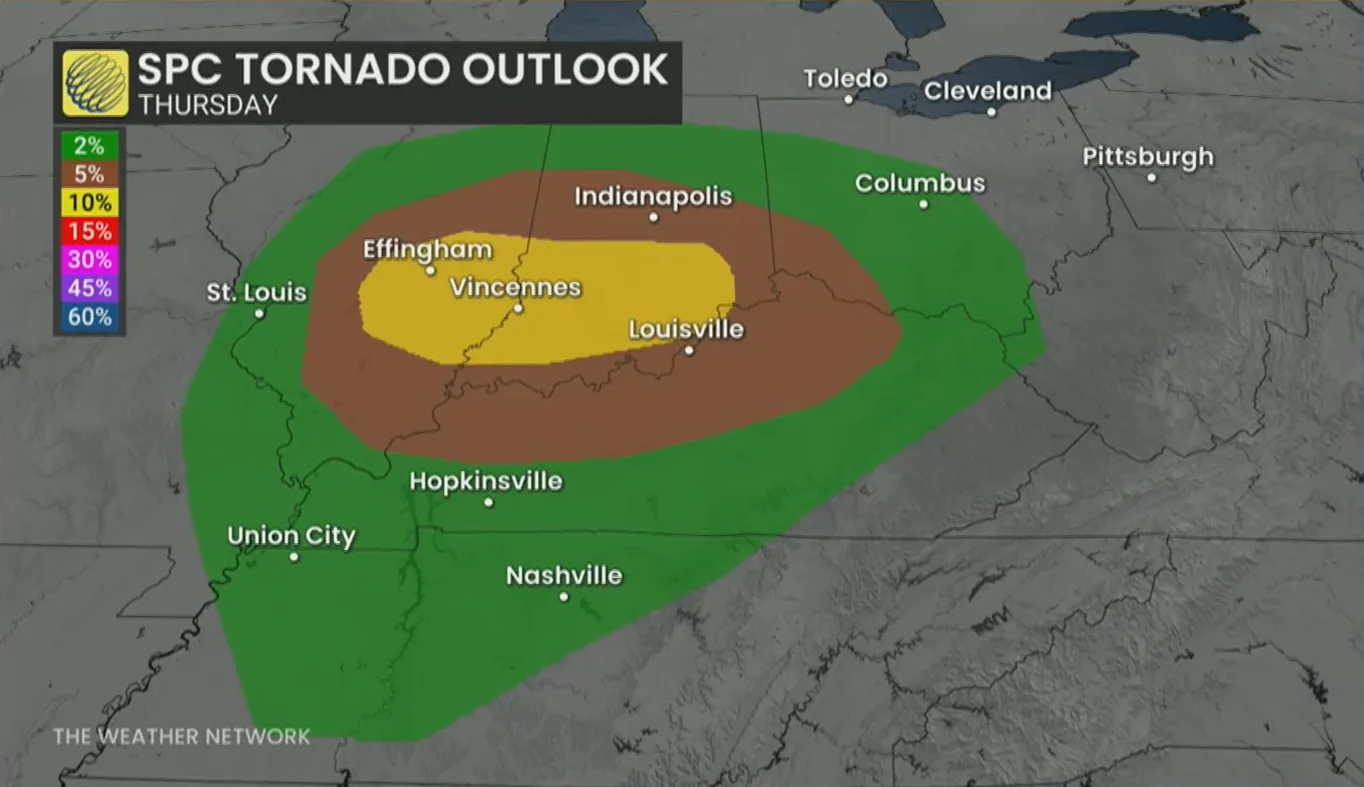
The U.S. Storm Prediction Center (SPC) expects a risk for severe thunderstorms across much of the Midwest on Thursday, including the cities of Chicago, St. Louis, Indianapolis, and Cincinnati.
Storms in portions of Illinois and Indiana may be capable of supporting one or two strong tornadoes.
Tornado activity in the U.S. tends to tick up during the latter half of February as the seasons change and instability grows. Most early-season tornadoes tend to remain over the southeastern states, though a more potent system can drag the threat northward.
Header image created using graphics and imagery from Canva.