Southern Ontario to be teased by summer-like warmth with severe storm risk
Summer-like heat will greet millions across southern Ontario early this week, but it may come at a cost. A Colorado low will grace the Great Lakes on Tuesday, bringing the threat of severe storms to the region
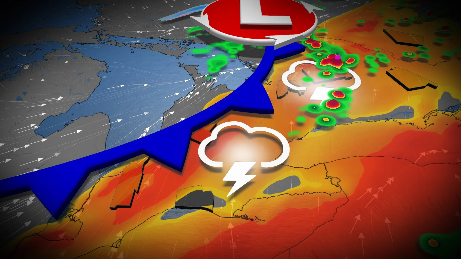
A potent Colorado low will bring southern Ontario a severe thunderstorm risk on Tuesday as the region gets a taste of summer-like heat.
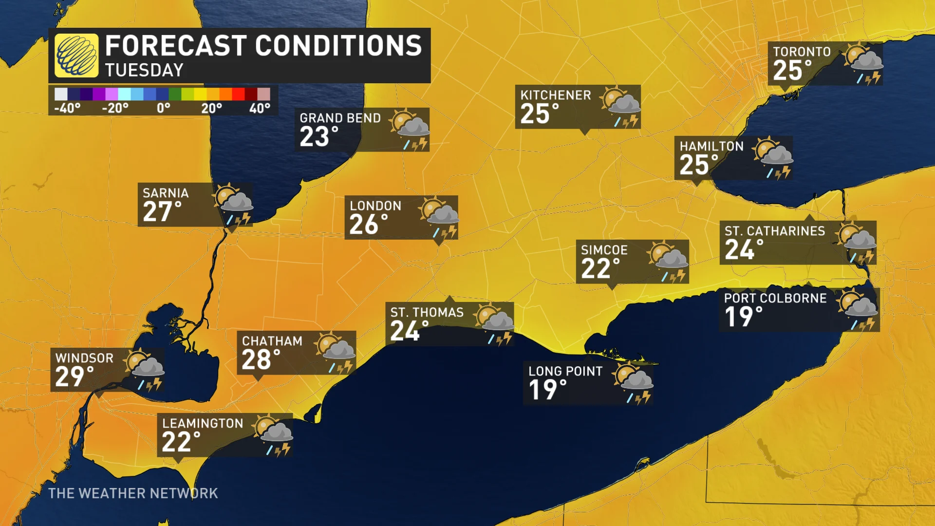
Temperatures are expected to soar into the mid- to high 20s for parts of the region. Temperatures could even hit the 30-degree mark in southwestern Ontario. If it happens, it will be the first 30-degree reading in Canada this year.
DON’T MISS: Canada’s election day forecast holds storms and sunshine
However, the warmth and humidity could be the catalyst for thunderstorms, with a chance of severe weather for a sizable portion of southern Ontario. The main hazards with any severe storm that forms will be large hail, strong winds and heavy downpours, but there is a low, but non-zero risk of an isolated tornado with favourable, low-level shear and low cloud bases present.
Monitor the forecast on Tuesday and stay aware of potential watches and warnings in your community. Conditions can change rapidly as strong storms bubble up.
Thunderstorm season ramps up with severe potential on Tuesday
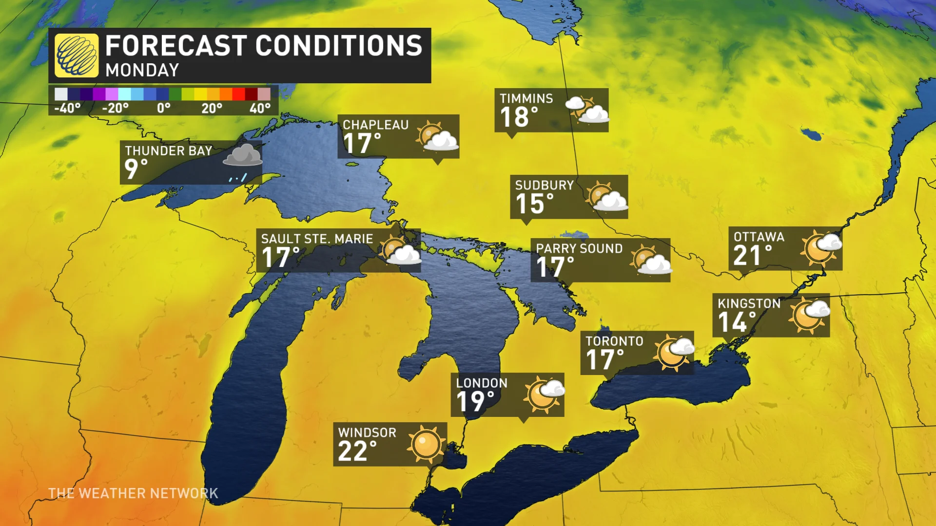
On Monday, the weather will co-operate with voters heading to the polls in the federal election. A ridge in the atmosphere crests across southern Ontario, ushering in mild temperatures that approach 20°C.
But, on Tuesday, conditions will change. The heat and a first taste of humidex will work to destabilize the atmosphere and fuel thunderstorm potential.
By Tuesday morning, a Colorado low lifts into northeastern Ontario, funnelling a very mild and moist air mass across southern Ontario. Temperatures will be upwards of 8°C-10°C above seasonal with dew points sitting near 20°C by Tuesday afternoon—-highly anomalous for April.
It will feel even a little muggy for those inland, away from the chilly lake influences.
The thunderstorm timing is still in flux, and we’ll narrow it down further on Monday, but the greatest risk appears to be from 2 p.m. to 7 p.m.
The strongest winds will be associated with thunderstorm activity, but a more potent gust risk emerges if storms cluster into a line into the evening hours.
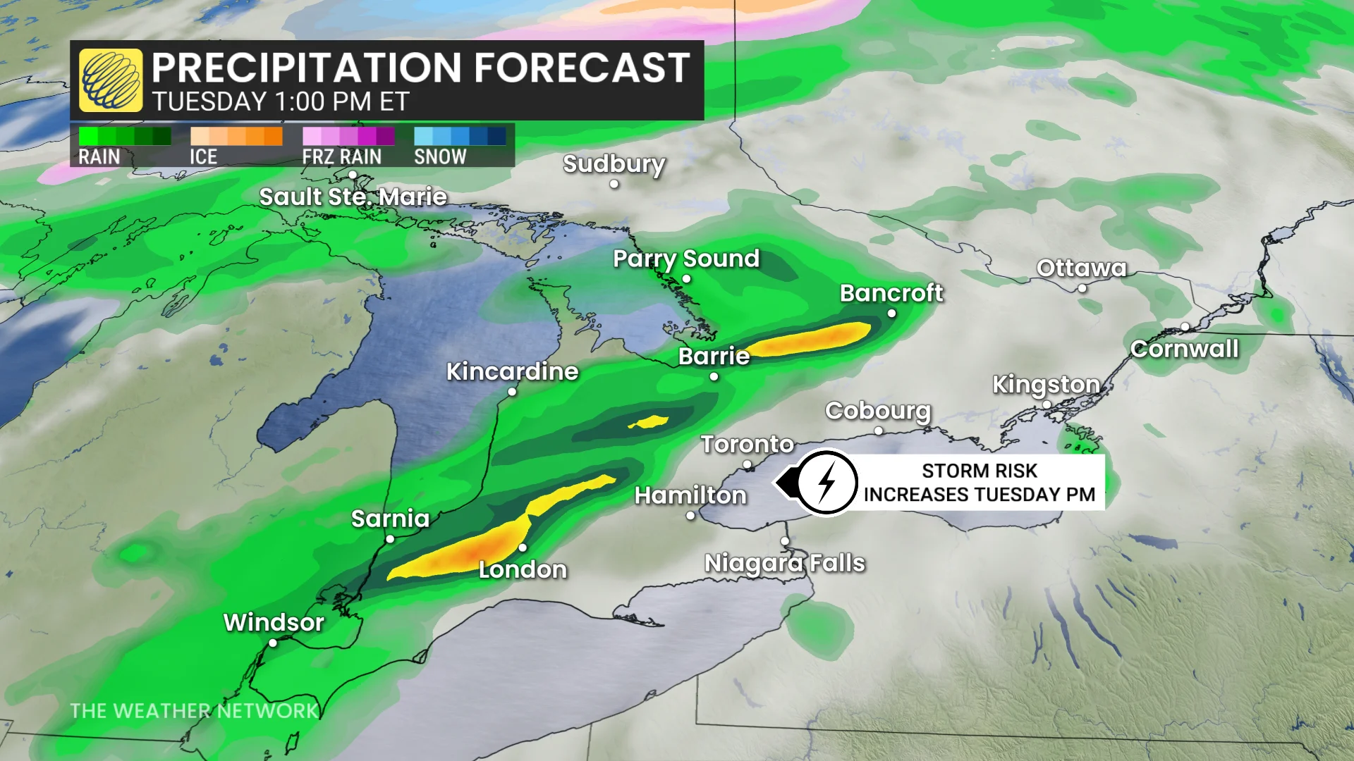
Heavy, localized downpours are expected but the storms will be moving at more than 80 km/h, diminishing the risk of flooding. Although there’s a lot of moisture in the atmosphere for April, storms won’t see and dump rainfall, as they’ll sweep through quickly.
Large hail is a concern in the most organized thunderstorms. There will be lots of cool air aloft, with the potential for building strong, sustained updrafts.
There is also a non-zero, tornadic threat, especially if storms remain isolated. The cloud bases are forecast to be low, and the winds change direction as you move aloft in the atmosphere.

Confidence is high that southern Ontario will be in the warm sector of a Colorado low Tuesday, increasing the threat of thunderstorms. However, confidence in the storm timing remains low, so check back for more precise forecasts on Monday and Tuesday.
The warmth won't last, however, as a noticeable cooldown will happen on Wednesday.
Beyond that, cooler-than-seasonal temperatures will dominate during early May, including a threat for a frost or freeze, especially outside of the urban areas. Also, another significant low-pressure system is expected by Thursday night with widespread rain, followed by a reinforcing shot of chilly weather. However, a warmer pattern is expected as we get deeper into May.
Be sure to check back for all the latest on your forecast across southern Ontario.