
Southern Ontario sees a mild and wild Sunday before temperatures crash
Folks in southern Ontario can expect to see more rain, blustery wind gusts and maybe even some thunderstorms on Sunday--potentially disrupting any outdoor plans amid the warmer temperatures.
A typical fall storm will bring a variety of weather conditions to southern Ontario on Sunday.
With warmer-than-normal temperatures in play, widespread rain and blustery wind gusts are in store, with a chance of thunderstorms--even severe possible for some areas--as well. In fact, exceptional warmth greeted southern Ontario on Sunday morning with temperatures more than 15 degrees above normal for Oct. 19.
DON’T MISS: Warmth hangs on through fall—but winter's closing in
Power outages have started climbing in southern Ontario as the wind gusts begin to strengthen. As of early Sunday afternoon, more than 10,000 people are currently without electricity, according to Hydro One. For the latest outages, click here.
Make sure loose outdoor objects and Halloween decorations are tightly secured or have been brought indoors as blustery winds continue on Sunday.
Enjoy the warmth while you can as temperatures will take a tumble by Monday as reality sets back in. Potentially the last 20°C of the year as long-range models indicate a return to seasonal conditions to finish October.
Windy, warm and possibly stormy Sunday
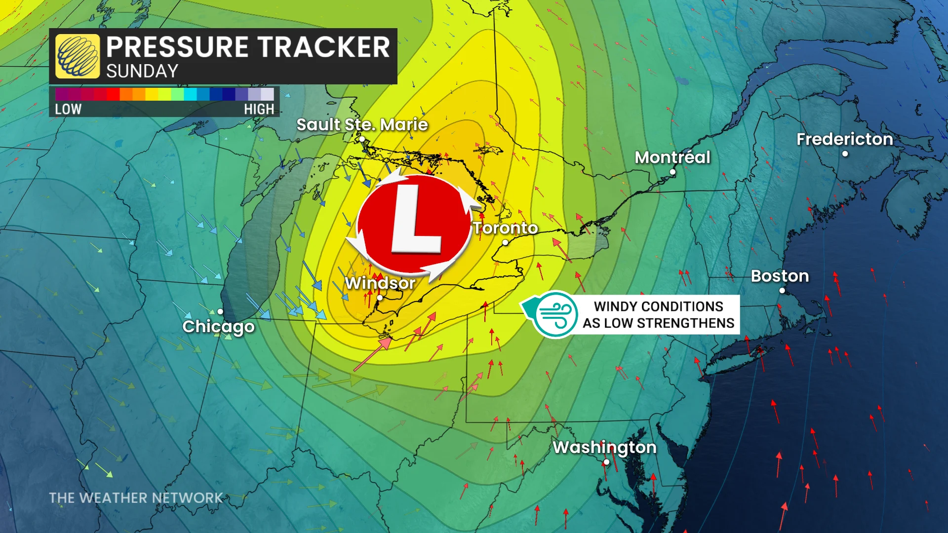
A low-pressure system has moved into the Great Lakes region. With it, a rich stream of moisture from south of the border will fuel more rainfall and a thunderstorm risk throughout the province on Sunday.
Burlington, Ont., recorded an astounding 22°C on Sunday morning, usually when average daytime highs are typically around 13°C. Temperatures in eastern Ontario will soar into the mid-20s, including Cornwall and Ottawa.
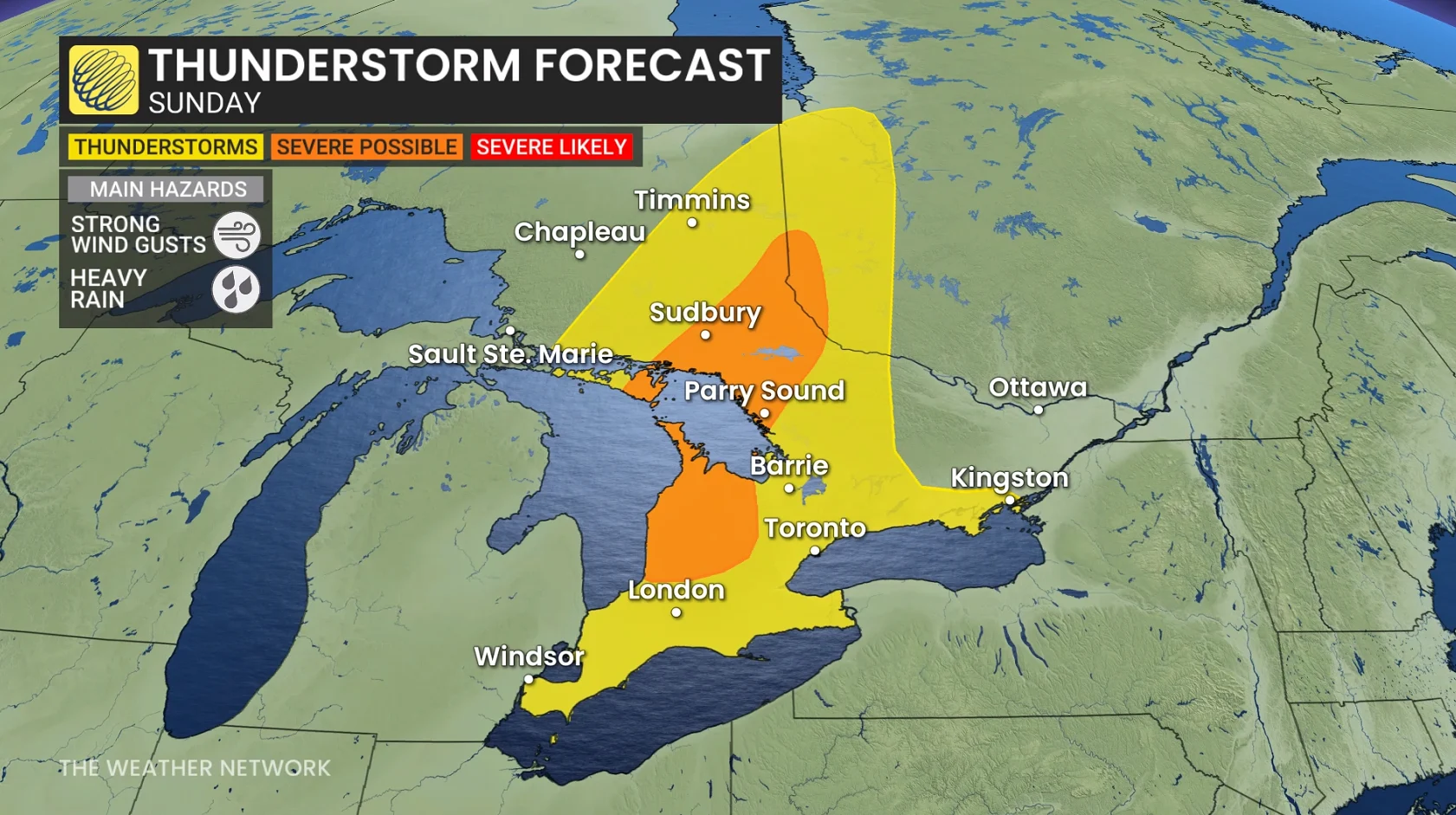
Moisture and instability associated with our growing storm could give rise to thunderstorms over southern Ontario on Sunday.
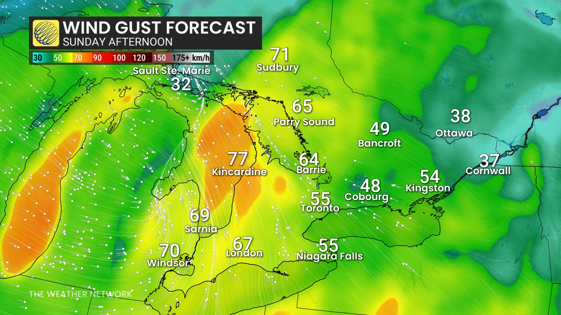
Ahead of the cold front, rain and thunderstorms will move across southern Ontario through Sunday afternoon. Gusty, southerly winds up to 70-80 km/h and heavy rainfall are the primary threats.
WATCH: Beautiful, warm morning in Ottawa won't last the day
Rainfall will be much more organized across northeastern Ontario, with the highest potential to exceed 50 mm, while some portions of southern Ontario are likely to get less than 20 mm. Locally higher amounts are possible beneath thunderstorms.
Localized power outages, driving hazards, and pounding waves along shoreline are primary threats.
Winds will peak late Sunday morning into the early afternoon.

Residents should ensure loose objects and Halloween decorations are brought inside or tightly secured before they go tumbling away in the blustery conditions.
Temperatures in eastern Ontario soar into the mid-20s, including Cornwall and Ottawa.
Potentially the last 20°C of the year as long-range models indicate a return to seasonal conditions to finish October