Rainy, snowy disruptions close out another busy week in Ontario
Prepare for a slow, snowy evening commute across parts of southern Ontario to close out the week
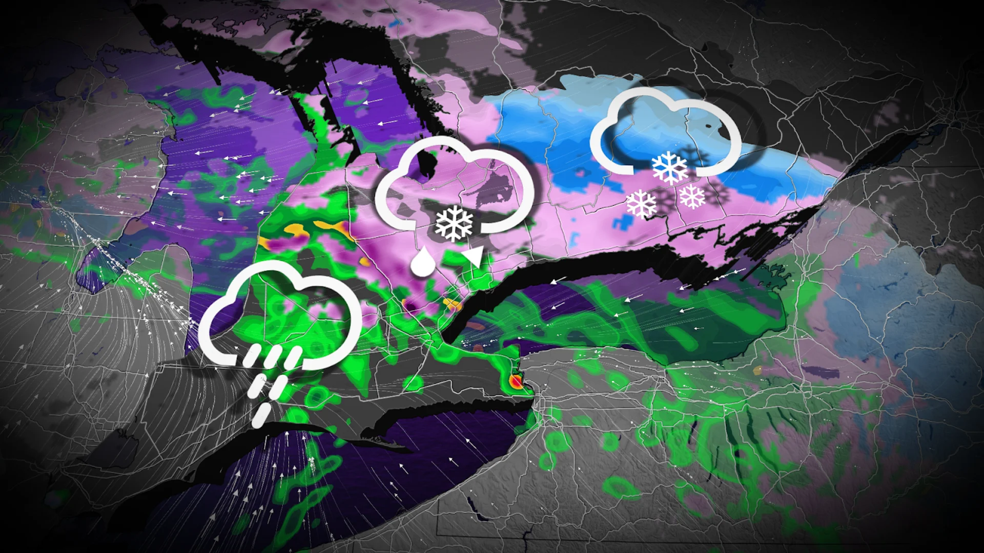
An unsettled pattern draped across the Great Lakes will continue into Friday as another round of wintry precipitation aims for southern Ontario.
Shovellable snowfall totals are on the way for portions of eastern Ontario, while folks toward the southwest are in line for a soaking rain.
The most uncertainty remains over the Greater Toronto Area (GTA), where a narrow transition zone between rain and snow will set up.
DON’T MISS: Trio of winter storms bring messy impacts to millions across Canada
Snow expected from Bancroft to Ottawa
We’re looking at another messy low-pressure system moving into the Great Lakes early Friday. This is the same system that brought thunderstorms to southwestern Ontario, and tornadoes to Indiana, during the day Thursday.

Rainfall will push from southwestern Ontario toward the GTA during the morning commute. We’ll see precipitation lift north and east of Toronto, where it’ll encounter stubborn temperatures below the freezing mark.
By the afternoon, rain will transition to wet snow east of the GTA across the 401 series, setting up a messy evening commute.
The heaviest snow is expected between Cobourg, Kingston, and Bancroft, where 10-20 cm of accumulation is possible. Ottawa can expect 5-10 cm of snow through Friday evening.

A narrow transition between rain and snow will set up over the GTA, leading to greater uncertainty in this region. Mostly rain is favoured in the forecast at this time.
5-15 mm of rainfall with additional snowmelt could lead to ponding and pooling in the area, especially around blocked drains.
Conditions will improve to kick off the weekend on Saturday, but weak instability lingering over the province will allow bursts of on-and-off snow to persist through the weekend.

How are we doing on snowfall so far this year?
6 cm fell at Toronto-Pearson Airport on Wednesday, pushing this season’s total to an impressive 173 cm. This is the airport’s snowiest winter since 2007-08. We’d typically see about 115 cm of snow by this point in the season.
Stay with The Weather Network for all the latest on conditions across Ontario.