Snow in Vancouver this month? It’s not impossible
An impending, major pattern change will bring winter weather to British Columbia. A blast of cold Siberian air is heading south, with potential snowfall for the South Coast in the final week of November
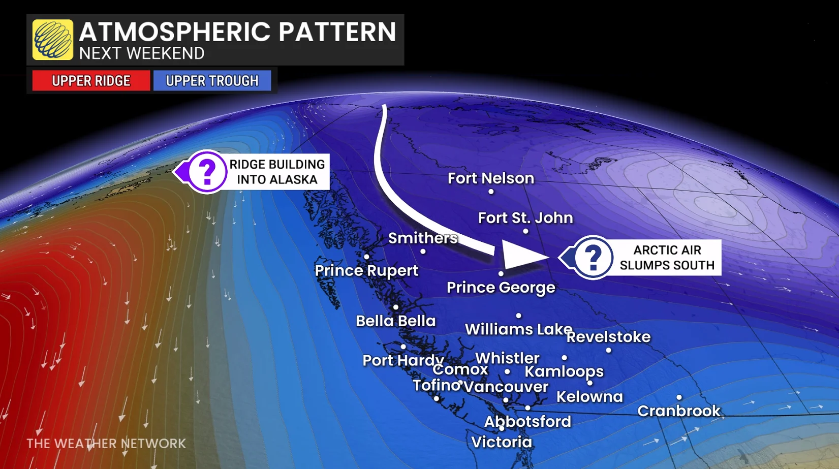
As we head into the final week of November, a major pattern reversal will unfold across Canada.
The key trigger will be a strong blocking pattern that will develop over Alaska and the Yukon. That will lay the foundation for the anticipated pattern for December.
SEE ALSO: Rare, mega-squall snaking from Lake Superior to the Atlantic Ocean
However, during the final week of November, a much colder and wintry pattern will develop across Western Canada as Arctic air plunges south into the region. That means Vancouver, B.C., could see snowfall before this month ends, something that doesn't happen often.
What's happening on the B.C. coast?
So, where is the source region of the prospective Arctic air? Currently, it's on the other side of the globe in eastern Siberia, associated with the tropospheric polar vortex.
However, some of the air mass will moderate as it crosses the North Pacific by next weekend, but the air mass that remains over land will be very chilly indeed.

Some of the Arctic air will spill well east of the Rockies, and determining just how much Arctic air fills B.C.’s valleys and lower elevations remains elusive.
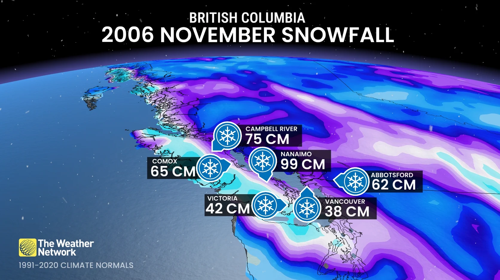
Worst November snowfall in history
When did the worst snowfalls in November history occur? Flashback to late November 2006, when some regions of the South Coast recorded a metre of snowfall over four to five days.
Nanaimo: 99 cm (144 per cent of annual snowfall)
Campbell River: 75 cm
Comox: 65 cm (128 per cent of annual snowfall)
Abbotsford: 62 cm
Victoria: 42 cm
Vancouver airport: 38 cm
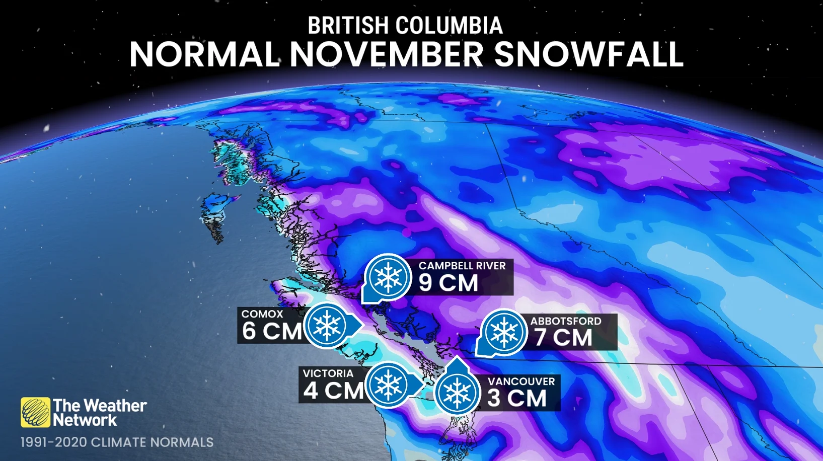
Compare these values to the average 1991-2020 November snowfall:
Campbell River: 8.6 cm
Comox: 5.5 cm
Vancouver: 3.2 cm
Victoria: 3.6 cm
Abbotsford: 7.1 cm
Seeing the supply of Arctic air that will make the journey, there is nothing that would indicate that we can’t approach or even exceed those average snowfall amounts––judging by the rough, upper-level pattern that’s on the horizon.
With files from Tyler Hamilton, a meteorologist at The Weather Network.
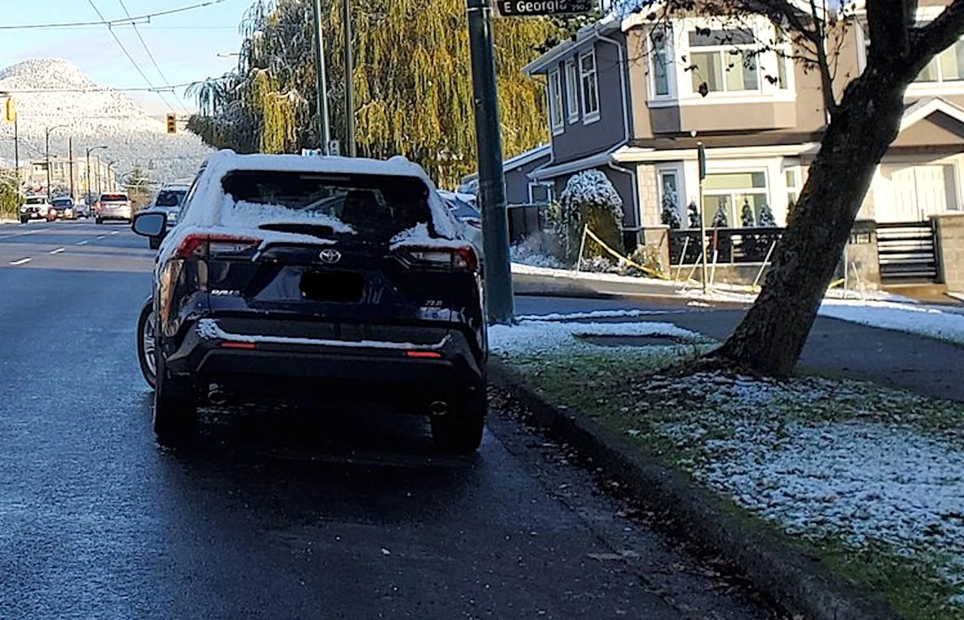
Thumbnail courtesy of Brad Atchison/X/@Brad604, taken in November 2022.
Stay tuned to The Weather Network for the latest forecast updates for B.C.