Snow in August? Northern Canada may see 15 cm this weekend
Friday’s expected daytime temperature could be a new record for the lowest high in Resolute, NU
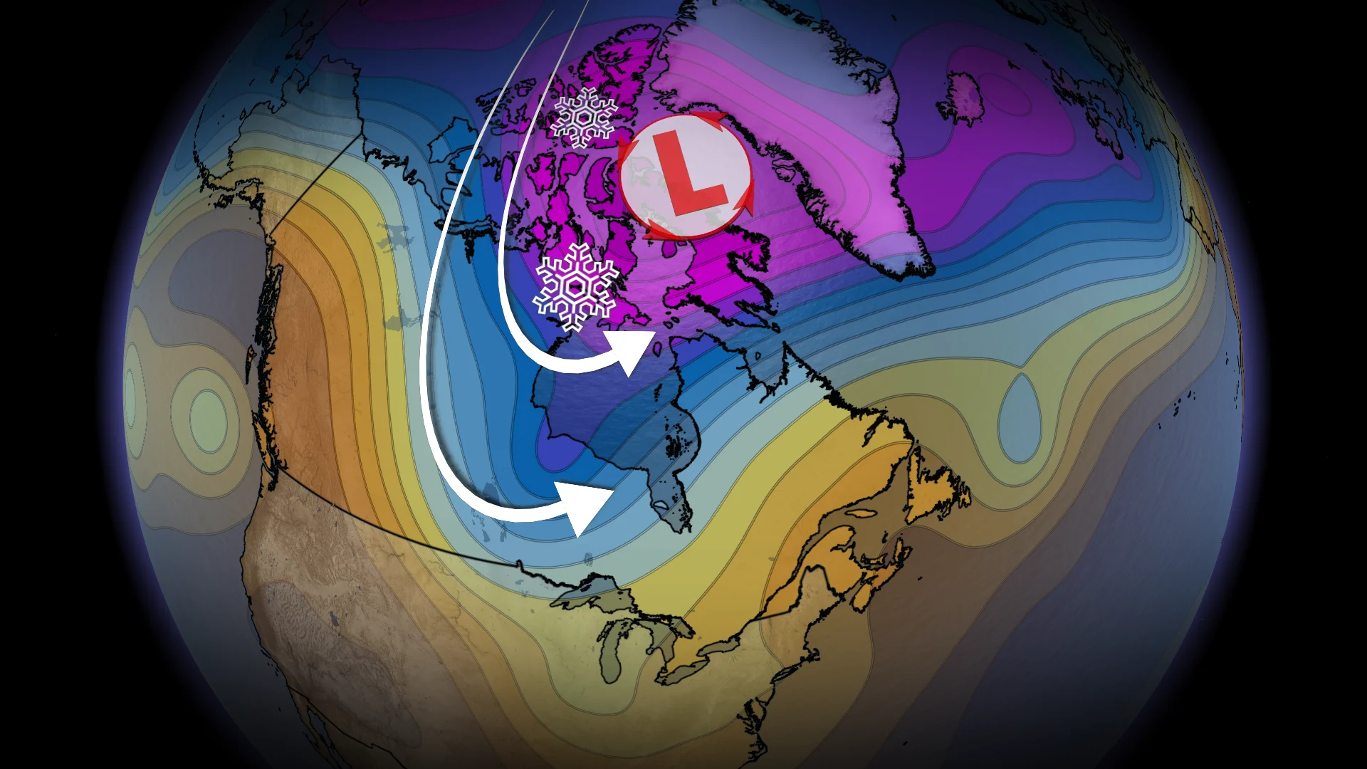
While Western Canada returns to summer temperatures, the Canadian Arctic is already shifting into winter mode. A few wintery systems are building in the north that may move a polar air mass south during early September.
In the northwest, a pocket of cold air is settling over Nunavut. A trough, with strength rarely seen at this time of year, can be seen over the Canadian Arctic Archipelago, holding this cold air.
Compared to Alberta, British Columbia, and parts of the Northwest Territories, which continue to experience daytime highs of 30C through this weekend.

Two wintery systems to watch
Along this temperature contrast, several wintery systems are forecast through northern Canada.
The first system is forecast to bring snowfall to Resolute on Friday and Saturday. With 5-10cm possible as temperatures are expected to remain below zero here.

The early winter system may not come as a shock to the residents of Resolute, NU, where the average high in January and February is around -28°C. But it is coming way earlier than usual.
Friday’s daytime highs around -3°C, feeling like -10 would be several degrees below normal and would be a new daily record. The monthly records for August in Resolute are -4.5°C for the lowest high on August 28, 1997, and -9.3°C for the lowest low during August 31, 1997.

A second, more potent system will follow Sunday and Monday that will impact north and southern regions across Canada.
In the north, heavy snowfall may move through parts of Baffin Island. In higher elevations further north from Iqaluit, over 15cm of snowfall is possible through this long weekend. With periods of whiteouts possible too, with winds exceeding 80 km/h.
This system will help to open the door for a polar air mass to move south during the first week of September. Forecasters are expecting a return to normal daytime highs for the Prairies, relieving the current heatwave. And, eventually, below normal temperatures are possible once again for Ontario, Quebec next weekend.