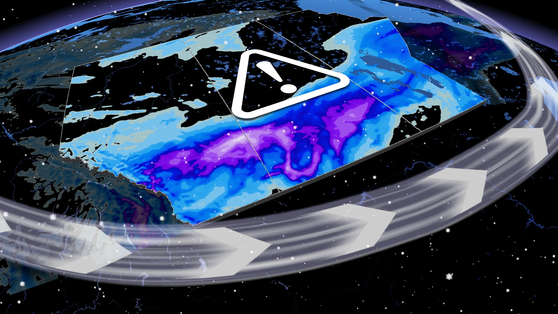
Significant snow continues across the Prairies, totals could reach 30+ cm
Heavy snow and freezing precipitation continue to impact the Prairies, with all three provinces facing hazardous travel conditions
A significant mid-April snowfall continues to impact the Prairies, with bands of snow spreading across all three provinces through Thursday.
Hazardous travel is expected on the Trans-Canada and Yellowhead highways across Alberta, Saskatchewan, and Manitoba. Blowing and drifting snow could reduce visibility, with 10-30+cm possible in some areas, including in Calgary, Alta. Locally, some areas could even see up to 40 cm of snow.
Weather Highlights:
A large swath of 10-30+cm of snow is forecast through Thursday, including in Calgary
Travel hazards with blowing snow and reduced visibility is likely
Snowy and messy conditions could disrupt Thursday commutes
DON'T MISS: Summer Sneak Peek: El Niño may split Canada’s summer in two
Be sure to check the road conditions before heading out.
Difficult travel as rounds of spring snow hit the Prairies
A potent snow event continues across the Prairies, bringing notable impacts to Alberta, Saskatchewan, and Manitoba. A stretch of the QE2 near Nanton, Alberta, was closed Thursday morning after a jackknifed tractor-trailer stalled traffic overnight Wednesday.
According to radar estimates, over 20 cm had already fallen east of Calgary by early Thursday.

Bands of snow will persist through Thursday across southern areas of all three Prairie provinces.
RELATED: Canada’s snow season turns historic as multiple cities top 500 cm
Southeastern Saskatchewan faces freezing rain warnings, with icy precipitation expected from Assiniboia to Brandon before transitioning to rain in areas along the southern border.

Gusty winds of 30-60 km/h will contribute to blowing and drifting snow, reducing visibility and creating hazardous travel along major routes like the Trans-Canada Highway and Yellowhead.
WATCH: Calgary, this is what the weather looked like while you were sleeping
Southern Alberta and Saskatchewan are forecast for the heaviest snow Thursday morning. Additional accumulations of 5-15 cm are possible in Alberta.
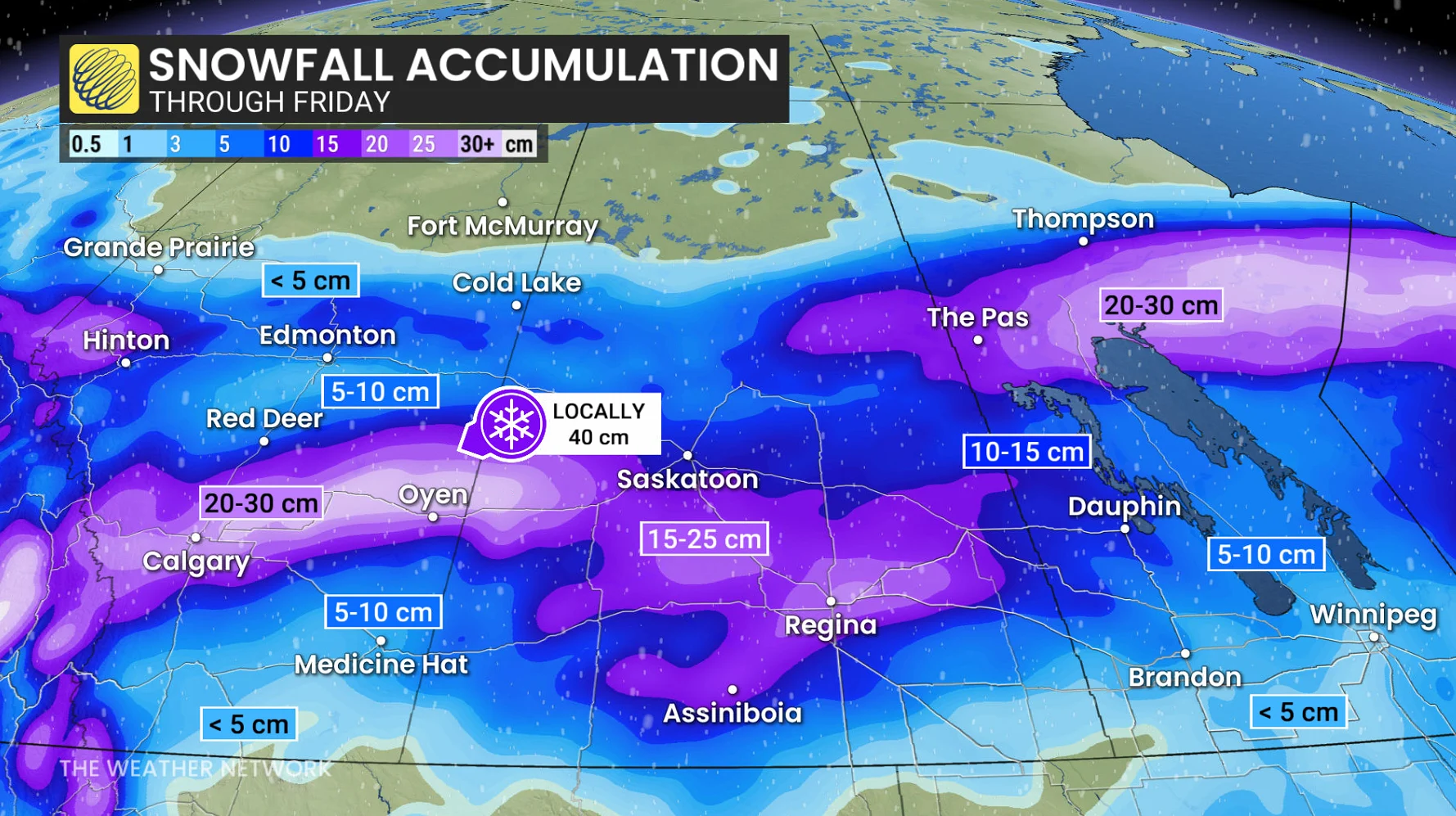
Saskatchewan, including Regina, could see snowfall totals of 10-25 cm. Temperatures across the region have dropped, resulting in icy roads.
Flood concerns as another system, warmer weather targets Manitoba
Another system will push into the eastern Prairies Thursday night, targeting Winnipeg with snow and freezing precipitation.
Up to 5 cm of snow and icy conditions could complicate Friday morning commutes, with precipitation expected to move into northern Ontario by morning.
Additionally, in the first flood bulletin of the season issued on Tuesday, Manitoba Transportation and Infrastructure’s Hydrologic Forecast Centre stated that it continues to monitor the potential for spring flooding.
"With warmer weather forecasted for this week, there is an increased flood risk in the Interlake region, including the Icelandic River and Fisher River basins, as well as an elevated risk of overland flooding in the Parkland region," the statement read. "Flood risk remains moderate to low elsewhere in the province."
The latest flood forecast information can be found on the Manitoba River Conditions and Forecasts Web Map.