Significant snow and ice threat as April begins in Atlantic Canada
Atlantic Canada braces for an active week, with multiple systems delivering snow, ice, and rain, likely causing travel disruptions until Thursday
A significant winter weather event will bring freezing rain, ice, and heavy snow to Atlantic Canada, with risks of slippery roads, power outages, and travel delays.
Weather Highlights
The system will linger into Wednesday
The system will bring heavy snow to some areas, while others may experience freezing rain or ice pellets, leading to hazardous travel conditions
Heaviest snow is expected in northern New Brunswick and the Avalon Peninsula
Stay updated on forecasts and any weather alerts in your area.
Travel deteriorates quickly Wednesday as snowfall rates pick up
Nova Scotia will see 15–30 mm of rain by Wednesday.
Precipitation will intensify overnight into Wednesday morning.

DON'T MISS: The high cost of plowing St. John's snowiest February
Heavy snow is expected to continue in northern New Brunswick and spread to Newfoundland.
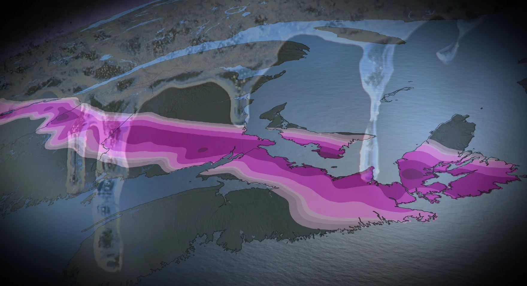
By Wednesday evening, snowfall accumulations of 15–25 cm are possible, with the highest totals likely in northern New Brunswick and the Avalon Peninsula.

A band of ice pellets and freezing rain will likely develop between areas of heavy snow and rain, affecting southern New Brunswick, parts of P.E.I., and northeastern Nova Scotia during early Wednesday.
Freezing rain amounts may range from a few millimetres to 10–15 mm, with southeastern New Brunswick and parts of Nova Scotia seeing the greatest impacts.

The exact placement of the heavy snow and longest-lasting ice remains uncertain.
DON'T MISS: Freezing rain is the 'worst' type of precipitation. Here's why
Those with travel plans should monitor local forecasts and be cautious of untreated, slick surfaces on Wednesday morning. Hazardous travel conditions are expected in areas with the highest snow and ice accumulations.