Significant lake-effect snow squall event threatens 20+ cm in southern Ontario
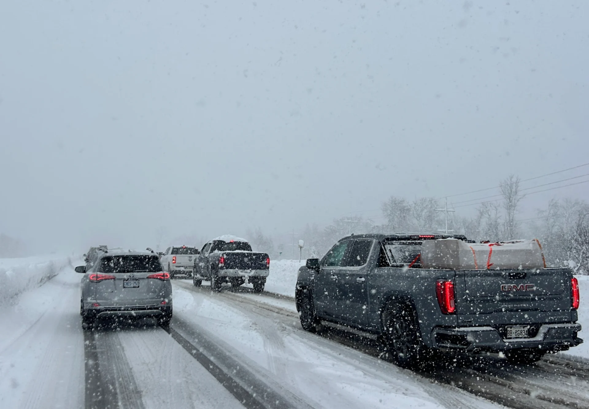
If winter tires aren’t installed yet, now is the time for southern Ontario drivers to take action. With lake-effect snow intensifying this week and a cold, active pattern continuing into early December, road conditions will remain challenging
A lake-effect snow squall event is set to begin Wednesday night and persist through Friday, impacting areas east and southeast of Lake Huron and Georgian Bay. The snow squall bands are expected to shift, spreading accumulation across a larger region instead of heavily impacting specific communities.
SEE ALSO: Winter road warriors: Here's what you should be keeping in your car
Harder-hit areas could receive 15-30+ cm of snow, accompanied by extensive blowing and drifting snow. Wind gusts reaching 50-60+ km/h through Thursday may result in whiteout conditions in some locations.
These hazardous conditions could lead to road closures in affected areas.

Rain and strong winds pick up through Wednesday
A strong winter storm is tracking through northern Ontario, bringing widespread impacts.
Rain and strong winds will develop Wednesday afternoon in southern Ontario as the low intensifies.
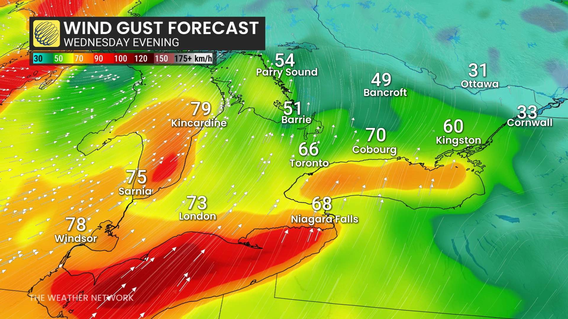
Wind gusts of 60–80+ km/h are expected across southwestern and south-central regions, including Windsor, London, Toronto, and areas east of Kingston, with stronger 80–90+ km/h gusts expected east of Lake Huron and from Long Point to Fort Erie. Folks in these areas should be prepared in case of whiteout conditions and potential power outages.
After the cold front passes, Arctic air will move in, causing temperatures to drop. Rainfall is expected to transition to snow by Wednesday evening.
DON'T MISS: Winter-proof your home with a heat pump that even works in -30°C
There is also a chance for an intense snow squall to develop, potentially affecting areas such as Port Colborne, Niagara, and Buffalo, leading to hazardous conditions.
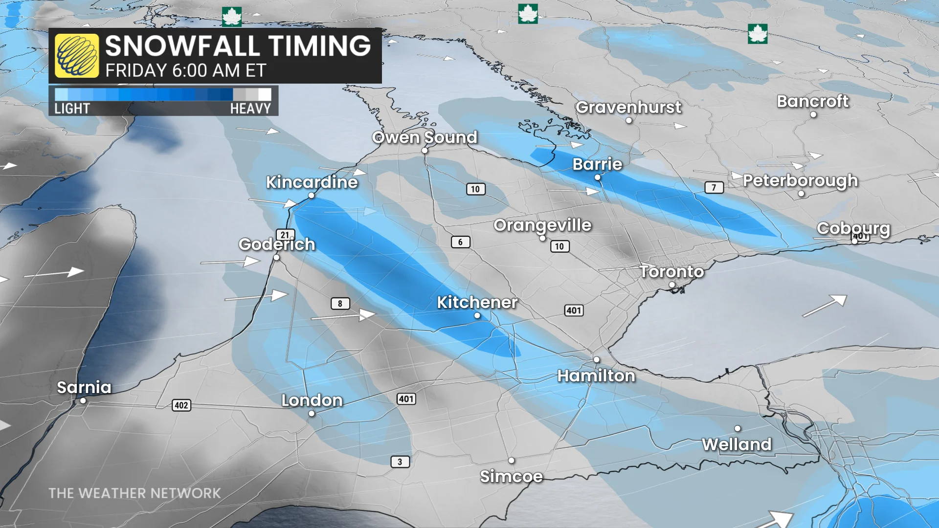
Lake-effect snow picks up Thursday and Friday, American Thanksgiving travel jeopardized
Prepare for significant lake-effect snow targeting traditional snowbelt regions in southern Ontario and surrounding areas on Thursday and Friday.
DON'T MISS: Winter's wrath unleashed: The 'Great Lake-effect'

The heaviest snowfall is expected downwind of Lake Huron and Georgian Bay, where 20-30 cm could accumulate over several days.
Strong snow squalls may develop, potentially bringing thundersnow and reaching as far as the Greater Toronto Area (GTA) and beyond.
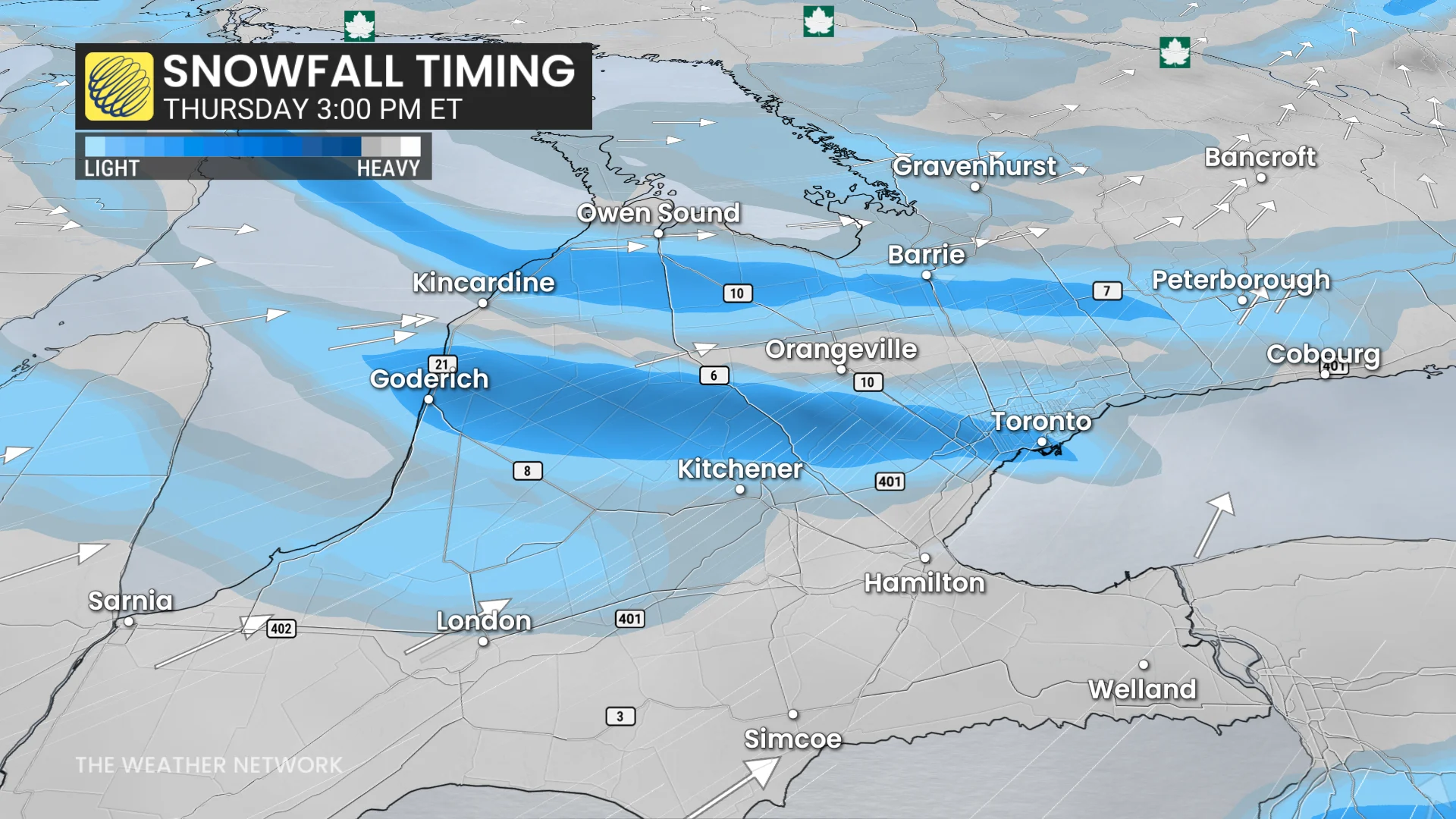
Squalls are expected to impact the 400-series highways Thursday afternoon and evening as they shift southward. Gusty winds of 50-70 km/h will accompany the snow, resulting in whiteouts, potential road closures, and challenging travel conditions within the snowbelt zones.
RELATED: Thundersnow is a rare and electrifying experience
For those travelling to the U.S. for American Thanksgiving, winter storm watches are in effect for Buffalo and Watertown, N.Y.
Closely watching a weekend snow maker
Forecasters will be monitoring the potential for widespread snowfall this weekend across southern, central, and eastern Ontario, as well as southern Quebec.
While uncertainty remains about the track and intensity of the system, snow accumulations of 5-15 cm are possible across the affected regions.
If winter tires aren’t already installed, this is the final chance as the cold and active pattern appears set to continue into early December.
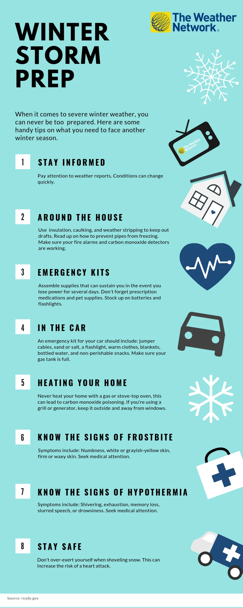
The time to prepare is now
When it comes to facing severe winter weather, you can never be too prepared. The infographic below has some handy tips on what you need to face another winter season.
Click here for a zoomable version of this graphic.
WATCH BELOW: This is what you should have in your emergency kit this winter
Stay with The Weather Network for more information and updates on your weather across Ontario.