
Short burst of rare summer-like warmth reaches Ontario
A storm moving through the Great Lakes sent temperatures soaring into the 20s for much of southern Ontario this weekend
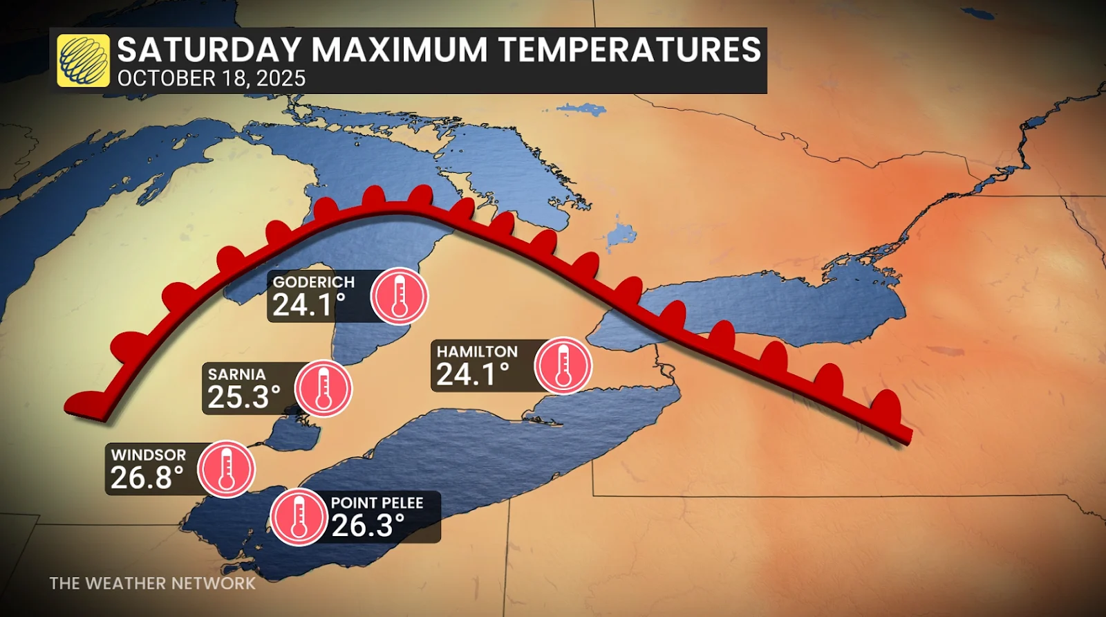
Temperatures soared into the 20s across southern Ontario this weekend as a potent storm system rolled across the region.
The summer-like air set daily records in some communities. Don’t expect the warmth to last very long—readings will fall back to reality behind a cold front marching through the province.
DON’T MISS: What does a classic fall storm look like in your part of Canada?
Warmth is hard to come by in October. It often takes a powerful low-pressure system like the one we endured this weekend in order to transport warmth into Ontario from the south.
Strong southerly winds helped to push temperatures into the 20s. The warm front moved through southwestern Ontario on Saturday before arriving in eastern Ontario and cottage country on Sunday.
Readings were downright impressive thanks to this storm. Windsor hit 26.8°C for a high on Saturday, followed by Sarnia’s 25.3°C and a 24.1°C temperature over in Hamilton.

Numerous records fell on Sunday once the warmth pushed farther north. Ottawa saw a high of 26.1°C, smashing the daily record set back in 1963. Kemptville made it up to 26.4°C on Sunday, beating the previous high which was also set back in 1963. St. Catharines reached 25.0°C at the peak of the day’s warmth, also setting a daily record.
Folks who love unseasonably warm weather are out of luck. A cold front associated with the low-pressure system will send temperatures falling back to reality to start the new workweek. Expect daytime high temperatures to settle around the mid-teens for your day on Monday.
Stay with The Weather Network for all the latest on conditions across Ontario.
Header image created using graphics and imagery from NOAA and Canva.