
Severe weather threat to disrupt northern Ontario, Quebec's weekend
Thunderstorms may put a damper on your weekend as the severe weather threat spreads across northern Ontario and Quebec on Saturday.
A volatile setup for severe thunderstorms developed across portions of southern Manitoba and northwestern Ontario on Friday evening. The storms continued to trek across northwestern Ontario overnight and early Saturday morning.
The severe weather focus will shift in to northern Ontario and Quebec on Saturday as the storms keep their strength and move northeast throughout the day and into the evening.
DON'T MISS: Ontario’s first significant tornado of 2025 confirmed
Be sure to keep an eye on the radar as well as local weather alerts if you're in the severe risk area on Saturday.
Severe storms expected to continue in northwestern Ontario Saturday morning
Early morning storms will continue to slowly roll through northwestern Ontario Saturday morning, bringing damaging wind gusts and heavy downpours to the region. Folks at their camps for the weekend should be aware of falling tree limbs and pooling water on the roads.
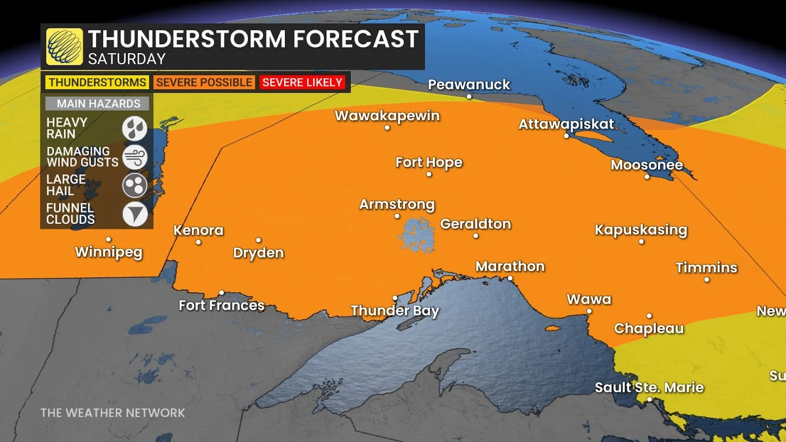
We could see wind gusts up to 100 km/h, as well as nickel to quarter-size hail from these early storms. Heavy downpours could also drop up to 50 mm of rainfall in some areas, increasing the risk of localized flooding and washed out roads.
Folks between Atikokan, Thunder Bay, and Ignace are at the highest risk of these hazards.
Travel along Highway 17 and and Highway 11 may also be impacted by the storms.
By the late morning hours, the storm risk is forecast to shift to the north shores of Lake Superior, around Armstrong, Geraldton, and up toward James Bay. Damaging winds and heavy downpours will continue to be the primary hazards heading into the afternoon.

There is also a chance for funnel clouds to spin up throughout the day with the stormy weather.
SEE ALSO: Heat warnings hoisted as prolonged hot, humid weather arrives
Storm risk shifts into Quebec Saturday evening
Thunderstorms will push into western Quebec later in the day Saturday thanks to a lifting warm front that will help to rekindle storms between the James Bay shorelines and Saguenay.
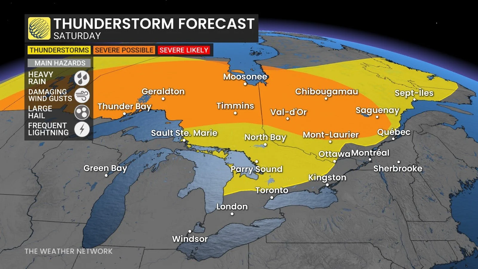
Unlike Friday night, the environment will not be set up to support strong thunderstorms overnight, so we should see the storms lose energy as they trek into the St. Lawrence Valley Saturday night and into Sunday morning.
Stay with The Weather Network for all the latest on conditions across Ontario and Quebec.