Severe storms fire up in Saskatchewan, prompting a tornado warning
A severe thunderstorm capable of producing a tornado has been detected in southern Saskatchewan. Residents in the affected region should be in their shelters.
A tornado warning has been issued in southern Saskatchewan as meteorologists with Environment and Climate Change Canada (ECCC) are tracking a thunderstorm that is potentially producing a tornado.
In addition to potentially producing a tornado and intense winds, large hail and locally intense rainfall are possible. See below for the details.
Current tornado warnings
R.M. of Moose Creek including Alameda
2:55 PM CST: Environment Canada meteorologists are tracking a severe thunderstorm that is possibly producing a tornado. Damaging winds, large hail and locally intense rainfall are also possible.
This storm is located northwest of Oxbow, moving southeast at 20 km/h.

This is a dangerous and potentially life-threatening situation.
Take cover immediately, if threatening weather approaches. If you hear a roaring sound or see a funnel cloud, swirling debris near the ground, flying debris, or any threatening weather approaching, take shelter immediately.
Go indoors to a room on the lowest floor, away from outside walls and windows, such as a basement, bathroom, stairwell or interior closet. Leave mobile homes, vehicles, tents, trailers and other temporary or free-standing shelter, and move to a strong building if you can. As a last resort, lie in a low spot and protect your head from flying debris.
Stormy start to the new work week Monday
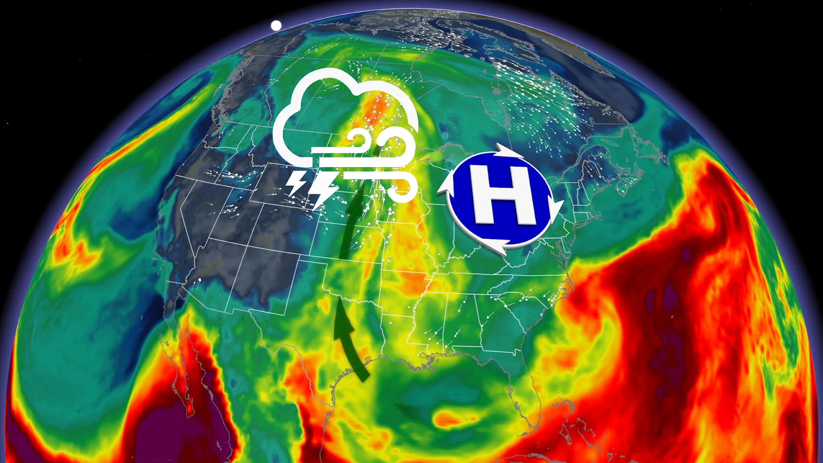
The severe weather is lingering thanks to an Omega blocking pattern, causing the active pattern to be a slow mover. An upper-level high pressure system is being flanked by a low pressure system centred on either side.

This is causing the low pressure system around the Prairies to be blocked from moving eastward, slowly dragging the stormy weather up and around the ridge created along the jet stream.
Severe weather pushes from Manitoba into Ontario
From the afternoon into the evening, thunderstorms are expected across the waterfront as the low system lifts over the border with the U.S., possibly bringing another round of severe storms, as well.
The main risk is expected to be strong winds that could build up to 80 km/h, while the airmass associated with the storms is quite moisture-laden, creating heavy downpours.
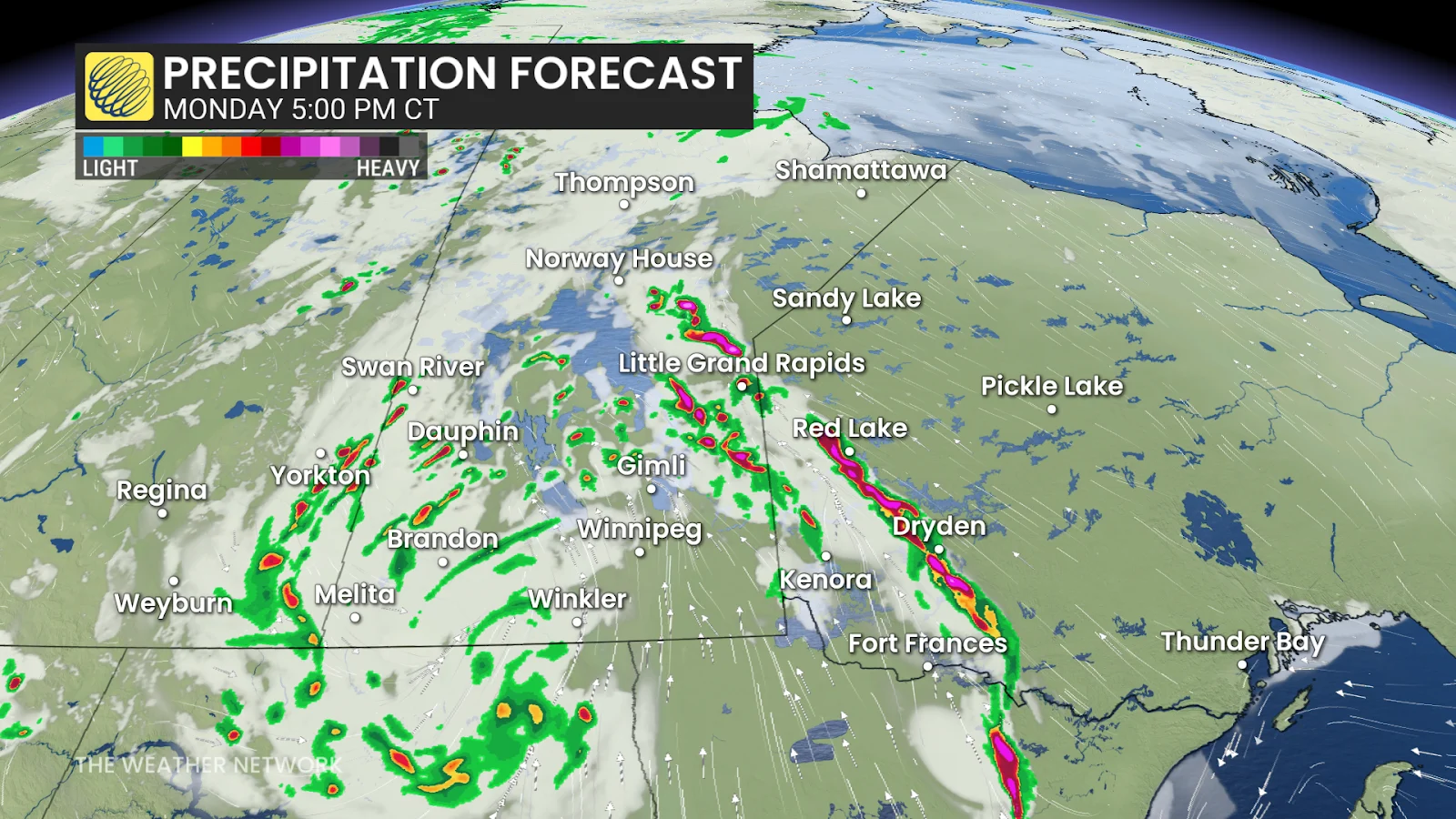
While the risk of flooding remains for eastern Saskatchewan, the heaviest of the rainfall is expected to shift eastward into Manitoba, with heavy rain in northwestern Ontario as well by the late afternoon.
By the evening, storms south of the border and rains in northwestern Ontario may move into Manitoba as they get less intense, but still bring down heavy rainfalls.
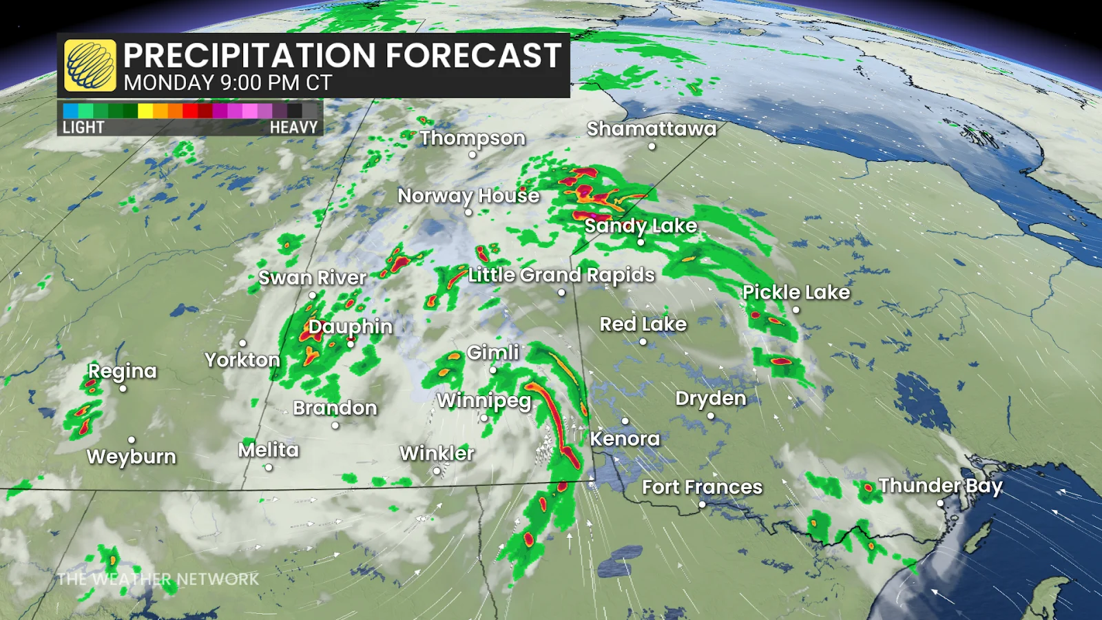
Southern Manitoba into northwestern Ontario will be the most active weather spot across Canada, while the rest of the country, and the majority of the population, can expect to see dry weather for the next week.
And alongside strong winds and rainfalls, large hail is expected to be a threa. Nickel-sized or greater, should be expected in isolated areas.
On top of all that, there is a chance of a rotating storm forming between eastern Manitoba and northwestern Ontario during the late afternoon into the evening. With thunderstorms forecast to have the potential to form, all the way from Thunder Bay to Cranbrook.

The areas with the greatest potential for supercells to form are Dryden, Sioux Lookout and Red Lake, while in the evening the risk will move north towards Sandy Lake, Ont.
The northward movement of the rainfalls is expected to keep the Interlake region and southern Manitoba rainy at all times, thanks to the northward pull of the low pressure system. Tuesday will bring more scattered storms for these regions as a trough behind the system slumps southward.

But the thunderstorm risk will continue, as stronger storms are brought into northwestern Ontario with the passage of the low-pressure system.