Severe weather risk precedes major cooldown for parts of the Prairies
A sharp drop in temperatures is on the way for parts of the Prairies, but not before potentially severe thunderstorms roll through southern Alberta and Saskatchewan on Sunday
While much of Western Canada deals with thick smoke from ongoing wildfires, another wedge of instability will foster fresh storm activity from British Columbia’s Interior through southern Saskatchewan on Sunday, with a swath of severe potential for southern-based areas.
Strong to severe thunderstorms are possible across southern portions of the Prairies on Sunday, mainly in Alberta and Saskatchewan. The main hazards will be large hail and potentially damaging winds, with a slight tornado risk across the region.
DON’T MISS: How severe weather alerts are issued, and potentially save lives
Keep an eye on the radar and listen for severe weather alerts in your area as you go about your day.
Looking beyond Sunday's storm risk, some areas could see a remarkable drop in temperatures for the start of the new work week.
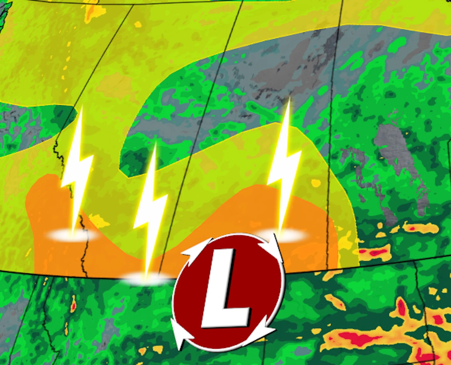
Sunday storm threat includes supercell risk
Warm air spiralling around a low-pressure system will allow the atmosphere to destabilize across the southern Prairies by Sunday afternoon.

The greatest risk for severe weather will cover southern Saskatchewan, including Regina. This is where ample humidity and the best dynamics may favour the development of supercell thunderstorms.
Any storms in Saskatchewan able to reach severe limits will be capable of producing damaging wind gusts and large hail. We’ll see a modest tornado risk across the region––a funnel cloud or even a brief tornado is possible, but it’s not the primary threat with Sunday’s storms.
Localized power outages will be possible due to strong winds, while localized crop damage is a possibility from large hail associated with the severe storms.

All of the heaviest rain misses the wildfire zones in the boreal forest, with no rain forecast to fall north of Prince Albert, Sask., or Cold Lake, Alta.
Looking ahead to an unseasonable chill
Folks across central Alberta and the Rockies will experience a temperature dip through the day Sunday, but a stronger signal for well-below seasonal temperatures is on the horizon.
The approaching pattern is likely to trigger a remarkable temperature drop Tuesday, with forecast daytime temperatures coming in 10-15 degrees below seasonal across central and southern Alberta.
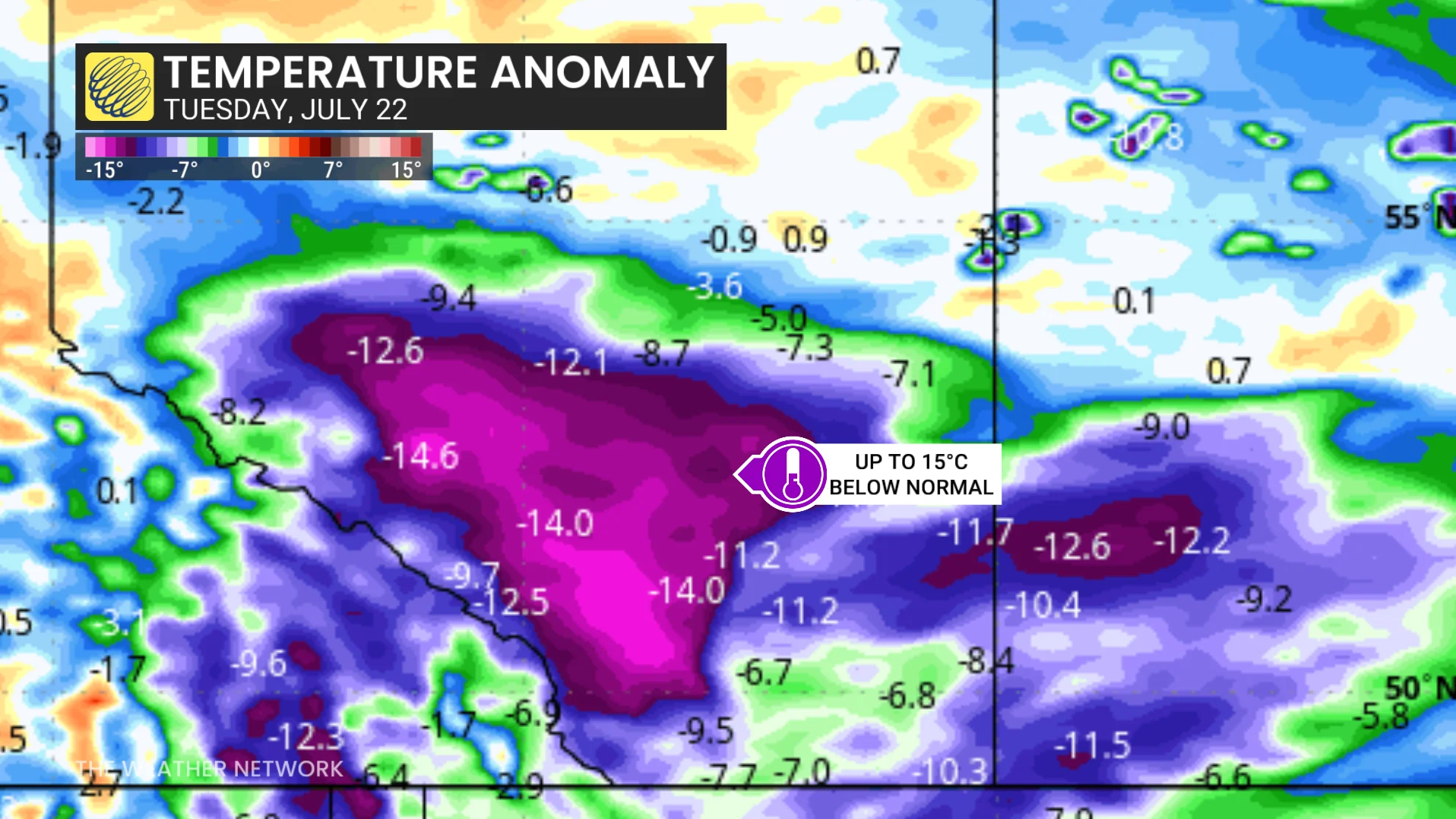
We could even see some heavy, accumulating snowfall in the Rockies above 2000 metres, especially near Jasper.
Stay with The Weather Network for all the latest on conditions across the Prairies.