Flood threat remains high as southern Ontario sees more rain, storms
Southern Ontario will continue to see rain and thunderstorms through Wednesday overnight, with another round into early Thursday morning and an afternoon risk, as the unsettled weather continues
After Tuesday overnight thunderstorms triggered Canada's first tornado warning and red alert of the year in the Windsor area, the stormy and rainy weather will continue through Wednesday night and reappear on Thursday.
DON’T MISS: Summer Sneak Peek: El Niño may split Canada’s summer in two
Thunderstorms will continue through Wednesday overnight, with another cluster expected to move into parts of southern Ontario on early Thursday morning. A risk for more storms will pop up on Thursday afternoon.
Weather Highlights:
Thunderstorm activity to continue through Wednesday night for some areas
Another round of thunderstorms expected Thursday morning in Windsor and Thursday afternoon and evening
Flood risk remains elevated, with numerous locales experiencing flooding and are under states of emergency
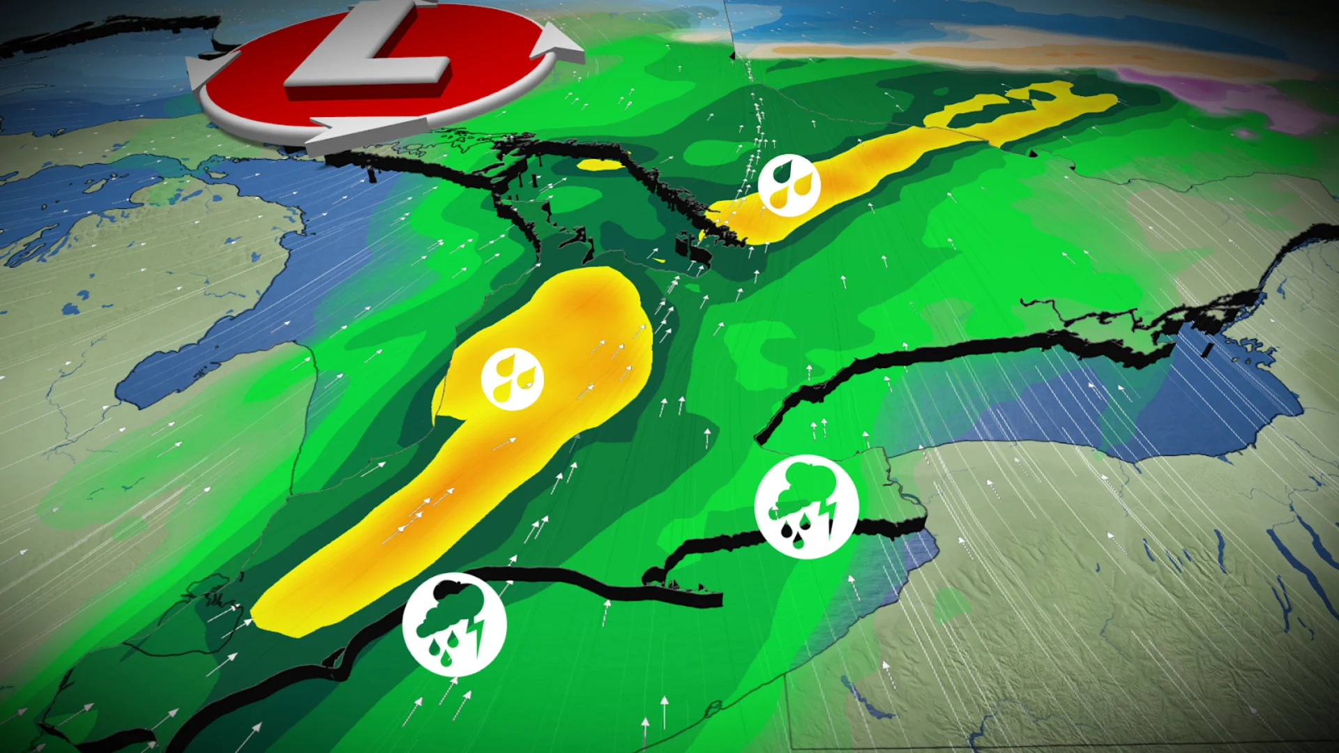
Another round of thunderstorms Thursday: Risk of heavy rain
Thunderstorms that are ongoing in southwestern Ontario will continue into Wednesday evening. There will be a chance of thunderstorms to reach parts of the Greater Toronto Area (GTA) during that time.
A large cluster of storms and rain are expected into the pre-dawn hours of Thursday morning, so the flood threat remains heightened.

Local flood warnings were issued for many parts of central and southern Ontario . All of central and southern Ontario remain under a provincial flood watch.
RELATED: Santa’s Village ‘under water’ amid flooding in Bracebridge, Ont.
Rounds of rain and thunderstorms are forecast through the Thursday morning hours, and then again popping up into the afternoon and evening.

Heavy rainfall is expected Thursday afternoon along Lake Huron shores and north of Barrie, areas already impacted by flooding earlier this week. Totals of 30-50+ mm are anticipated.
Rain will spread into eastern Ontario by Thursday evening.
Feels like March? Thunderstorm risk eases this weekend in southern Ontario, but much cooler weather moves in
Expect calmer weather for Friday, with a mix of sun and cloud. Highs near 20°C are possible in Windsor, Toronto, and Ottawa.

Approach low-pressure system on Saturday will bring a line of rain and thunderstorms across central and southern Ontario, followed by a cooldown to end the mild air that has dominated much of the week in southern Ontario.
Early next week is forecast to resemble late March, with changeable temperatures throughout the final week of April. Near-seasonal to cooler-than-seasonal conditions are anticipated to persist into early May.
WATCH: Early-morning thunderstorm wake-up call in southern Ontario Tuesday
Stay tuned to The Weather Network for the latest forecast updates across southern Ontario.