Severe storms locks onto Edmonton as Alberta braces for days of heavy rainfall
Storms are expected to linger over Edmonton and surrounding regions as Alberta enters another period of unsettled weather this week.
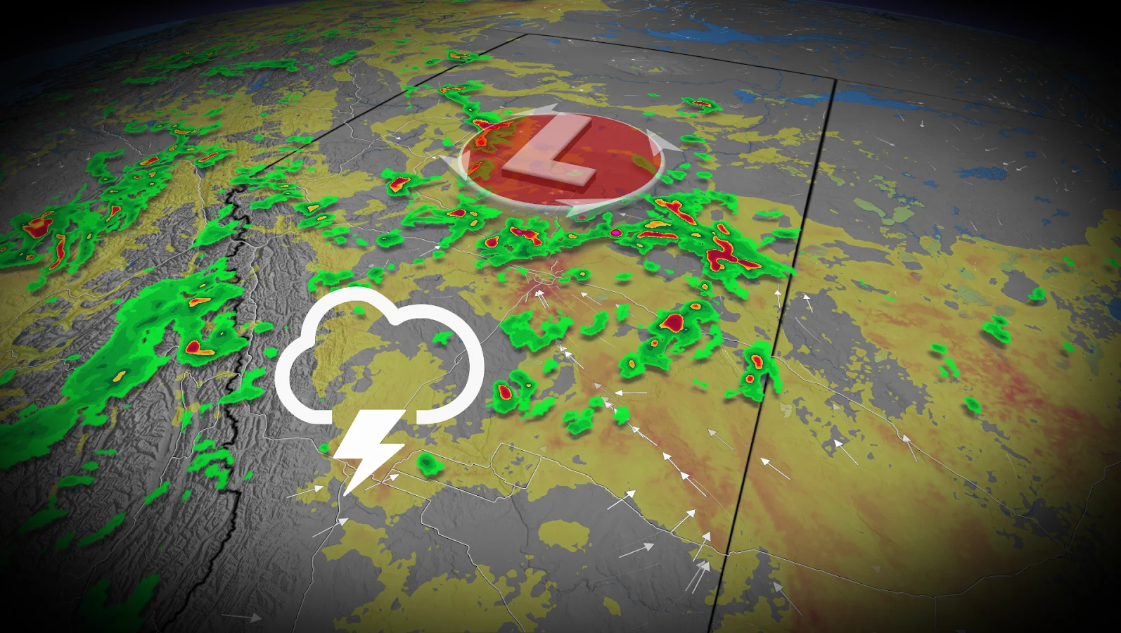
A slow-moving low-pressure system is projected to stall over central Alberta, bringing severe thunderstorms and heavy rain to Edmonton and surrounding areas for the next 24 to 48 hours.
Forecasters warn that the system could bring large hail, intense downpours and up to 75 mm of rain by the weekend.
DON'T MISS: Multiple systems fuel consecutive days of Prairies' severe storm risk
Central Alberta in the crosshairs of foul weather
Wednesday's weather seems to be shaping up to be more than just a quick rain shower. Storms are expected to sweep across the province, focusing on a corridor from Red Deer to Slave Lake.
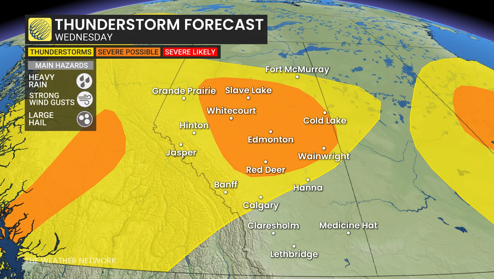
By late afternoon, storms are expected to fire up and track northeast through the evening and overnight. Drivers on the QE2 near Red Deer should expect isolated commute impacts as the system strengthens.
Thursday and beyond: A stormy stretch
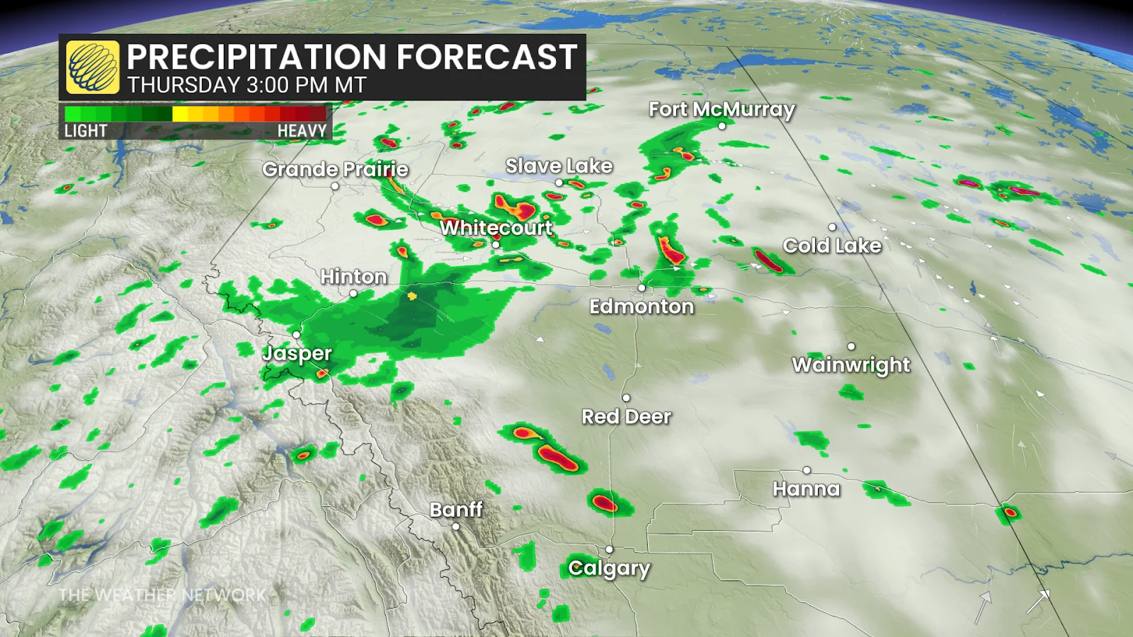
The unsettled pattern will not be changing anytime soon. Rain is expected to continue through Thursday morning, with storm activity picking up again later in the day over Edmonton and points north.
Calgary could experience a passing storm by Thursday afternoon, yet the majority of the severe weather is concentrated farther north.
Friday brings more widespread storms as the slow-moving boundary moves eastward, keeping Alberta soaked. By the weekend, some areas could receive 50 to 75 mm of rain in total.
CHECK OUT: Climate change helping rats thrive in Canada, experts say

Large hail, gusty winds and lightning remain possible with severe storms. Driving may be dangerous during heavy rains.
Residents should stay alert and prepared.
Stay with The Weather Network for all the latest on conditions across Alberta.