Severe storm threat spreads into Atlantic Canada with a quick blast of heat
Heat, humidity, and thunderstorms are all part of the upcoming weather for Atlantic Canada, but a sharp temperature contrast is expected between the Maritimes and Newfoundland
The extreme heat and humidity that's been affecting Ontario and Quebec for the past several days will briefly reach the East Coast on Tuesday. However, these conditions will be pretty short-lived, as stormy weather moves in, bringing relief from the heat.
Residents are advised to stay hydrated and limit outdoor activity during hot periods, and be sure to monitor local weather alerts as conditions change.
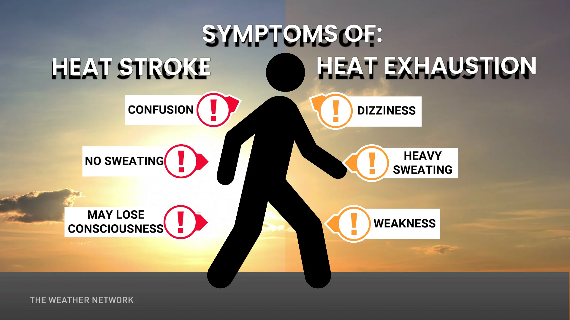
DON'T MISS: Extreme heat ahead: Heat stroke warning signs to watch for
Tuesday: Severe thunderstorm risk as temperatures heat up in the Maritimes
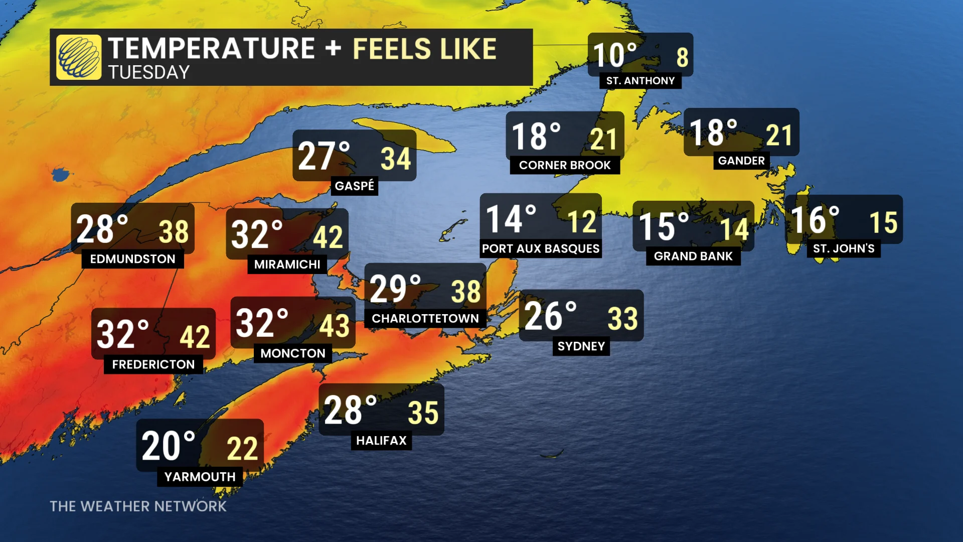
New Brunswick and inland Nova Scotia are set to experience the most intense heat on Tuesday, with temperatures climbing into the low 30s and humidex values making it feel closer to the low 40s. These conditions follow record-breaking temperatures recently observed in Ontario.
In contrast, Prince Edward Island and coastal areas of Nova Scotia will benefit from the cooling influence of the Atlantic Ocean. Temperatures there are expected to peak in the high 20s, with humidex values ranging from the low to mid 30s.
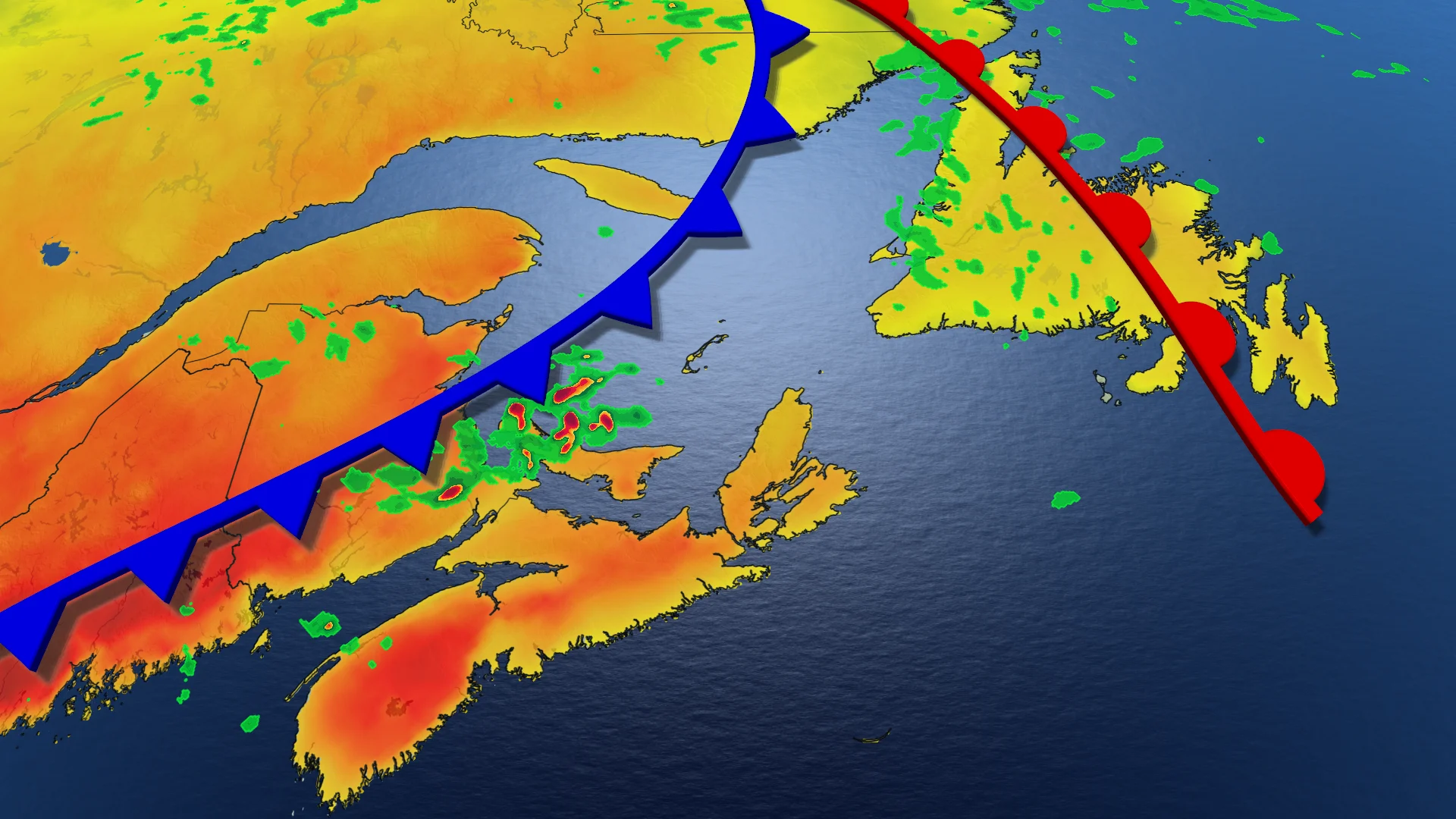
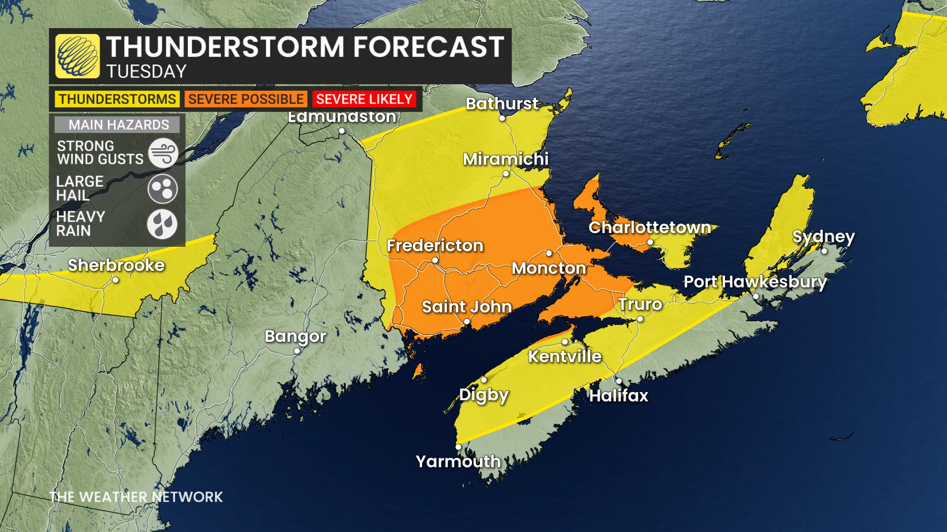
This heat will contribute to atmospheric instability, setting the stage for storm development as a cold front moves through the Maritimes on Tuesday afternoon.
Some storms could reach severe levels, potentially bringing strong wind gusts and hail up to the size of a toonie. Residents are encouraged to stay informed and monitor any weather advisories.
There is the chance for some rain showers in western Newfoundland, and maybe even a rumble of thunder across southwestern sections of the island.
Major temperature contrast in Newfoundland
While temperatures across the Maritimes heat up however, Newfoundland will be feeling like a whole different season in comparison.
Daily high temperatures across Newfoundland are forecast to only reach the mid-teens this week, but without any humidity present, it will actually feel even colder!
SEE ALSO: Why extreme heat is one of the world’s deadliest weather disasters
As the stifling air feels like the mid-30s across the Maritimes on Tuesday, St. John's in Newfoundland will be seeing a high of 16°C, but it will only feel like 15—that's half of Moncton's daytime high. In terms of what it will actually feel like outside, we're looking at a difference of 28.
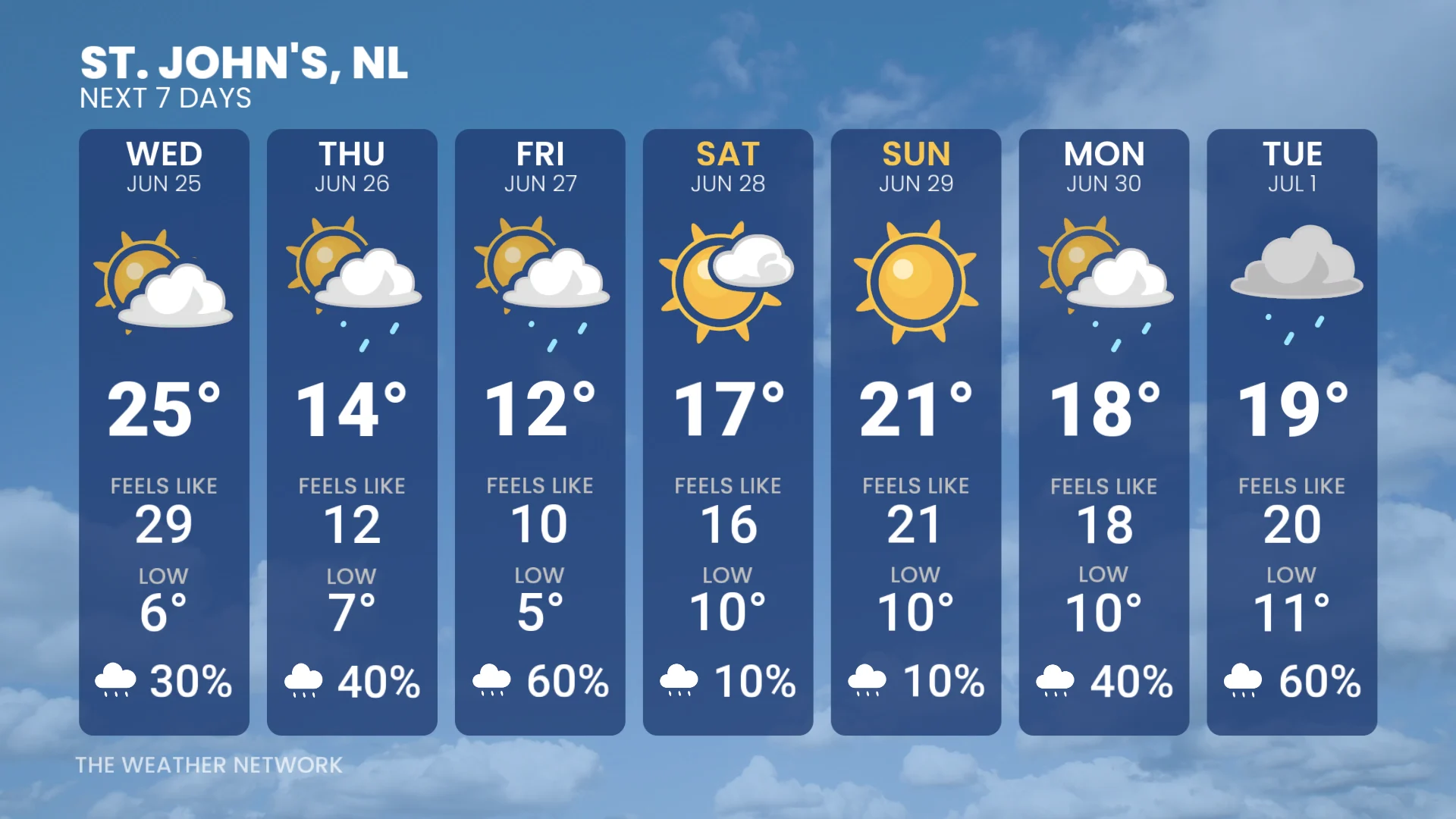
Wondering when it will get warmer? There is a one-day warm up forecast for St. John’s on Wednesday, with a daytime high of 25°C, and a humidex value near 30.
But that blast of warmth is brief, as it’s going to be even colder at the end of the week with temperatures sitting between 12-14°C.
WATCH BELOW: Try these hacks to beat the trapped heat in your car
Hot weather safety tips
Drink plenty of water. Avoid caffeine and alcohol, which can be dehydrating.
Avoid direct sunlight, especially during peak hours and when the UV rating is high.
Wear lightweight, loose-fitting clothing.
Use air conditioning when possible. If you do not have access to air conditioning, consider visiting a cooling centre, a shopping centre, or a public library.
Check on elderly relatives and other vulnerable neighbors.
Avoid strenuous activities during the hottest parts of the day.
If you experience symptoms of heat-related illnesses like dizziness, nausea, or confusion, seek medical attention.
Stay with The Weather Network for more information and updates on your weather across Atlantic Canada.