Severe storm threat shifts into parts of southern Ontario, funnel cloud risk
After a storm-filled Monday evening in parts of northern Ontario, the threat for severe weather returns to parts of the southwest and Lake Erie shores on Tuesday--including a conditional risk of funnel clouds
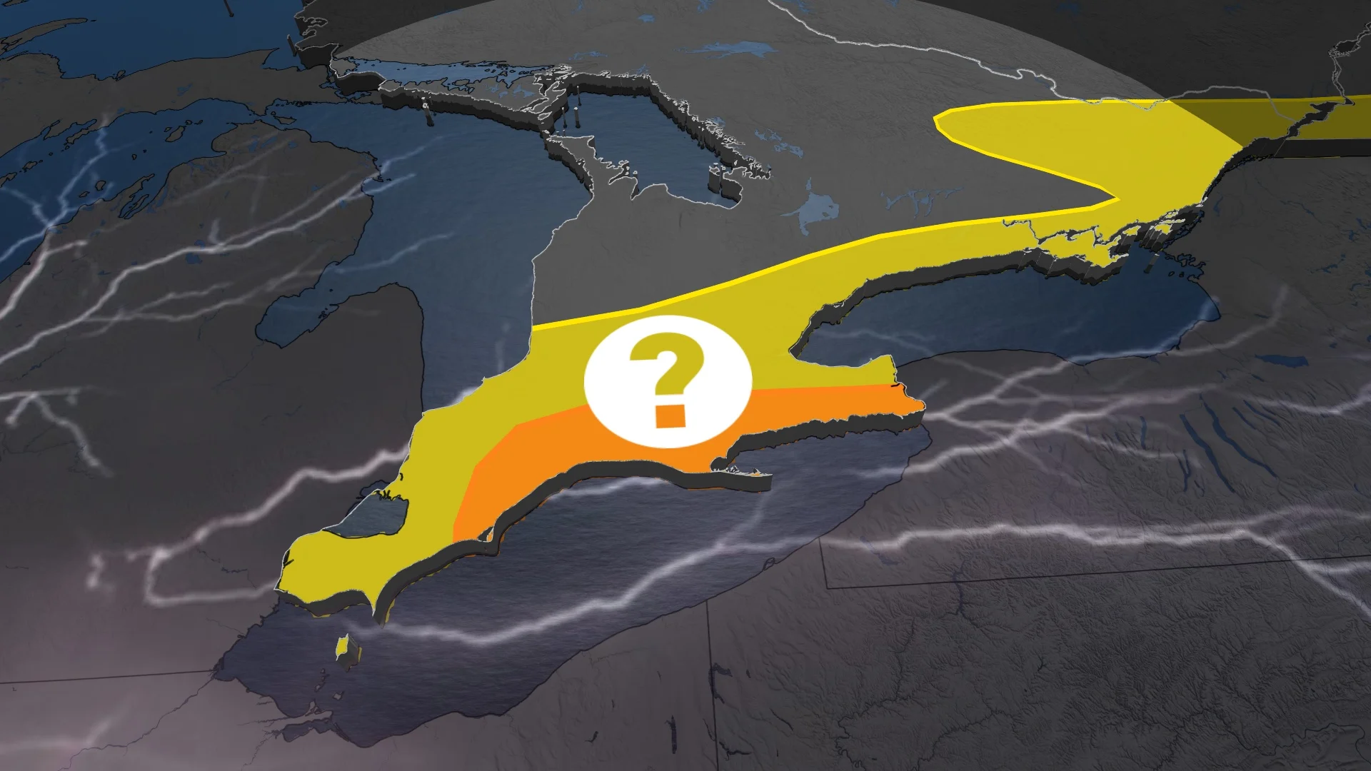
Once again we will see a risk of severe thunderstorms on Tuesday around southwestern Ontario and the Lake Erie shores.
The threat reappears after Monday's severe storms that prompted a tornado warning in parts of Quebec, although there is no confirmation of one occurring at this point.
SEE ALSO: Hair suddenly standing straight up? Take cover immediately
Tuesday will see the thunderstorm threat shift southward, with the severe chance mainly for areas near Lake Erie and towards London and Niagara region.
There is also a small, conditional chance of funnel clouds and even a weak landspout tornado for areas in the severe-possible region. However, there is still a considerable amount of uncertainty in the setup still.
Be sure to monitor local weather alerts and incoming conditions throughout the day.
Threat for severe storms and funnel clouds on Tuesday
The risk of severe thunderstorms on Tuesday will be centred around southwestern Ontario and the Lake Erie shores, with the main threats being heavy rain and strong wind gusts.

While the thunderstorm risk will shift south, there is a large amount of uncertainty still.
RELATED: Storm downs trees, knocks out power in Mattawa, Ont., area
Lake breezes may trigger severe storms along the Lake Erie shores, tracking into the Niagara Peninsula. It is uncertain if the relatively weaker storm trigger can override the suppressing heat. If it does, we may have a boom setup for funnel clouds or a landspout tornado.
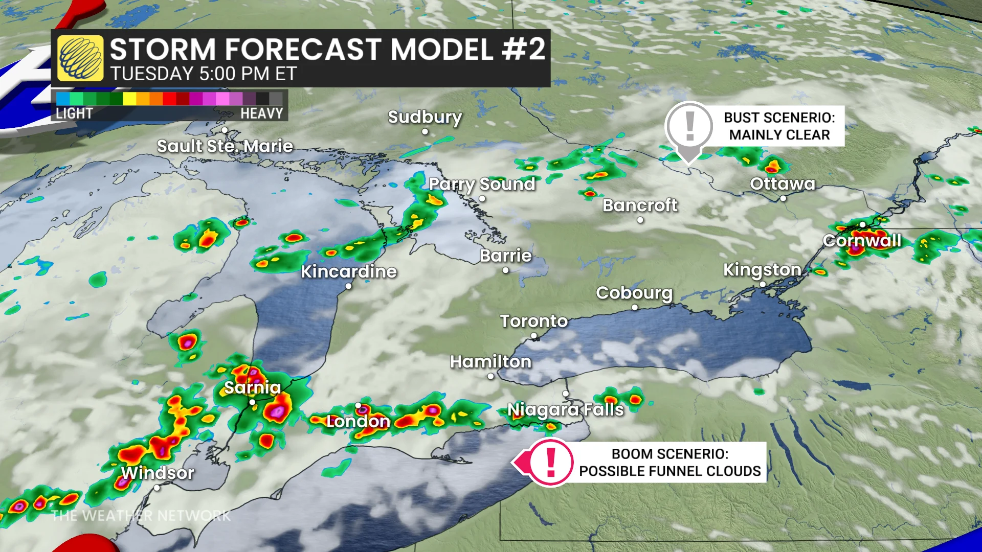
Storms elsewhere in southern Ontario, including the Greater Toronto Area (GTA), have the chance to produce downpours. Amounts of 40-80 mm are possible, so localized flooding on roadways is on the table.
If the lake breezes fail, eyes will be on the Ottawa region for the ring-of-fire thunderstorm cluster moving through by the late-afternoon period.
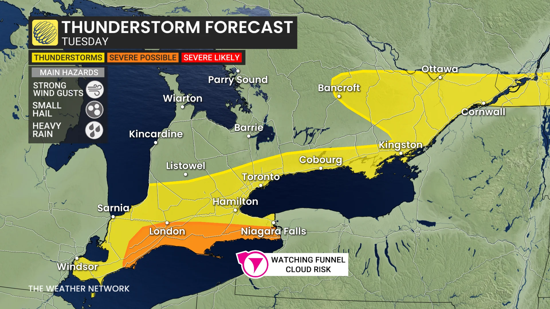
The risk also continues for eastern Ontario and southern Quebec, with some stronger storms possible by the late afternoon, too, including Ottawa, Gatineau and Montreal.
Stay with The Weather Network for more information and updates on your weather across Ontario and Quebec.