
Stay aware as severe storms continue in Manitoba, NW Ont. Thursday night
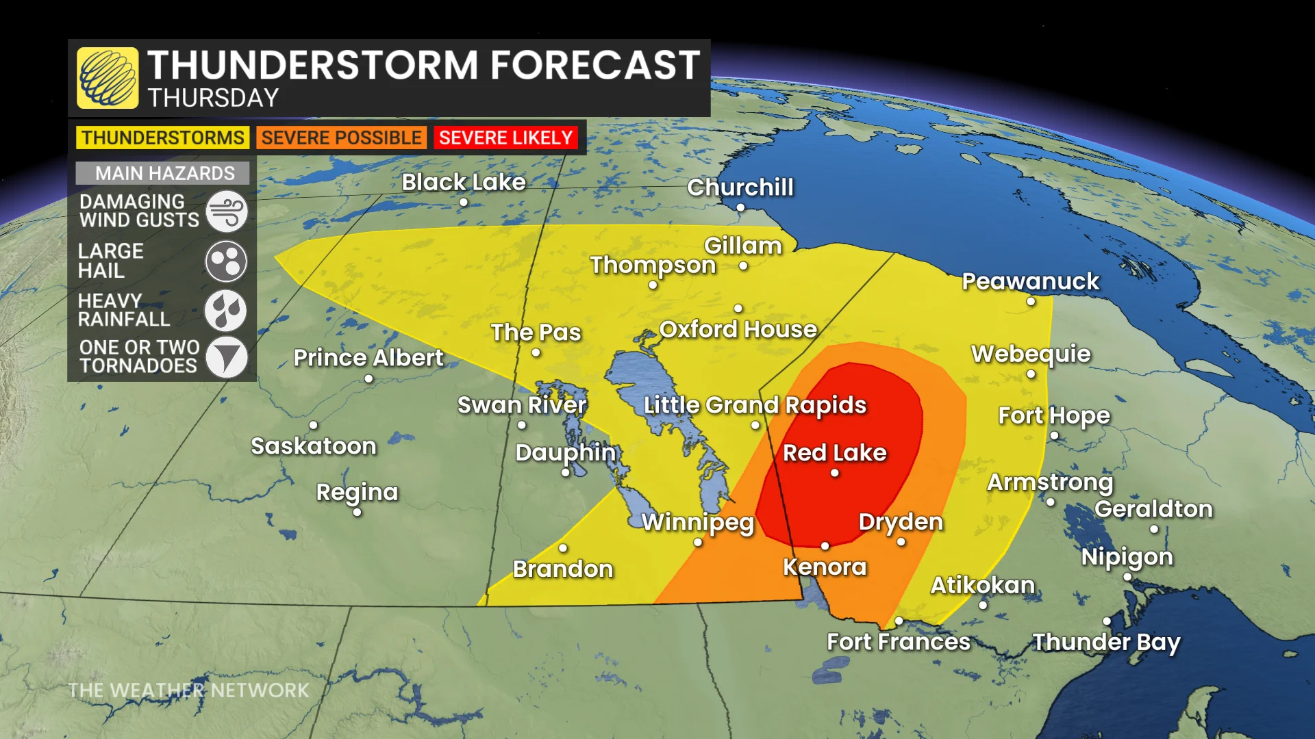
The thunderstorm potential will reappear in Manitoba and northwestern Ontario on Thursday, with a tornado chance present alongside damaging wind gusts and large hail
Strong to severe thunderstorms continued to build across portions of southern Manitoba and northwestern Ontario on Thursday evening as a cold front pushed into high instability draped across the region.
DON'T MISS: Get the latest wildfire news and safety tips to help you stay safe
It'll be important to remain weather-aware, and stay up-to-date on all of the latest watches and warnings as conditions change.
Thursday night: Storms continue to develop and push east
A large low-pressure system tracking eastward created a setup for thunderstorms in southern Manitoba and northwestern Ontario late Thursday.
SEE ALSO: Canada’s rain gauge runs dry, cities top weeks without rain
High thunderstorm energy built through the day, and an approaching cold front acted as the spark to ignite a line of strong storms across the region.
Severe thunderstorms may bring damaging winds of 90-110 km/h and hail between 2-4 cm in size, equivalent to loonie to golf ball-sized hail.
While tornado potential remains uncertain, there is a slight risk of one or two tornadoes developing.

Stay alert for updated forecasts and any weather warnings.
DON'T MISS: 2025 is Canada's second-worst wildfire season on record for area burned
Heading into the weekend, temperatures across the Prairies will be variable. Northern regions are expected to remain cooler than normal, while southern areas will experience warmer-than-normal conditions, with periods of warmth pushing in from south of the U.S. border. Looking ahead to next week, warmer-than-average temperatures are anticipated to prevail across much of the region.
Be sure to check back for the latest updates across the Prairies