Severe storm threat brings large hail risk to Alberta, but there's a big benefit
Thunderstorms are expected to affect Alberta over the next few days, with the potential for some to become severe. Stay informed on the latest updates and monitor weather conditions closely
A thunderstorm threat will cover parts of southern and central Alberta over the next several days, some which could turn severe in nature.
Strong winds and the threat for large hail in populated areas are the main risks if storms develop. Heavy and persistent rain is also on the table, with 50-75 mm possible in some areas through Sunday.
DON'T MISS: Get the latest wildfire news and safety tips to help you stay safe
Mid-June is certainly an important period for rainfall across the region, providing much-needed moisture. While some wildfire-affected areas are unlikely to receive the volume of rain required to fully address ongoing challenges, days of significant rainfall will help in the efforts to control the fires, and reduce the risk for new fires to begin.
Residents are encouraged to stay updated on weather alerts and potential impacts related to heavy rainfall and thunderstorms in the coming days. Here's a closer look at the multi-day weather breakdown.
Thursday:
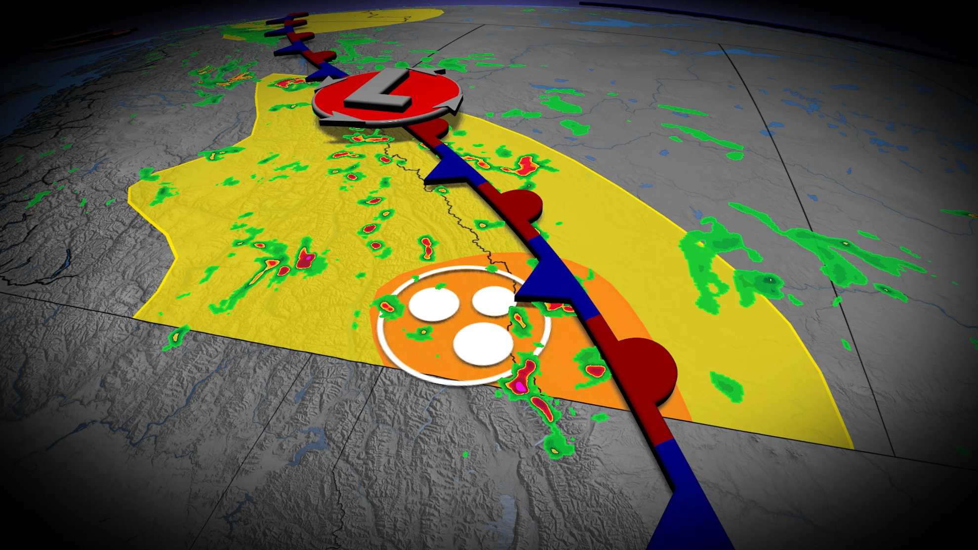
A stationary boundary is expected to develop over the Rockies Thursday, leading to widespread thunderstorm activity. Some storms could become severe, bringing risks of large hail, heavy rainfall, and strong outflow winds.
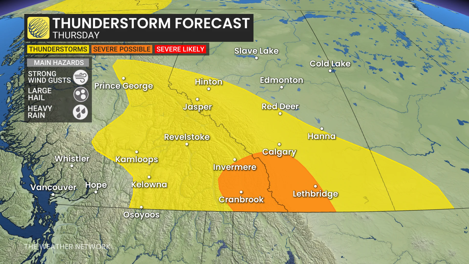
By late afternoon, these storms may track eastward, potentially impacting the southern foothill regions.
Friday:
On Friday, another low pressure system will develop and move north, delivering steady rain to Edmonton and areas further north.

RELATED: How does hail get so big?
Thunderstorm activity remains a concern across central Alberta, with conditions favouring large hail development between Calgary and Edmonton.
By the evening hours, elevated thunderstorm potential is anticipated near the southern Alberta-Saskatchewan border.
A shift in wind direction is expected to help disperse wildfire smoke in southern areas, as well.
Saturday:
The low pressure system in northern Alberta is expected to shift east into Saskatchewan on Saturday, while continuing to generate thunderstorms along its frontal boundaries stretching across Alberta and Saskatchewan.
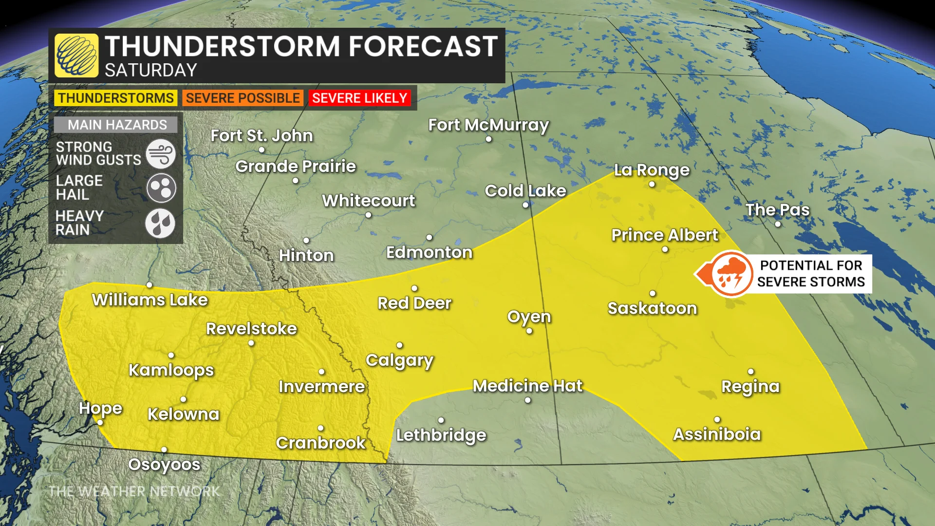
Residents should remain alert to potential storm development over these next several days, and monitor local weather updates across impacted areas.
DON'T MISS: The Weather Network's exclusive summer 2025 forecast
The much-needed rain the region has been waiting for
In all, between 50-75 mm of rain is possible in some areas by Sunday.
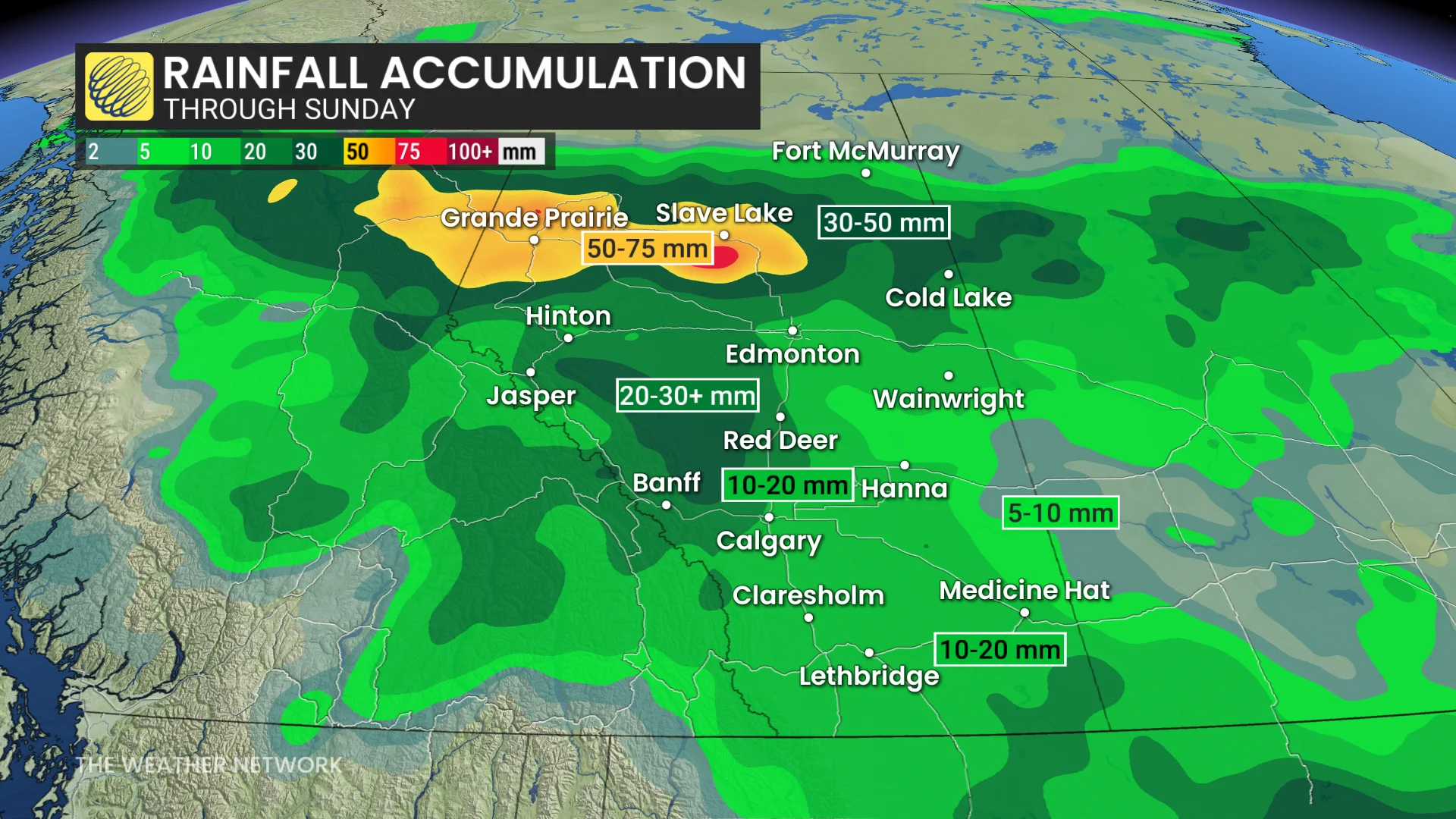
The expected rainfall will not only aid wildfire suppression efforts, but will also cover much of the agricultural regions in the southern Prairies, offering essential moisture.
Looking ahead, a shift to a hotter weather pattern is anticipated by the end of June once again.