See where you land in a divided weather pattern that kicks off April in Canada
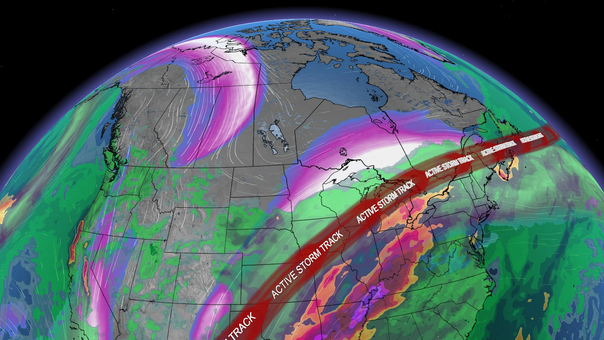
An active pattern takes hold of Eastern Canada over the next 7 days, while much of Western Canada heads into a bit of a dry spell. A shifting jet stream means changing conditions
Spring has sprung and we'll say goodbye to the last of the winter months this week. But that doesn't necessarily mean the winter weather is completely over just yet.
A contrasting weather pattern will shape up over Canada, with parts of the country seeing a bit of an extended dry spell, while others face a more active set up, with the chance for more freezing rain, snowy conditions, heavy rain, and even thunderstorms.
April is known to be one of the most volatile months of the year for the country, after all.
DON'T MISS: A typical April’s weather across Canada is one wild ride
Quieter pattern across Western Canada as April begins
The weather pattern across the west will be rather quiet for the most part over the next seven days.

That's as the jet stream stays south of the country, dipping down into the United States.
Coastal British Columbia will remain mostly dry for the next week ahead, with temperatures rising pleasantly into the weekend.

Alberta will be the exception in terms of dry conditions, as another blast of snow takes aim at the province mid-week.
The heaviest swath looks to fall across the foothills, but bursts of snow could impact Calgary at times, as well.

By late week, all of Western Canada will be quiet and dry, with an overall warming pattern shaping up for the first weekend of April.
DON'T MISS: Get to know the hidden gems across Canada
Brace for rain, ice, snow, and even thunderstorms across parts of Eastern Canada
The focus of the active weather will remain locked over sections of central and eastern Canada -- hot on the heels of a major ice storm for Ontario, and a widespread freezing rain event for Quebec and New Brunswick.
The jet stream will set up from the Great Lakes to Atlantic Canada, bringing in back-to-back system through the next week.

This will include a large and strong storm that will track into the Great Lakes region mid-week, bringing more ice and snow to parts of northern Ontario. Localized totals of 20+ cm are possible, and that includes the Thunder Bay area.
Mostly rain is expected for southern Ontario and southern Quebec, but a period of freezing rain is possible for the Nickel Belt region, east of Georgian Bay, the Ottawa Valley and southern Quebec. Some snow is also possible at the start for Ottawa and Montreal, with a quick changeover to ice, and then straight rain.
RELATED: Ice storm aftermath: Safety tips to keep in mind
A relatively quick changeover to rain will help to prevent a repeat of the ice storm that we saw over the weekend.
Heavy rain is likely across southern Ontario, with widespread totals of 25-50 mm, and as much as 50-75+ mm in localized spots. There is also a significant threat for strong to severe thunderstorms, especially for southwestern Ontario into Wednesday night.

This system eventually tracks into Atlantic Canada for Thursday and Friday, with yet another system forecast for the late weekend, and into early next week for eastern Canada. This will be a start to April that will certainly test your patience.