
Season rewind in southern Ontario as snow, chilly temperatures return
Don't put away the winter gear, yet. Southern Ontario is facing an abrupt return to winter weather with plunging temperatures, incoming snow and strong wind gusts--impacting early-week commutes
Southern Ontario will take a step back into winter early this week as temperatures will tumble back into the single digits, with the chance for snow to spread across into early this week. Brace for slippery roads and tricky travel.
DON'T MISS: Will Canada's April bring a summer preview or a winter rewind?
A deepening trough building across southern Ontario is siphoning in Arctic air from Nunavut. This air mass exchange will have a drastic impact on temperature and the weather pattern to kick off the week.
Weather Highlights
Sharp cooldown as Arctic air sends temperatures plummeting
More organized snow possible Monday night into Tuesday morning
Warmth returns on Thursday
April chill, snow return to southern Ontario
The first several days of April have featured volatile temperature swings and changeable weather across southern Ontario. Temperatures on Friday soared to Canada’s warmest values this year, reaching 25.8°C in the Hamilton area.

Winds have been particularly gusty, as well, at times reaching 70 km/h, along with scattered thunderstorm activity.
RELATED: How Colorado lows and Texas lows affect our weather in Canada
Another round of snow-showers develops late Monday with these convective bands of snow spinning off Lake Huron and Georgian Bay as a weak low-pressure system attempts to become better organized by the evening.
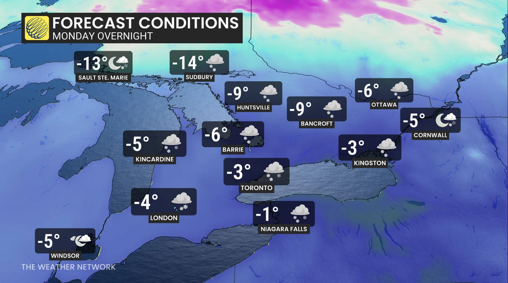
Monday overnight features a more organized band of snow north of Lake Ontario associated with the trough, bringing more localized snowfall accumulation.
Locally, more than 5 cm is possible, but confidence is low in the exact placement of the heaviest amounts.

Bursts of moderate-to-heavy snow through Tuesday morning will be a concern for the GTA, Kitchener-Waterloo, London and Niagara.
Most places in southern Ontario will see at least a trace of snow, but regions east of Toronto appear to have higher odds of seeing more organized snowfall through early Tuesday morning.

Daytime highs are forecast to stay below freezing across most of southern and eastern Ontario, with temperatures 7°C to 9°C below normal.
The temperature roller-coaster continues as southern Ontario once again ramps up temperatures by Thursday. A new low tracks well north to Hudson Bay, putting southern Ontario comfortably in the warm sector through Friday.
Highs in the mid-to-upper teens are possible along the 401 corridor.
Stay tuned to The Weather Network for the latest forecast updates across southern Ontario.