Severe storm threat pops up in southern Ontario, prompting watches
A risk of severe thunderstorms with heavy rain, strong winds, and small hail is possible Tuesday evening in parts of southern Ontario, while northern parts of the province brace for 5–15 cm of snow
A strong storm is set to deliver a blend of spring and winter weather impacts across Ontario this week.
Weather Highlights:
A second wave of strong thunderstorms is possible between 5 p.m. and 10 p.m., bringing another round of heavy rain, strong winds, and small hail
Severe thunderstorm watches are in effect
Northern Ontario will see light freezing rain and snow, with 5–15 cm forecast
Flood watch issued for Grand River watershed
Two additional systems are expected later in the week
A clash of air masses will result in summer-like warmth across parts of the south, while northern areas will experience lingering winter cold. The province will see rounds of snow, ice, rain, and thunderstorms through Wednesday morning.
Here's what you need to know:
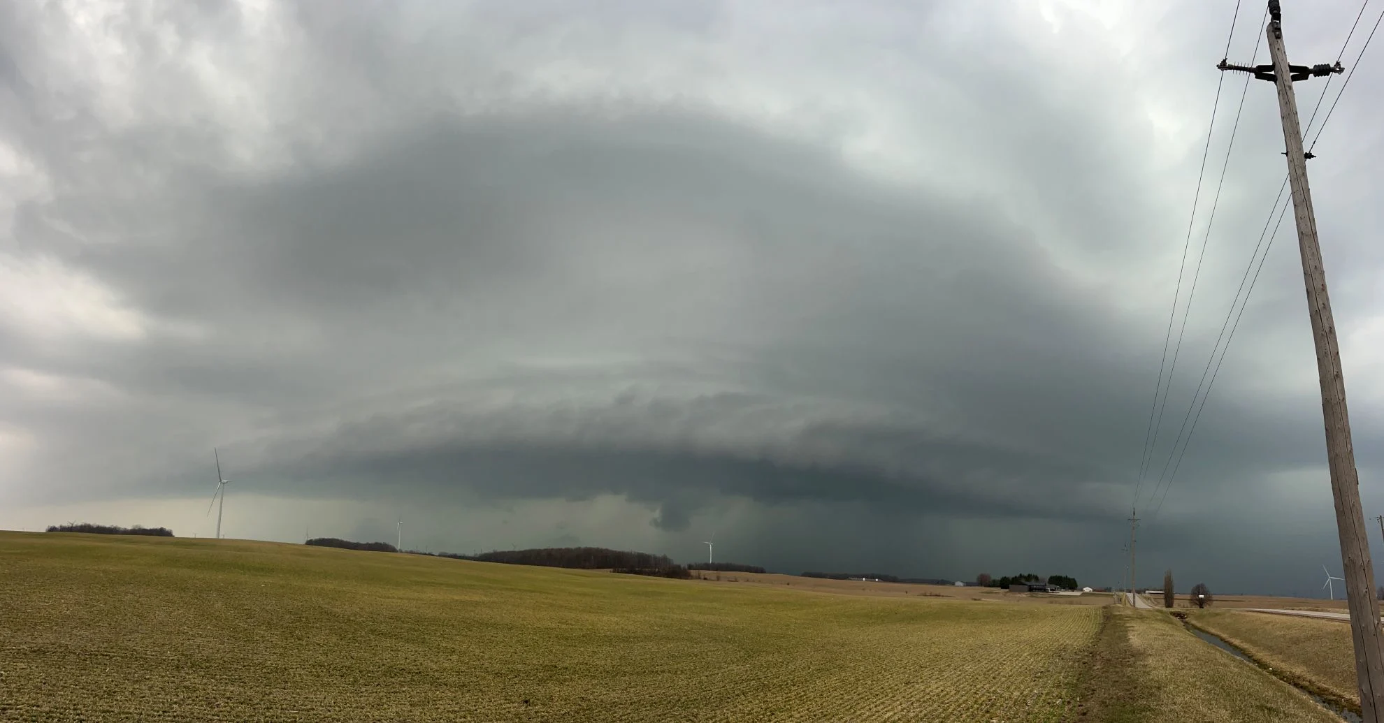
Southern Ontario braces for another round of thunderstorms Tuesday night
Early morning thunderstorms swept through southern Ontario and the Greater Toronto and Hamilton Area, prompting severe thunderstorm watches and warnings. Reports of pea-sized hail emerged from Guelph, along with pooling water on roads.
RELATED: Flood watch issued for Grand River watershed; up to 60 mm of rain forecast
By this evening, the cold front approaches off Lake Huron, moving from west to east. From 8 p.m. to 10 p.m., expect thunderstorms to roll into the GTA, Niagara and regions east.

Hazards include locally heavy rainfall, strong wind gusts, and small hail.
Rainfall amounts of 20–40 mm are likely, with isolated higher totals possible in areas affected by thunderstorms. This could lead to isolated flooding or water pooling on roads.

Snow and freezing rain expected for northern Ontario on Tuesday
Meanwhile, a band of snow will move across parts of northern Ontario, including Thunder Bay and areas east of Lake Superior through Tuesday. Snowfall may vary in intensity throughout the day as waves of precipitation accompany an incoming system. Heavier snow is expected Tuesday afternoon, particularly along the shores of Lake Superior.
Snowfall accumulations of 5–15 cm are forecast for regions north and east of Lake Superior.
DON'T MISS: A typical April’s weather across Canada is one wild ride
Further south, communities northeast of Georgian Bay, including the Nickel Belt, may see periods of freezing rain and ice pellets beginning Tuesday morning. While precipitation is expected to remain light early on, there may be minimal ice buildup.
By Tuesday evening, freezing rain and ice pellets could intensify. However, there is some uncertainty about the system's track, which could shift the areas facing the greatest risk of freezing rain farther north or south.
More stormy weather to come late week across Ontario with mixed precipitation
Ontario will encounter two additional rounds of stormy weather later this week, featuring multiple precipitation types and fluctuating temperatures.

The first system is set to arrive Thursday, bringing snow and ice to northern regions and rain to southern areas. A third system is forecast to move in on Saturday, following a similar path with another mix of precipitation types.
Be sure to check back for updates as we fine-tune this forecast.
April is a turbulent month of weather
With April set to kick off on Wednesday, spring's fluctuating pattern is expected to continue. Temperatures will gradually trend upwards, with occasional warmer days and milder cold spells. However, consistently warm, above-normal conditions are unlikely to dominate as the month progresses.
Be sure to check back on April 1 as we release our official, monthly weather outlook!