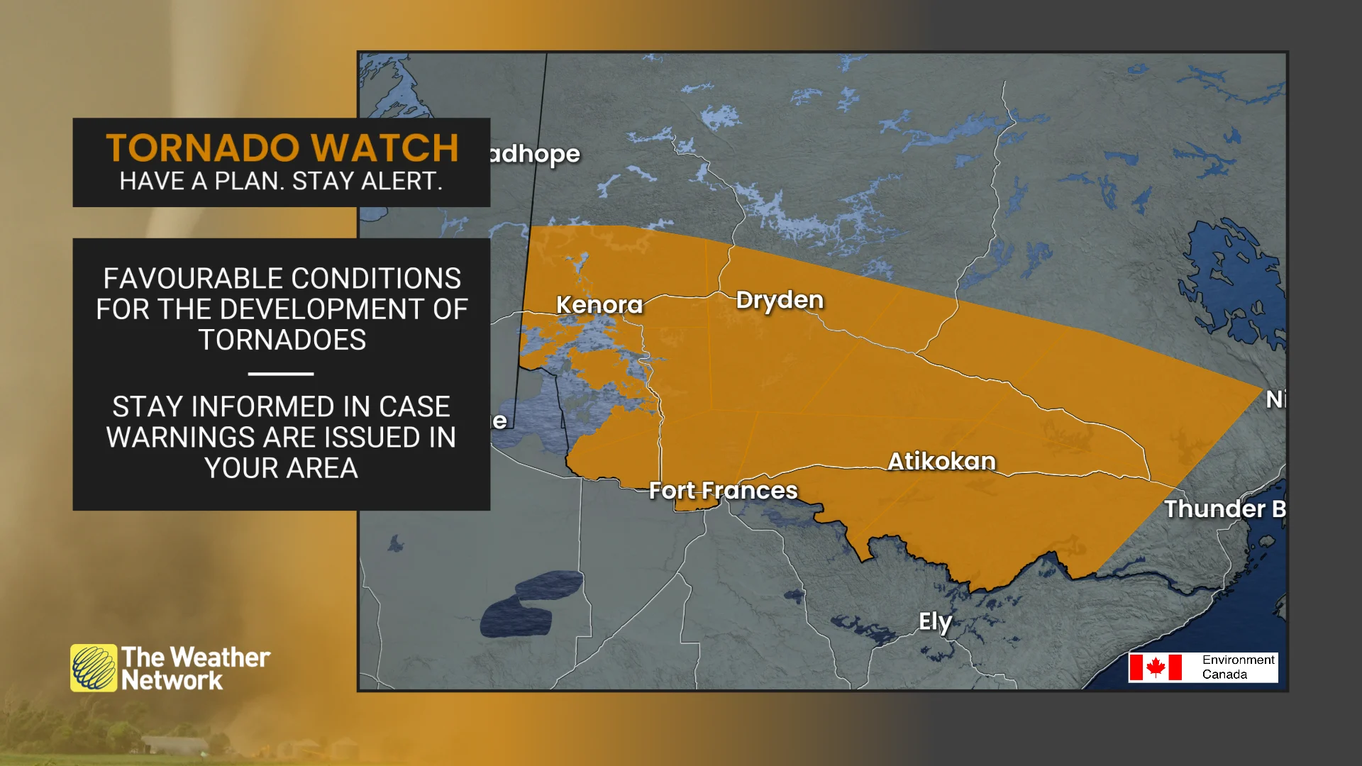
Tornado watches issued in northwestern Ontario amid severe storm potential
Residents across northwestern Ontario are advised to monitor the forecast closely as severe weather, including the potential for a tornado, is expected to continue through Sunday evening. Check back regularly for updates.
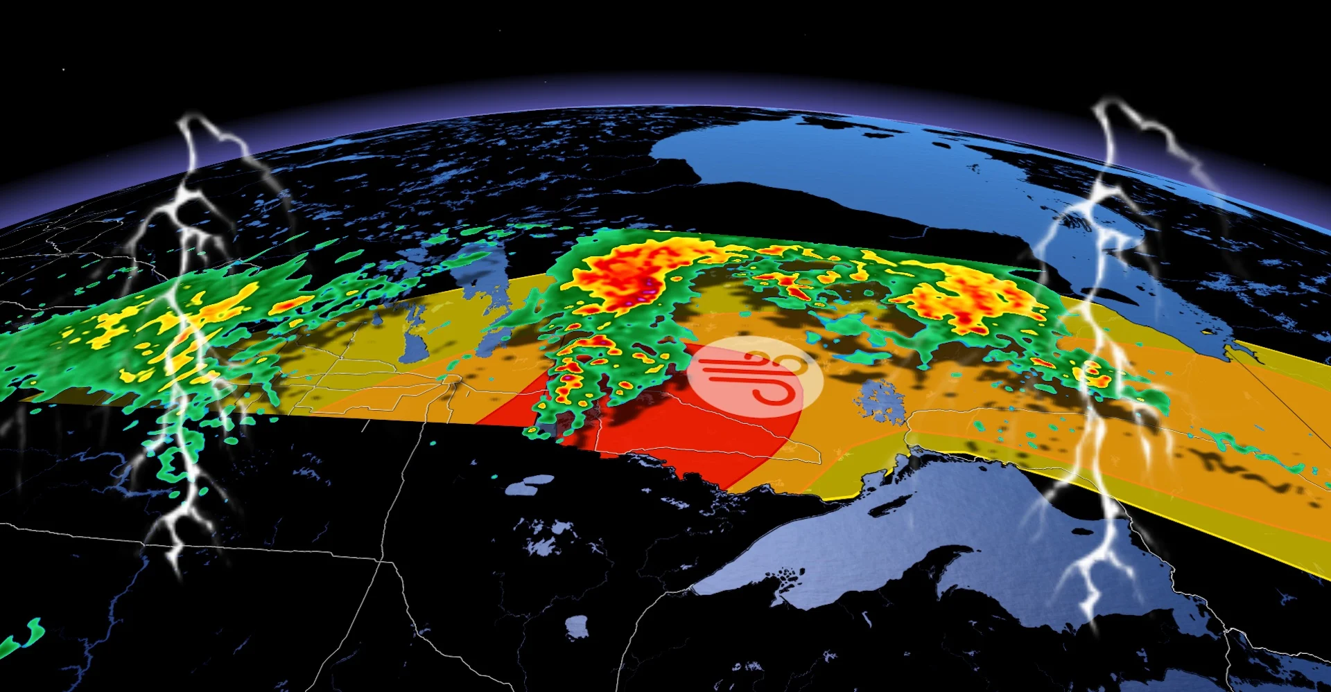
Atmospheric conditions favourable for the development of thunderstorms that could produce tornadoes have surfaced in northwestern Ontario.
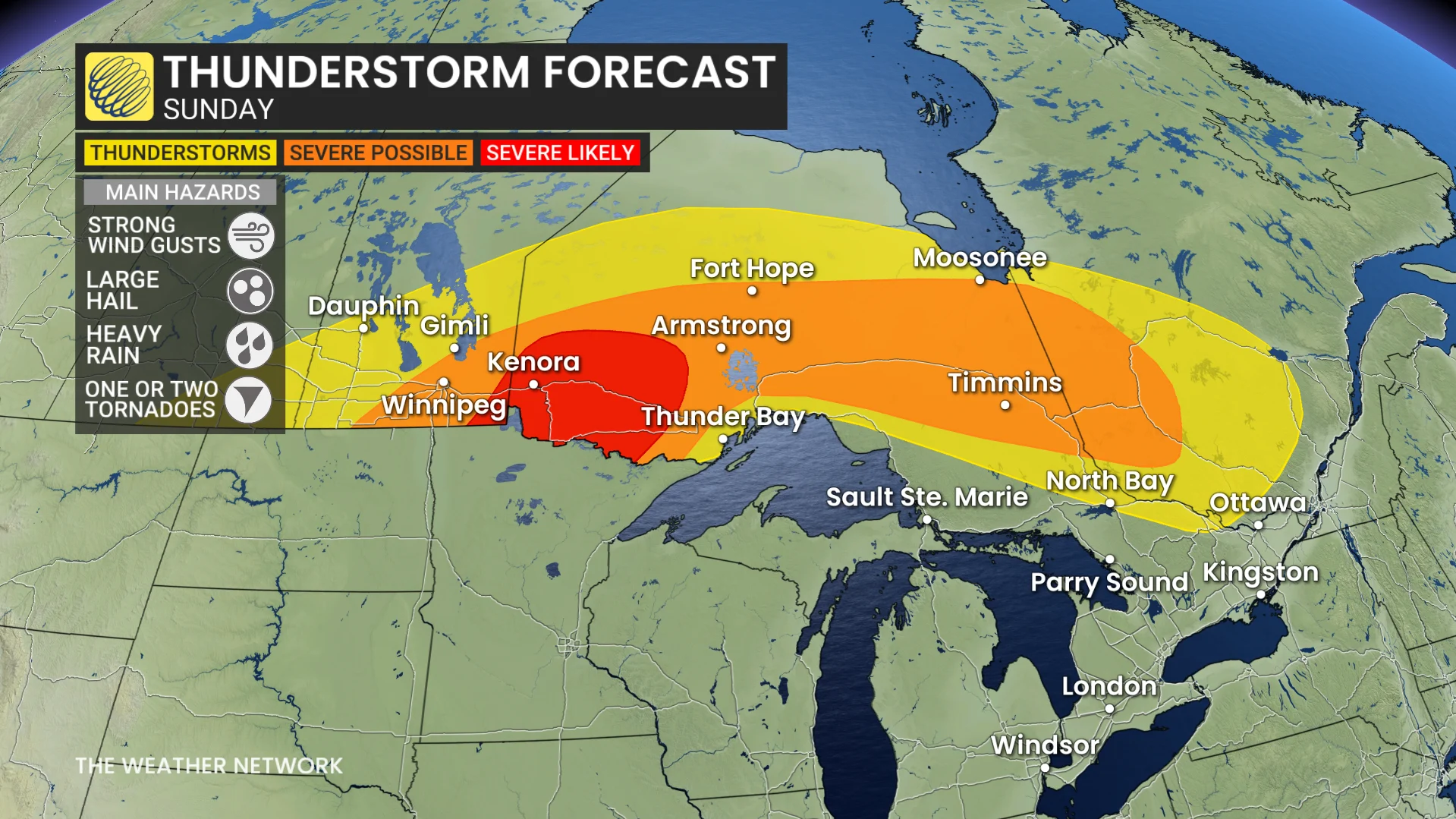
Severe storms capable of producing heavy rain, strong winds and large hail are possible in parts of southern Manitoba and northwestern Ontario on Sunday. The threat for tornadoes, however, is situated in northwestern Ontario, and will persist through Sunday evening.
DON'T MISS: The Weather Network's exclusive summer 2025 forecast
Pay close attention to watches and warnings in your area as severe weather, including a tornado or two, could develop on Sunday.
Current tornado watches
Atikokan - Shebandowan - Quetico Park
Dryden - Vermilion Bay
Fort Frances - Emo - Rainy River
Ignace - English River
Kenora - Grassy Narrows - Whitedog
Seine River Village - Mine Centre
Sioux Narrows - Nestor Falls - Morson
Upsala - Raith
11:21 AM EDT: Conditions are favourable for the development of severe thunderstorms, which may produce tornadoes. Strong winds, large hail and heavy rain are also possible.
While there will be a severe thunderstorm risk early Sunday afternoon, the tornado threat is expected to materialize late this afternoon and persist through the evening hours.
Hazards: Isolated tornadoes, wind gusts up to 120 km/h, ping pong ball to possibly approaching tennis ball-sized hail and heavy rainfall.
This is a dangerous and potentially life-threatening situation.
Be prepared for severe weather. Take cover immediately, if threatening weather approaches.
In the event of a tornado, or if a tornado warning is issued for your area, it is recommended you take the following actions: Go indoors to a room on the lowest floor, away from outside walls and windows, such as a basement, bathroom, stairwell or interior closet.

Leave mobile homes, vehicles, tents, trailers and other temporary or free-standing shelter, and move to a strong building if you can. As a last resort, lie in a low spot and protect your head from flying debris. Lightning kills and injures Canadians every year. Remember, when thunder roars, go indoors!
Severe thunderstorm chances grow Sunday afternoon and evening
A powerful ridge of high pressure developing over the eastern United States will nudge into Ontario through the end of the weekend.
The outer periphery of these heat ridges serve as the ideal environment for the development of thunderstorms, which then ride around the edge of the ridge like trains on railroad tracks.

A low-pressure system developing off the Dakotas will push along a strong warm front and move into southeastern Manitoba on Sunday.
DON'T MISS: PHOTOS: Tornado hits Saskatchewan as severe storms pelt Prairies
The warm front will initially push north and will tap into very humid air, allowing any thunderstorms that form to bring heavy rain.
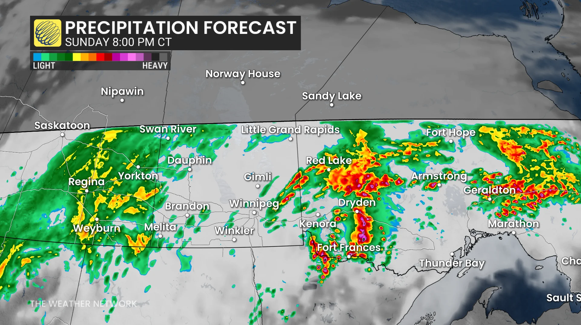
A second line of storms expected to initiate in the late afternoon on Sunday, shifting farther west through the overnight period.
Nocturnal thunderstorms are dangerous because it’s easy to miss severe weather warnings while you’re tuned out or asleep. Make sure you have a way to receive the latest severe weather alerts the moment they’re issued.
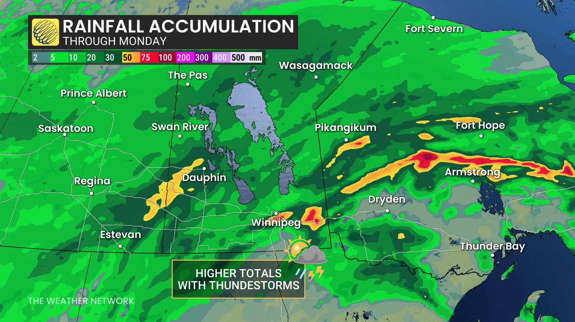
Storms may line out as they track towards northwestern Ontario, bringing the best chance for large hail, strong winds and a chance of rotation. That means one or two tornadoes will be possible.
Heavy rainfall will be the main hazard with high moisture levels in the atmosphere, and storms may redevelop over the same area, so localized flooding is possible.
Strong winds exceeding 100 km/h is possible, as well as large hail up to 2-3 cm in diameter for areas in the severe-likely region (red).
However, a strong cap over the region will lead to the uncertainty of the intensity and timing of the storms, but there is quite a bit of instability and fuel the development.
If these storms do develop, there will be heavy rain associated with the cells. Forecasters will have to see how the first round plays out to get a better idea on the cap, and if it will break and lead to strong storms developing.
Stay with The Weather Network for all the latest on conditions across southern Manitoba and northwestern Ontario.