Relief from the heat arrives in Ontario, but with rounds of rain, strong storms
Ontario heat wave ends as major cool down brings much more comfortable temperatures, but with a storm threat and periods of rain heading into the weekend
Ontario's first summer heat wave, marked by record-breaking heat and dangerous humidity, has come to an end as much cooler temperatures break the hot weather.
DON'T MISS: Canada Day weekend brings changeable summer weather across the country
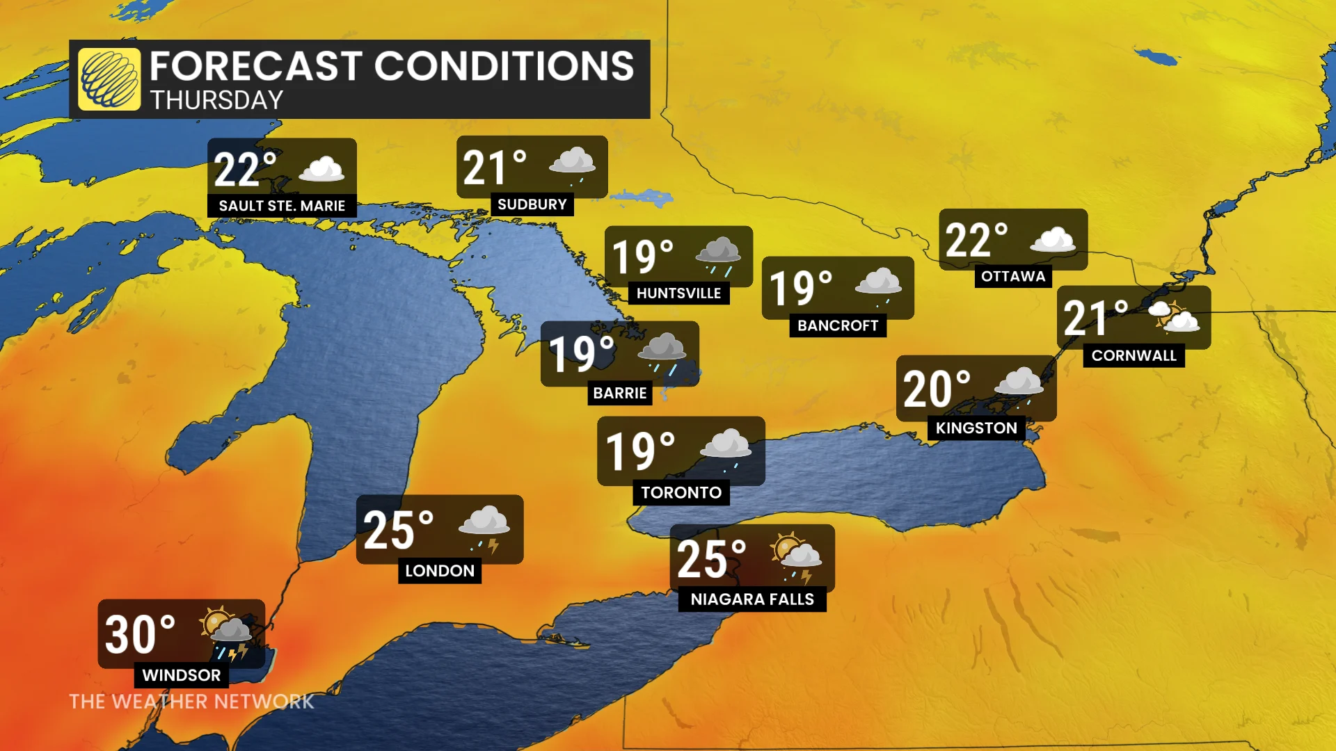
By Thursday, a sharp drop in temperatures will be felt across much of the province, with daytime highs struggling to even crack the 20-degree mark.
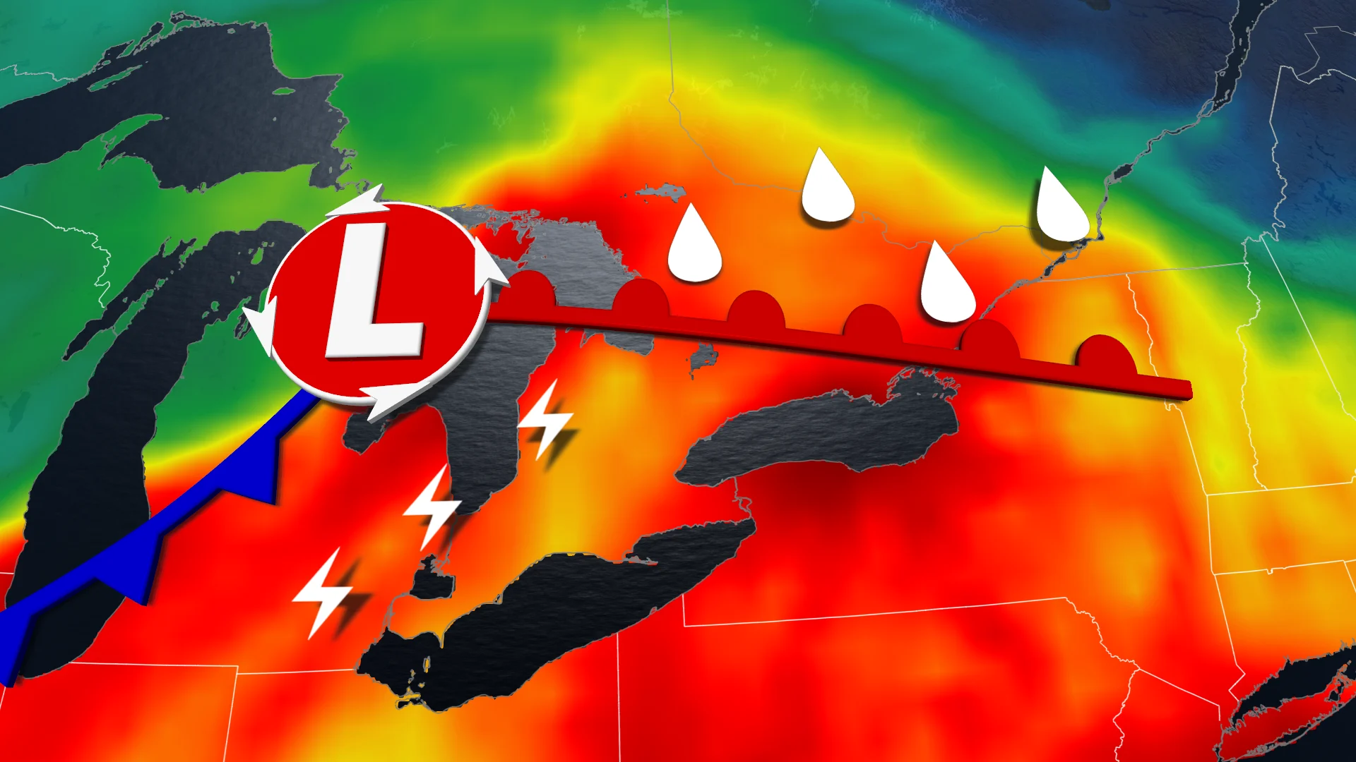
With the heat relief however, comes rounds of rain and the threat for thunderstorms heading into the weekend. Some of the storms have the potential to become quite strong and severe, so it'll be important to keep a close eye on any weather alerts in your area.
__Thursday: Temperatures quickly tumble and first round of rain hits __
The first round of rain moved into the Nickel Belt early Thursday morning, spreading into central Ontario by midday, and set to reach eastern Ontario by the afternoon.
Southwestern Ontario will experience a mix of dry conditions and passing showers, while remaining quite warm. There's also the chance for a rumble or two of thunder throughout the day.
DON'T MISS: The Weather Network's exclusive summer 2025 forecast
Temperatures across the Greater Toronto Area (GTA), central, and eastern Ontario will hover around 19-20°C. This will feel like a significant drop compared to the 30°C highs earlier in the week, which, with the humidex, made conditions feel closer to the mid-40s.
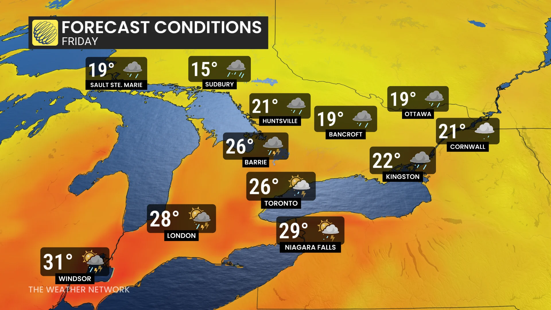
Friday: Risk for strong thunderstorms with wind and hail
The next round of rain is set to arrive late Thursday night into Friday morning, starting in northeastern Ontario before moving into central and eastern Ontario through the morning hours. The GTA may also see rain return Friday morning.
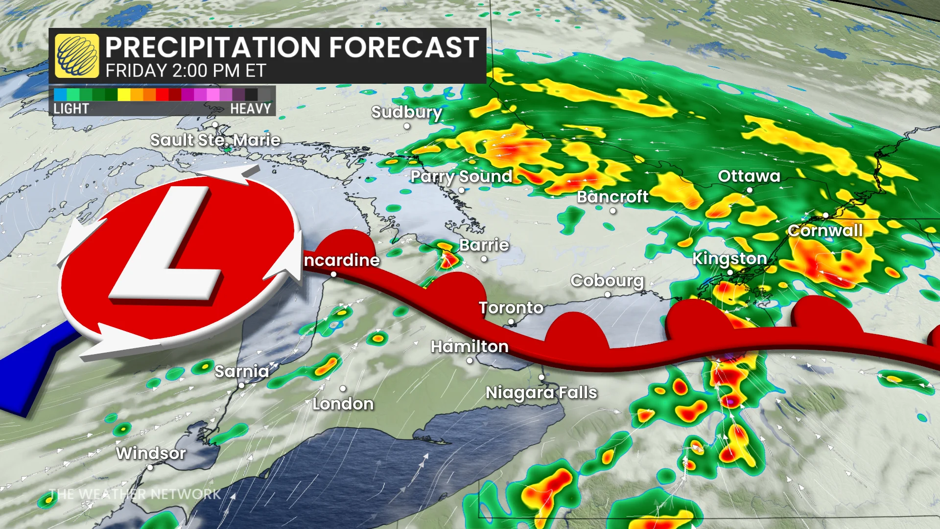
Rain is expected to continue in central and eastern Ontario into Friday night.
Thunderstorms are possible Friday afternoon and evening as a frontal system moves through. Some storms could be strong, with the potential for powerful wind gusts and hail.
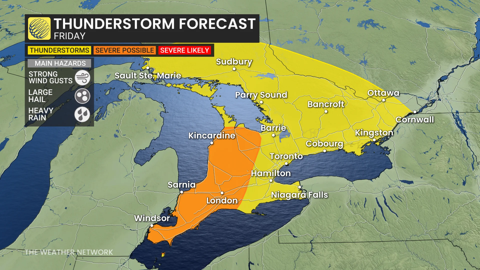
The timing of the front will dictate how close to the GTA the severe storms reach, but at this time, the greatest threat remains for the Lake Huron shorelines.
Temperatures in the GTA will see a slight increase, while central and eastern Ontario will still struggle to reach 20°C.
Saturday: Some lingering showers as temperatures recover
Rain is expected to taper off in central and eastern Ontario by Saturday morning, though scattered showers could continue across the east through the afternoon and evening.
Temperatures will slowly recover, reaching the low to mid-20s by Saturday afternoon.
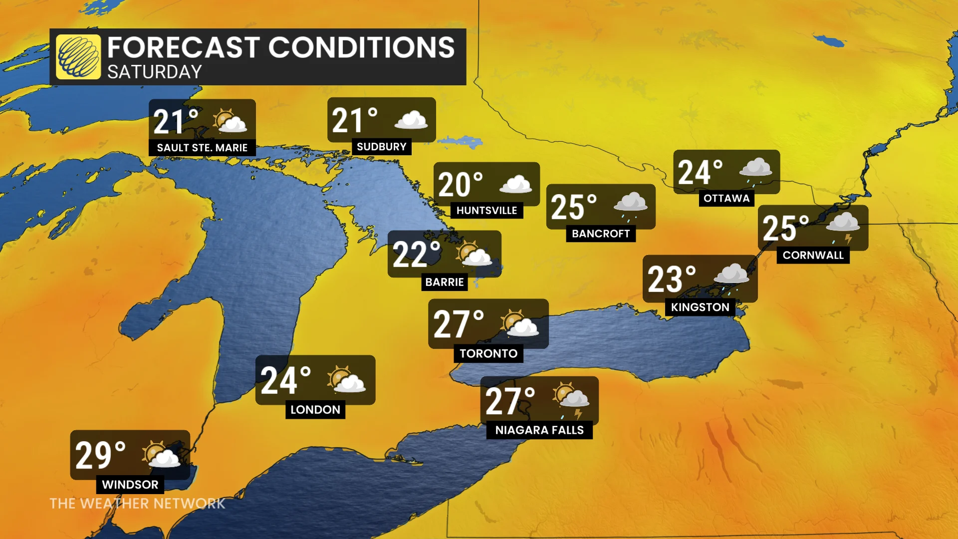
There is still uncertainty regarding the exact timing of the heaviest rain and when it will clear, particularly for eastern Ontario, where precipitation may persist into Saturday afternoon.
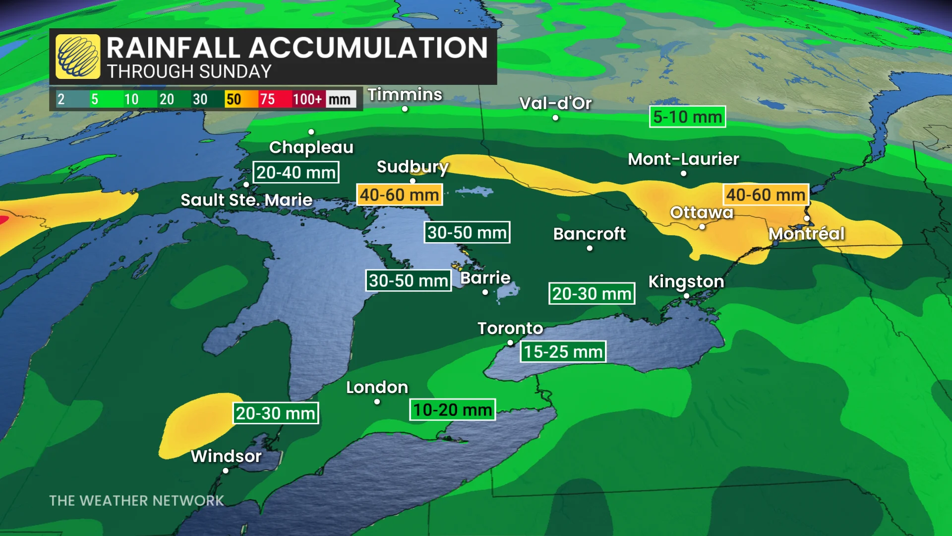
In all, a widespread 10-20 mm of rain is forecast, but with much heavier amounts for parts of northwestern and eastern Ontario. Some of the harder-hit areas could see as much as 60 mm through Sunday.
Early July looking cooler than normal
Monday will bring back hot and humid weather across the region. Showers and thunderstorms are forecast to develop ahead of a cold front, which is expected to move through overnight Monday, and into Tuesday for Canada Day.
SEE ALSO: No fireworks: Check out this pet-friendly Canada Day celebration in Toronto
The first few days of July will feel cooler, with temperatures near or slightly below seasonal averages and notably lower humidity levels.