
Ready for a tease of spring? Thaw to spread across Canada

It’s a Canadian thaw courtesy of the Pacific Ocean
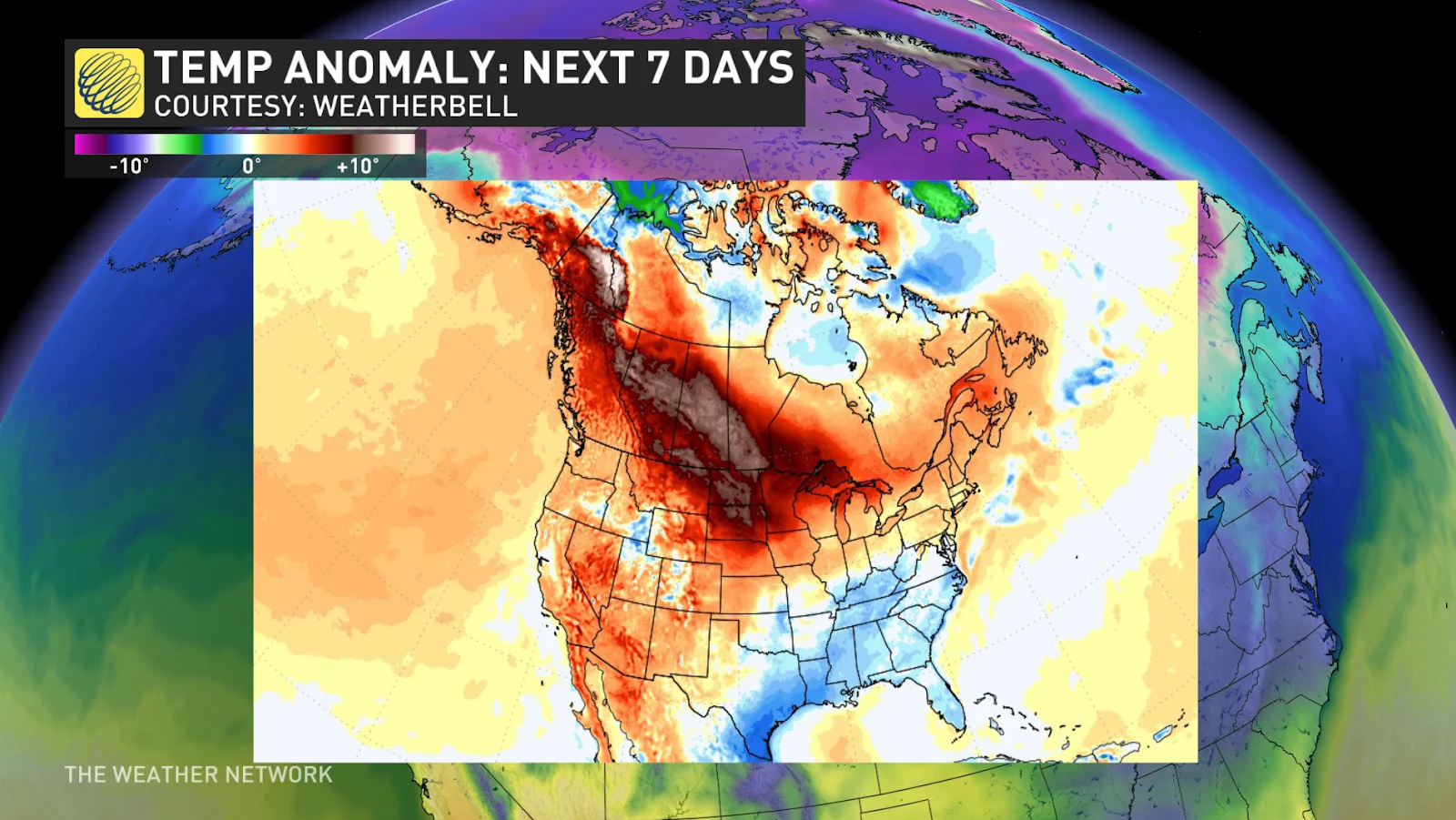
A brief tease of spring sweeping across the country this week will bump temperatures to above-seasonal levels from the Yukon to Newfoundland.
Some areas could see a 45-degree temperature swing over the course of seven days.
DON’T MISS: La Niña’s last hurrah? Pattern could disappear by this spring
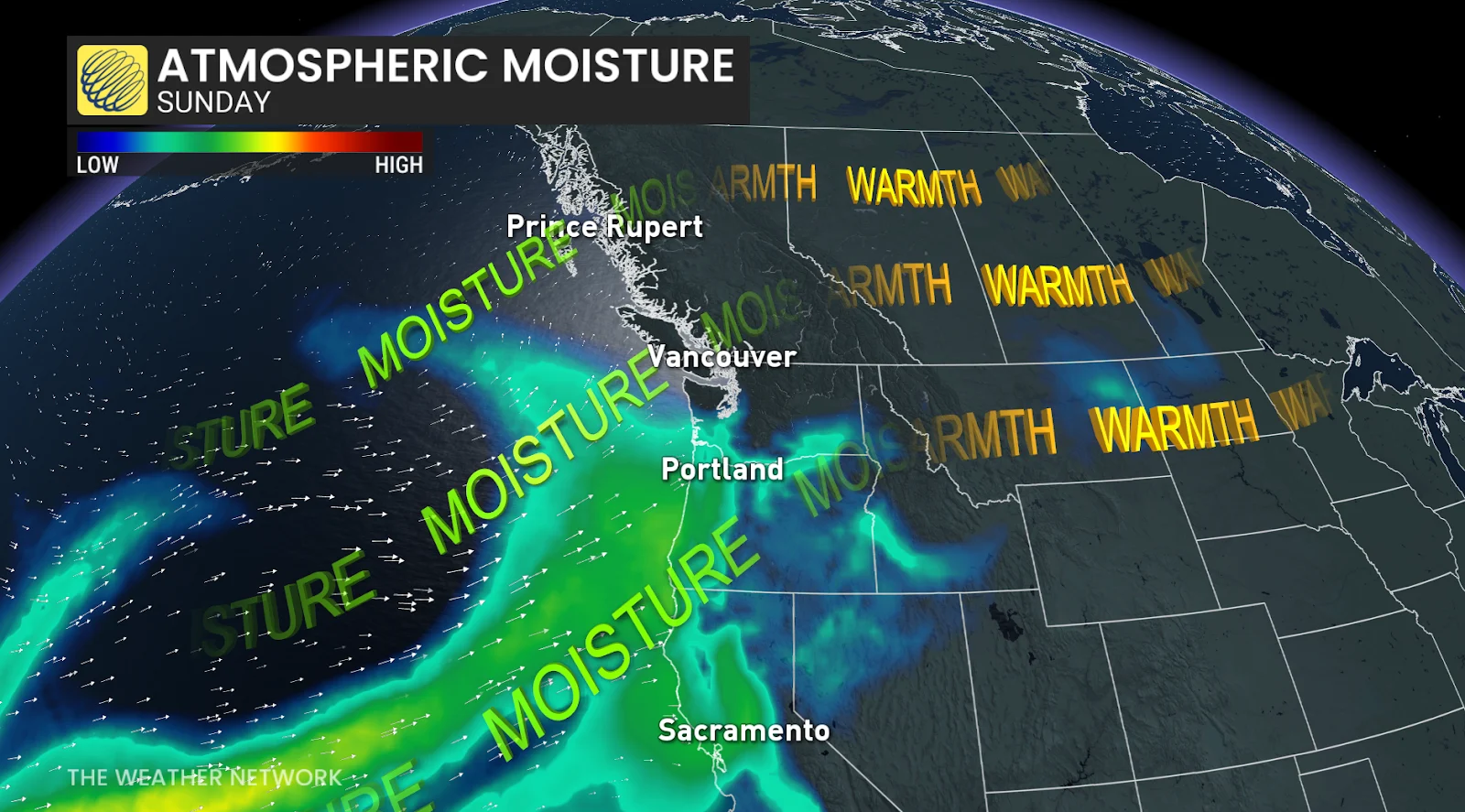
After weeks of suffering in the deep freeze, there’s hope on the horizon for a vast swath of Canada that’ll soon fall under the spell of westerly Pacific flow.
Vancouver notched its first double-digit high temperature of 2025 on Saturday, coming in at a balmy 10°C. This mild air will continue moving east in the days ahead.
The greatest temperature spike will occur on the Prairies, where we will have seen a 40-45 degree temperature swing over the course of just a week.
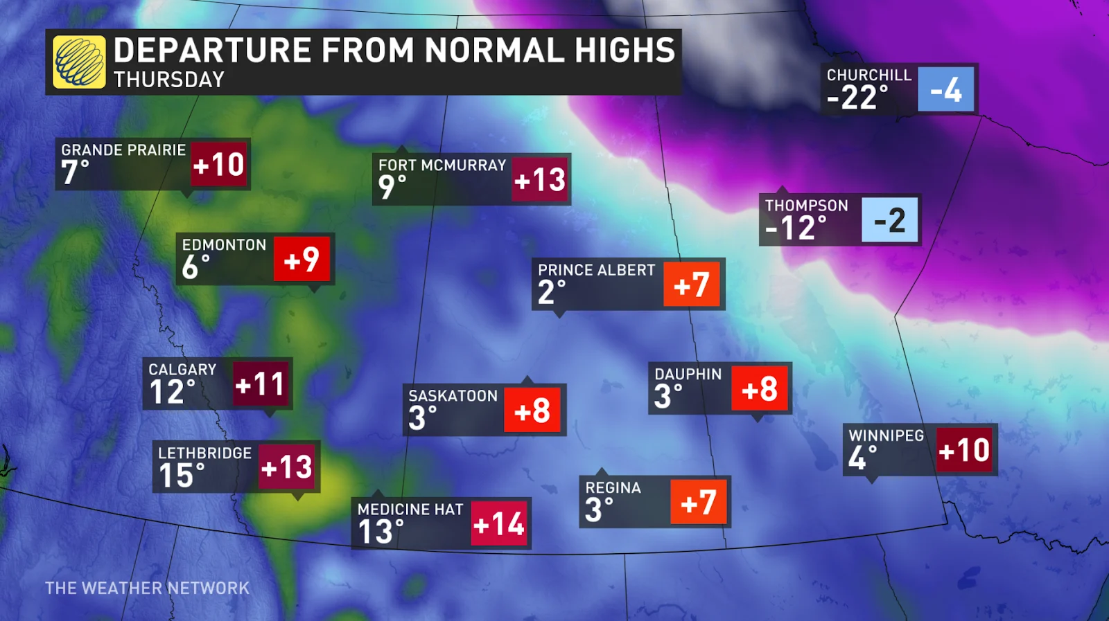
Widespread above-seasonal temperatures are likely across the southern half of the Prairies. The mild air will peak on Thursday with daytime highs in the teens across southern Alberta, including Calgary. Even a 3°C reading in Saskatoon and Regina will register 7-8 degrees above seasonal for the end of February.
RELATED: Great Lakes have the most ice in years amid prolonged cold spell
Mild conditions will spill into the Great Lakes and Eastern Canada through the middle of the week. Folks across southern Ontario and southern Quebec will see above-seasonal temperatures by Thursday.
Toronto’s expected high of 4°C will come in 3 degrees above seasonal, while the same high temperature in Ottawa is a significant departure from the city’s average of about -2°C for this time of year. Ample snowpack and above-freezing temperatures are a recipe for a slush-fest across the region.
It’s much the same story across Atlantic Canada, where temperatures in the middle to upper single digits will greet folks in Fredericton and Halifax by Tuesday. Don’t worry, St. John’s—your temperatures will eventually rise above freezing this week, as well.