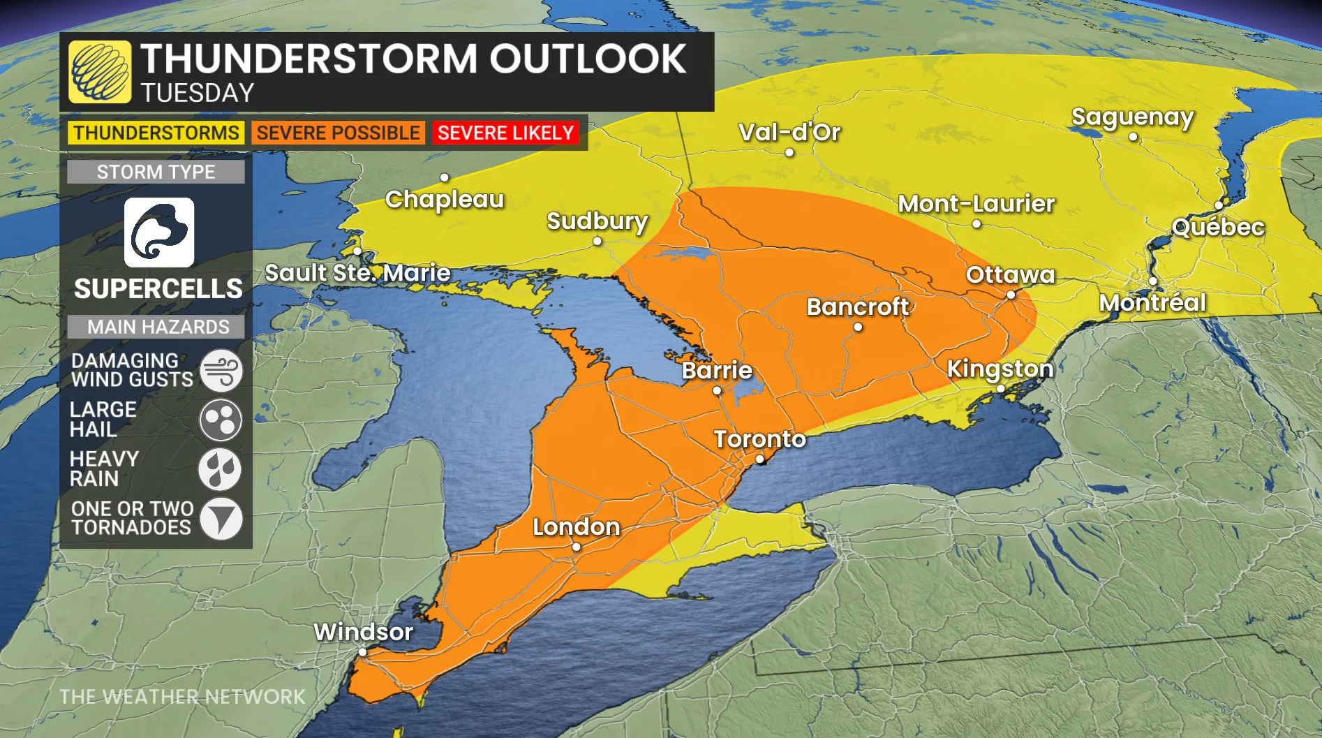
Raised severe storm risk in southern Ontario includes tornadic potential
A taste of summer heat in southern Ontario on Tuesday could also set off severe thunderstorms in the afternoon and evening, with all hazards on the table--including a supercell and tornado risk––as atmospheric conditions will be conducive
Tuesday will be a day to be weather-aware in southern Ontario and pay close attention to the forecast--and the skies--as a favourable setup for severe weather unfolds.
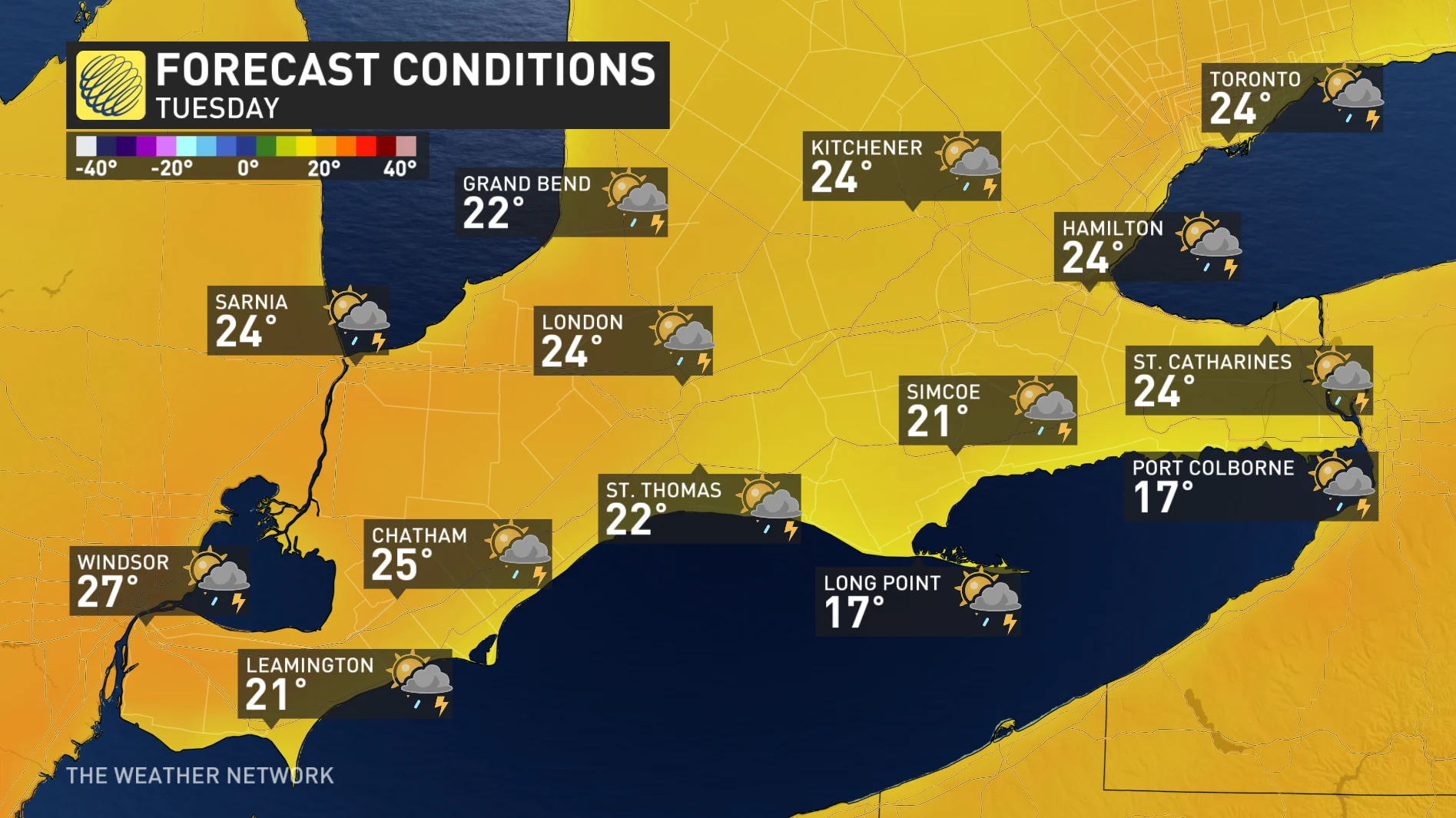
While temperatures are expected to soar into the mid- to high 20s for parts of the region, possibly even hitting the 30-degree mark in the southwest, the warmth and humidity could be the catalyst for thunderstorms, with a decent chance of severe weather for a sizable portion of southern and eastern Ontario.
DON’T MISS: Expecting hail? How to mitigate impact to yourself and your property
The main hazards with any severe storm that forms will be large hail, strong winds and heavy downpours, but there is a low, but non-zero risk of an isolated tornado or two with favourable, low-level shear and low cloud bases present.
Monitor the forecast on Tuesday and stay aware of potential watches and warnings in your community. Conditions can change rapidly as strong storms bubble up.
Thunderstorm season ramps up with severe potential on Tuesday
On Tuesday, conditions will change. The heat and a first taste of humidex will work to destabilize the atmosphere and fuel thunderstorm potential.
By Tuesday morning, a Colorado low lifts into northeastern Ontario, funnelling a very mild and moist air mass across southern Ontario. Temperatures will be upwards of 8°C-10°C above seasonal with dew points sitting near 20°C by Tuesday afternoon—-highly anomalous for April.
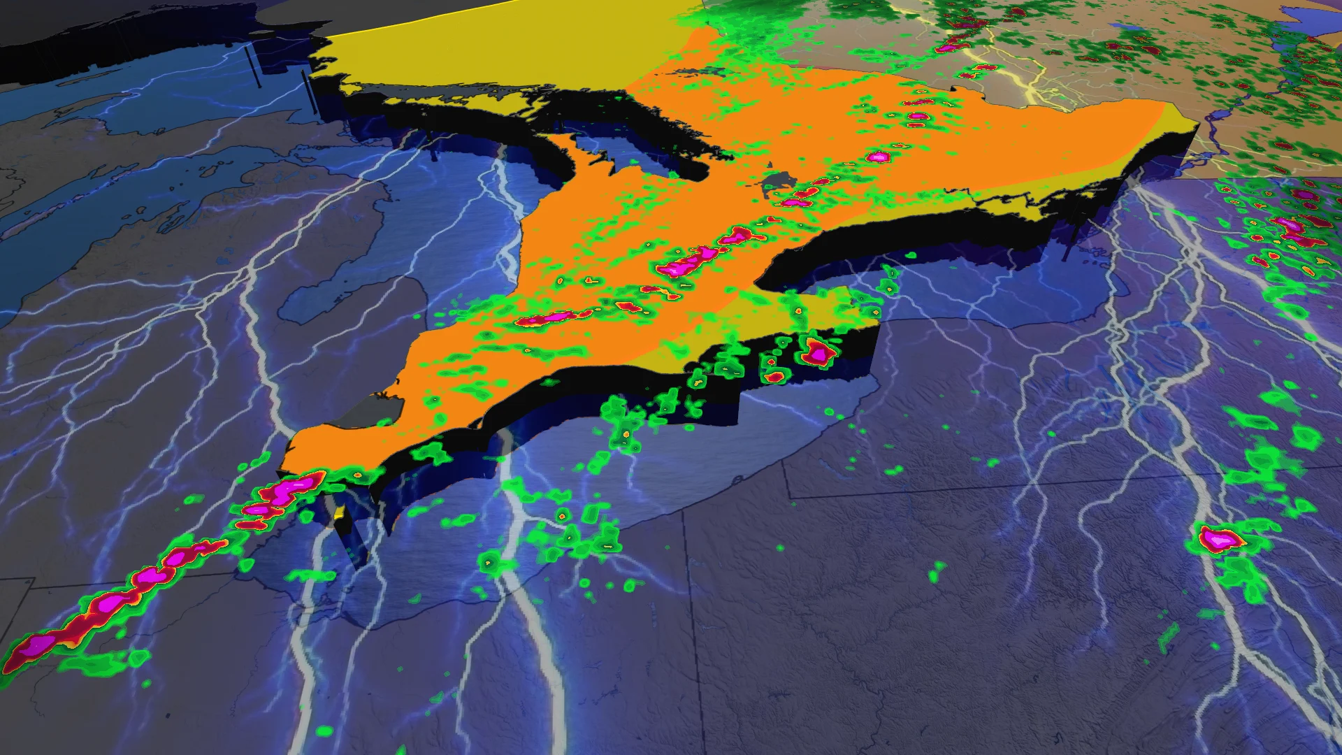
Non-severe storms are forecast across southern and eastern Ontario, including Georgian Bay, on Tuesday morning. The main threats will be locally heavy rain and lightning.
It will feel even muggy for those inland, away from the chilly lake influences.
By late Tuesday morning, the convection eases while instability increases for those in the warm sector. In the afternoon, thunderstorms will become more organized ahead of an approaching cold front. Some regions in southern Ontario may experience a couple rounds of thunderstorms, depending on how the setup evolves on Tuesday.
There is the risk for showers and thunderstorms throughout the day, especially in central Ontario and areas around Georgian Bay. Thunderstorms are forecast to be speckled across southern Ontario, from Windsor to Georgian Bay and eastern Ontario, on Tuesday morning.
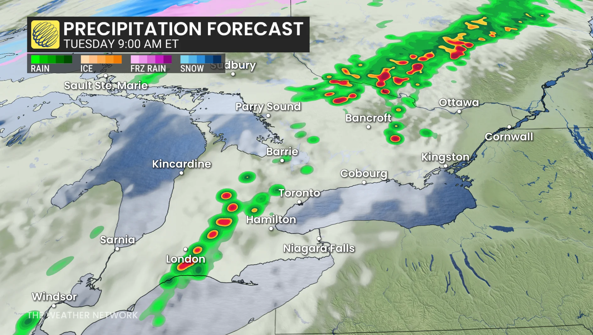
Tuesday 4 p.m. Ontario precipitation timing forecast
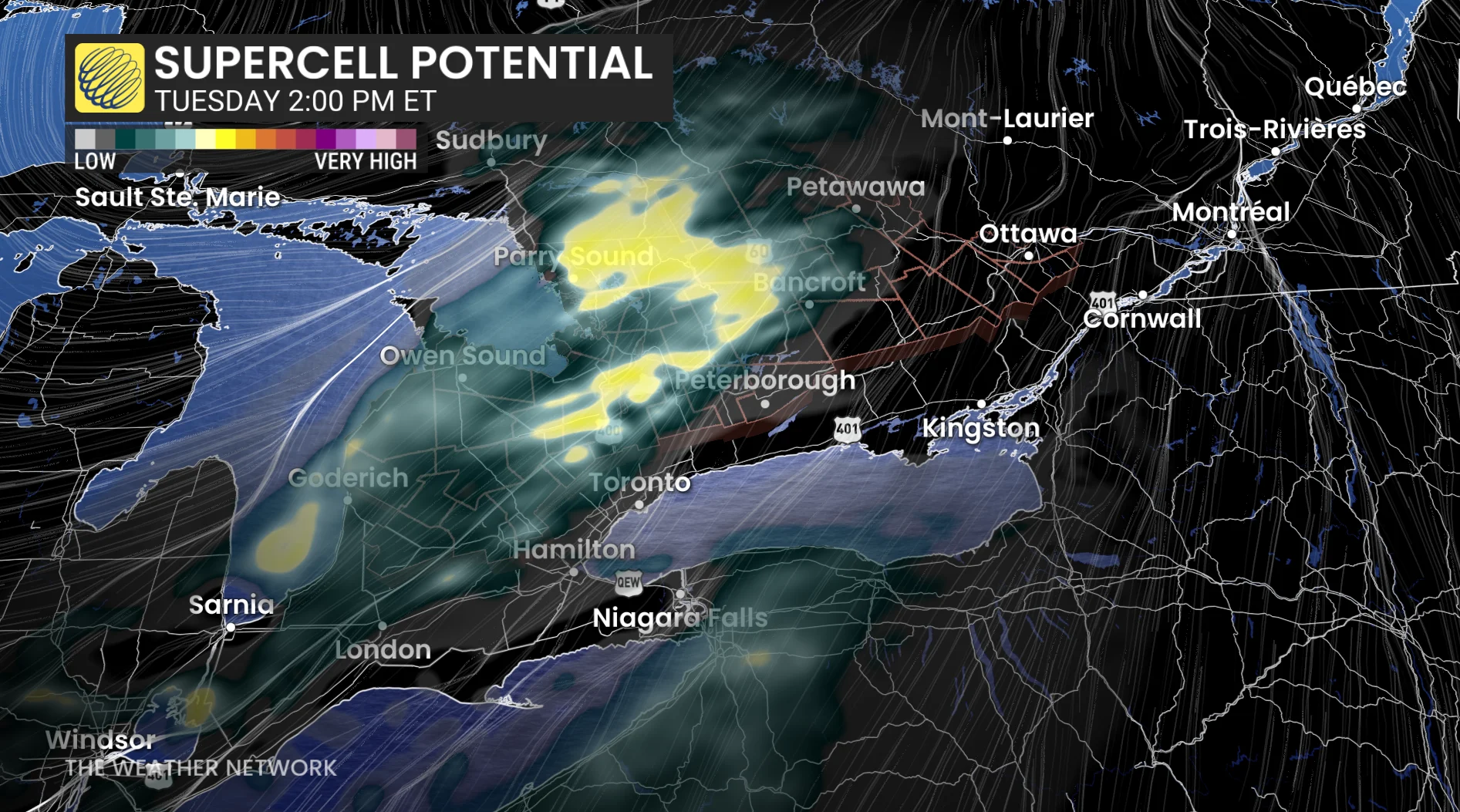
Some stronger storms could also develop in parts of northeastern Ontario, but the greatest risk for the worst of the storms appears to be from 3 p.m. to 8 p.m.
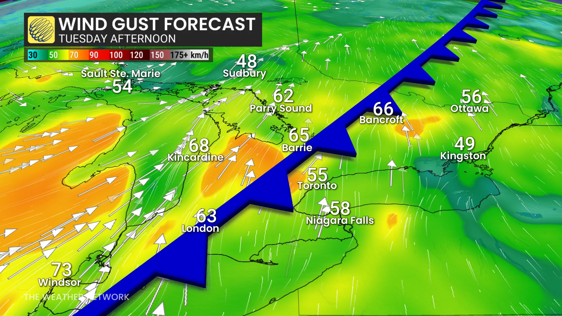
The strongest winds will be associated with thunderstorm activity, but a more potent gust risk emerges if storms cluster into a line into the evening hours. Some of the gusts within the storms could become damaging, reaching 100+ km/h.
Heavy, localized downpours are expected but the storms will be moving at more than 60 km/h, diminishing the risk of flooding. Although there’s a lot of moisture in the atmosphere for April, storms won’t see and dump rainfall, as they’ll sweep through quickly.
Large hail between 2-4 cm in diameter is also a concern in the most organized thunderstorms. There will be lots of cool air aloft, with the potential for building strong, sustained updrafts. We could even see hail up to the size of ping pong balls.
There is also a non-zero, tornadic threat, especially if storms remain isolated. The cloud bases are forecast to be low, and the winds change direction as you move aloft in the atmosphere.
Confidence is high that southern Ontario will be in the warm sector of a Colorado low Tuesday, increasing the threat of thunderstorms.
The warmth won't last, however, as a noticeable cooldown will happen on Wednesday.
Beyond that, cooler-than-seasonal temperatures will dominate during early May, including a threat for a frost or freeze, especially outside of the urban areas. Also, another significant low-pressure system is expected by Thursday night with widespread rain, followed by a reinforcing shot of chilly weather. However, a warmer pattern is expected as we get deeper into May.
Be sure to check back for all the latest on your forecast across Ontario.