Thunderstorms and rain relief finally on the way for drought-stricken Ontario
Some much-needed precipitation is on the way later this weekend, and it's bringing some storms with it
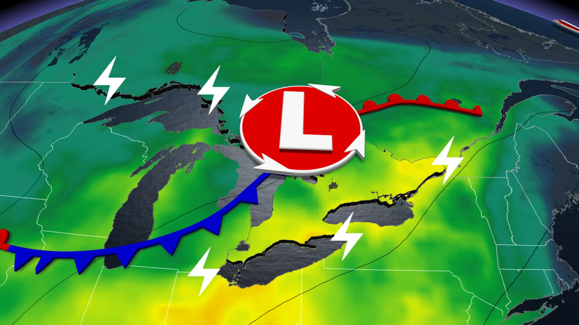
Some much-needed rain is on the way to Ontario to round out this weekend as a low-pressure system moves across the Great Lakes. And potentially the last severe storm of the summer.
On Sunday, thunderstorms could potentially pop up all across the province from Toronto to Kenora, with severe thunderstorms expected mostly in southern Ontario from Windsor to Owen Sound.

The majority of these storms will remain below the severe limit, but isolated stronger cells may form west of the GTA, where stronger winds are more likely.
DON’T MISS: More dangerous than snow: Why driving in the rain can be a bigger hazard
Conditions are just right to allow the storms to form. Saturday’s fall chill dropped temperatures, just as a warm airmass will move into southern Ontario along with a low-pressure system on Sunday.
On top of that, moisture is building, with dew points climbing into the mid to upper teens; these factors are generating the right conditions for Sunday to see some thunderstorm energy build.

Still, the energy is modest-to-moderate, so nothing too intense, with thunderstorms expected to have gusty winds and small hail.
The major parts of these storms will be the rain relief coming to combat the dry season.
We’ve seen a very dry stretch of weather across most of southern and central Ontario. Many communities were mired in a moderate drought or worse as of the end of August, with conditions only worsening through the first few weeks of September.
The thunderstorms will start developing after 5 pm near Lake Erie and the Bruce Peninsula, and then spread east.

There are some hazards to look out for. While the rain is good, drought-dry soil will be prone to localized flooding, and the rain is expected to be heavy.
MUST SEE: Ontario's fall colours hang in the balance: Brilliant or browning?
Storm developments will continue into the overnight as the low-pressure system pushes east, bringing the rain and thunderstorms with it. With the GTA not expected to see a rumble till 10 pm.

This overnight pour will give Monday a muggy feeling, leaving humidex values sitting in the 30 range across southwestern Ontario.
That being said, the total rainfall could deliver up to 30 mm of rain going into Tuesday, which is more rain than what’s been recorded in the past several weeks, a much-needed relief for the province.
While models predict the heaviest rain will drop in Brice, Grey, Simcoe and Haliburton counties, with a decent amount across the 401 corridor.

But the ample moisture means lingering instability across southern Ontario, with more thunderstorm risk to come, the majority of the instability around Essex and Chatham-Kent.
How bad is the rainfall deficit? Toronto-Pearson has only recorded 19.3 mm of rain so far this month, a far cry from the airport’s average September rainfall of 69.4 mm.
Stay with The Weather Network for all the latest on conditions across Ontario.