Quebec facing a major, wintry blow with 15-30 cm on the table for some
A major snowfall to close out the weekend is targeting a good portion of Quebec, including Montreal, with totals of 10-30 cm possible. Drivers can expected slick roads and slow, difficult travel
Weather Highlights:
An approaching storm could produce a swath of snow in southern Quebec
The low will remain south of Montreal, with a potential for the mixing and rain-snow line to limit accumulations in the city
Precise snowfall totals remain somewhat uncertain at this time
Gusty conditions in spots could reduce visibility along the St. Lawrence, with a combination of snow and ice pellets making for difficult road conditions
Wintry travel troubles to continue spill into the Monday morning commute
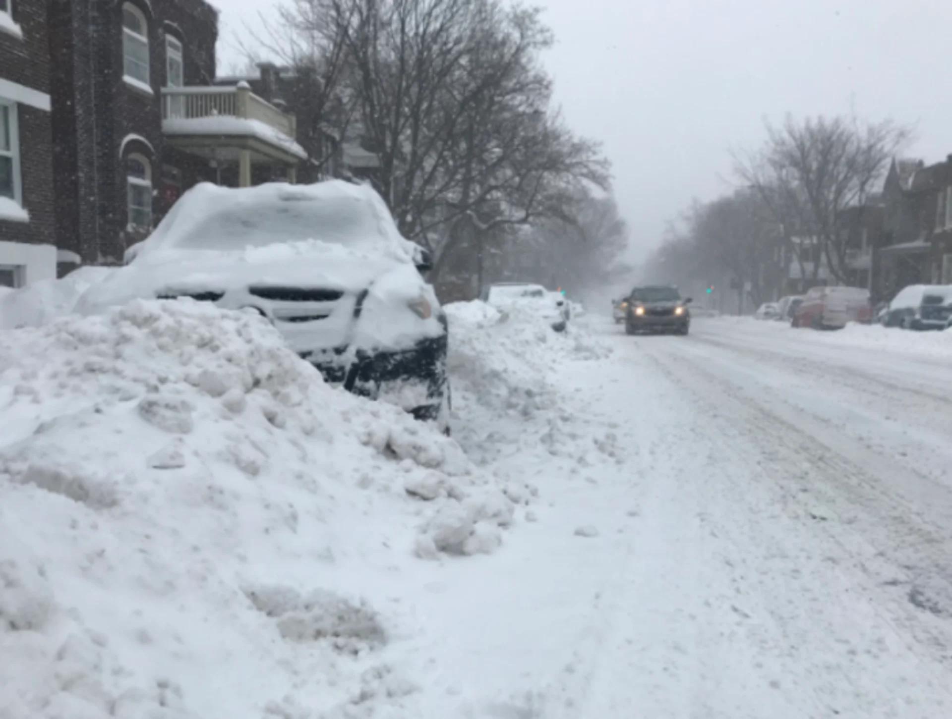
Weekend snowfall could slicken roads
A storm expected to cross the Great Lakes this weekend could bring a swath of accumulating snow to portions of southern Quebec on Sunday, potentially leading to slick roads and snarled travel throughout the region.

RELATED: Why the first snowfall of the season can catch drivers by surprise
Light snowfall picks up through the Sunday morning hours for the Montreal area, with mixing in the Eastern Townships.
Winds will be driving out of the northeast at 20-40 km/h, increasing the risk of blowing snow.
Residents are advised to keep a close eye on the forecast and prepare to adjust travel plans accordingly.
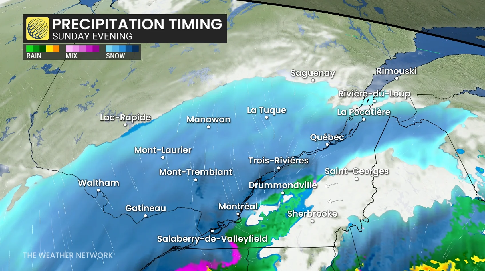
Gusty conditions are expected along the St. Lawrence, with a combination of snow and ice pellets, which can lead to poor visibility and slick driving conditions.
Several factors could affect how much snow falls throughout the city of Montreal.
High confidence for the heaviest snowfall to occur Sunday evening across Montreal with snowfall rates of 1-2 cm an hour.
Although the low tracks south of Montreal Sunday evening, temperatures are forecast to nudge above the freezing mark in the overnight, bringing a wintry mix and the chance of rain south of the St. Lawrence River.
Precise snowfall totals remain somewhat uncertain as the mixing and rain-snow line crosses into city limits Sunday night, preventing higher totals. A path just a bit farther south could drag the bulk of the precipitation south of the international border.
Marginal temperatures may also play a role. A colder scenario could bring Montreal its first accumulating snow of the season, with the possibility of significant totals.
However, slightly warmer temperatures would limit accumulating snow to the higher elevations north of the city, with only a few centimetres possible in the city proper.
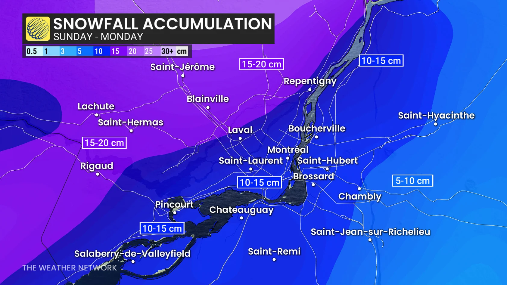
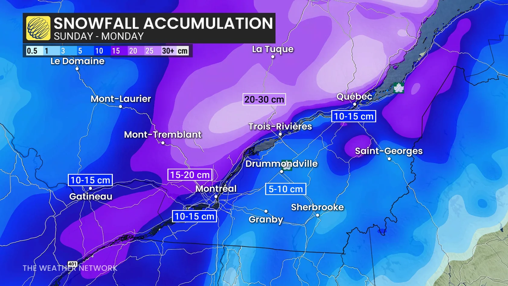
Snowfall forecast:
Shawinigan: 20-30 cm
Saguenay: 20-30 cm
Quebec City: 10-15 cm
Trois-Rivières
Montreal: 5-15 cm (bigger range to account for risk of mixing)
Drummondville: 5-10 cm
Sherbrook: Less than 5 cm
The major ski resorts are mostly looking at a complete snow event, except for a mix on Monday north of Quebec City.
Mont-Tremlant: 15-20 cm
Mont Saint-Anne: 15-20+ cm
Le Massif de Charlevoix: 15-20+ cm
A good, early-season snowfall for the ski resorts means the opening days later in November and early December may be achievable for the local ski resorts.
Montreal averages about 15 cm of snow in a typical November.
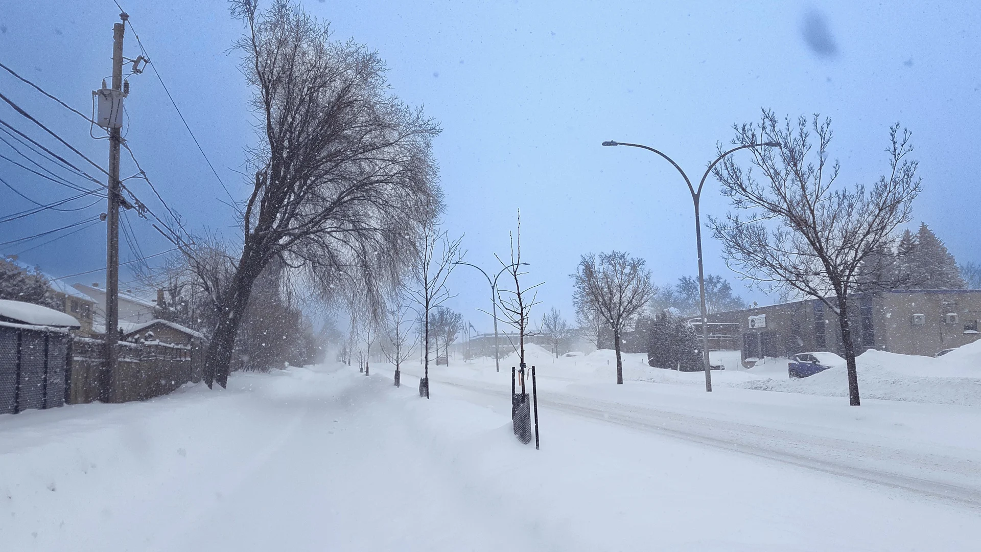
February 2025 snowfall near Montreal, Que. (Henri Périard/Submitted to The Weather Network)
Sunday overnight will see Montreal transition back to light snowfall through the pre-dawn hours Monday morning, with a wintry mix continuing farther northeast.
Monday will feature wet snow and a wintry mix north of Sorel towards Trois-Rivières and into Quebec City as warmer air is drawn north. As well, very heavy snow for Saguenay and Rimouski, then transitioning to rain by afternoon.
Monday night features some bonus snow for southern Quebec--Sherbrooke, Drummondville and Montreal-- as another pulse of moisture moves across the region.
Increased risk of traffic accidents with an early-season snowfall. Drivers will need to adjust to road conditions and slow down with limited visibility.
Safety tips for driving in adverse weather
Install winter tires. Winter tires can improve stopping distance by up to 30 per cent in wintry conditions.
Prepare an emergency kit. Include the basics like snacks, first aid kit, flashlights and blankets.
Plan your travel. If possible, postpone trips during active weather and especially freezing rain. Driving is not worth the risk.
Adjust your speed. A gentle reminder that stopping distance increases exponentially as your speed increases.