Prairie clipper parade makes stops in Ontario and the U.S. Southeast
A multitude of Prairie clippers will be making a journey across North America soon, dropping winter weather in parts of Western Canada, Ontario and parts of the U.S. along the way
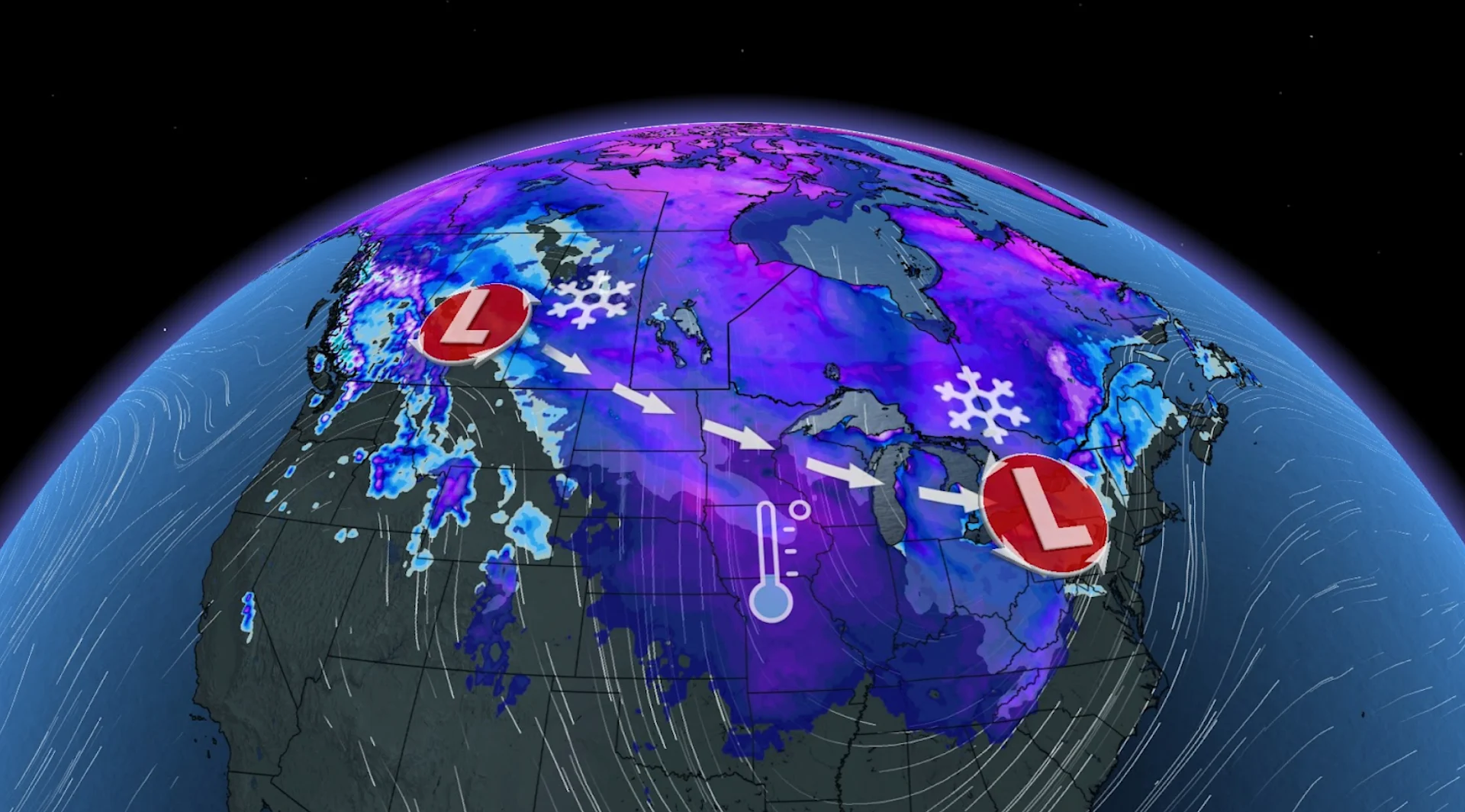
A taste of early winter is coming to parts of Canada for several days, with the focus on Ontario and Quebec as Arctic air will plunge south onto the Prairies late week––resulting in multiple clippers that will transport the snow and chilly temperatures eastward and as far south as Florida.
Multiple clipper systems are set to deliver snow across parts of the Prairies Thursday and Friday. Ontario will then see a clipper and a major cooldown this weekend, with the potential for some wintry impacts. There will be a chance for some lake-effect snow into next week, as well, ahead of a mid-November warm-up.
DON'T MISS: When should you switch to winter tires? Provincial breakdown, here

With winter nearly here, it's the time to make the change to winter tires. So, drivers should stay alert to the changing conditions, especially with this being the first dose of snow for many areas this season.
Timing and pinpointing the first clippers and snow
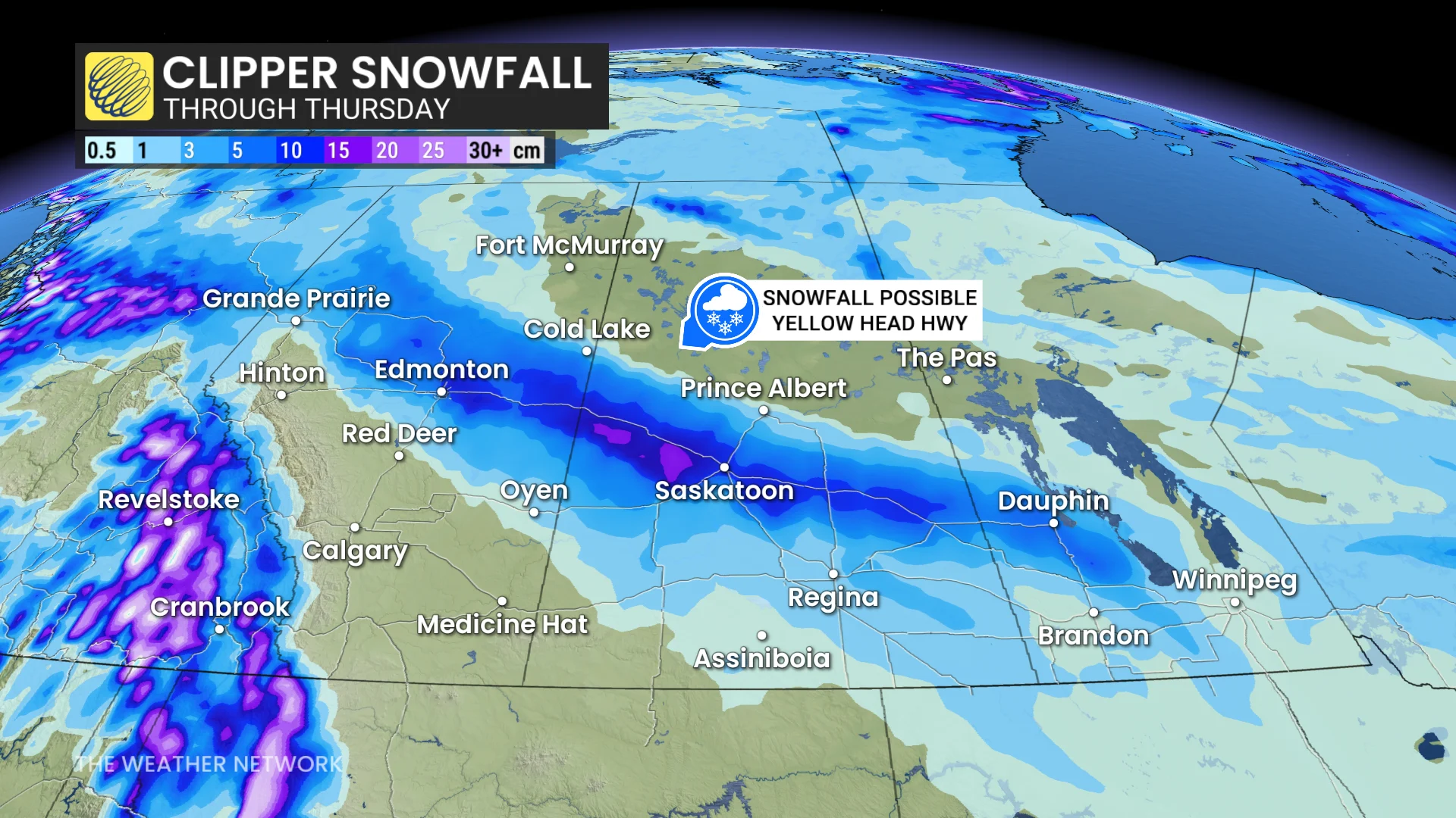
On Thursday, clipper No. 1 brings notable snow to parts of the Prairies, along the Yellowhead Highway from Edmonton, Alta., to southern Manitoba.
On Friday, Ontario's first clipper will stay in northeastern sections with the snow, while rain and moderate wind gusts are felt in the southern end.
DON'T MISS: Are you ready for 'Snowvember'? Snowfall threat looms over Canada
The system will then draw an additional shot of cold air over the Great Lakes in its wake, however, setting the stage for the next systems and more wintry weather in the region.
Folks on the Prairies can anticipate two rounds of impactful snow for travel on Thursday and Friday.
Clipper 2 will be more impactful for Eastern Canada and the U.S.
Clipper No. 2 for the Prairies on Friday brings 5 cm to southern Alberta and Saskatchewan. It will be less impactful for the region but a big story for Eastern Canada and U.S.

The system will then swoops across the Upper Midwest on Saturday, intensifying as it draws in Gulf of Mexico moisture.
There is high uncertainty right now, but it could bring the first measurable snow to much of southern Ontario this fall.
The exact track is still uncertain, but accumulations of 5-10+ cm will be possible.
One scenario puts a swath of substantial wet snow north of the track (5-10+cm possible), with rain or a mix of rain and wet snow near and south of the storm track. At this point, the most likely scenario is that the substantial snow will be well north of the 401 corridor––from east of Lake Huron and Georgian Bay, across cottage country and across Haliburton.
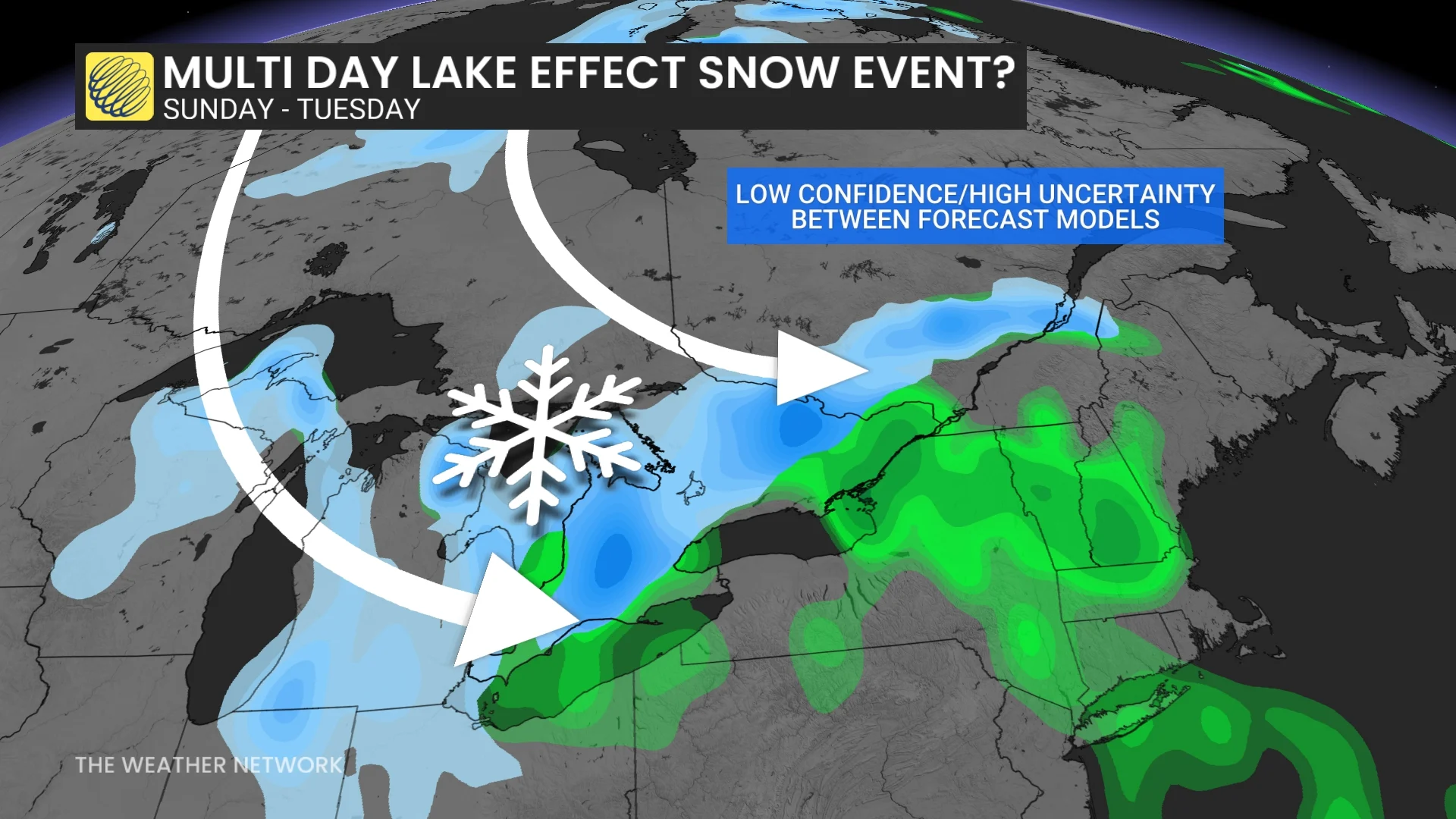
However, a track farther to south is still possible, so major implications would be in play for parts of the Greater Toronto Area (GTA). Please check back for updates.
Drivers will need to be weather-aware and alert to the changing conditions, especially with this being the first dose of snow for many areas this season.
That won't be it for the snow.
Additional snow, in the form of lake-effect, is anticipated for the Lake Huron and Georgian Bay snowbelt regions on Monday.
Canada won't be only country feeling the wintry wrath.
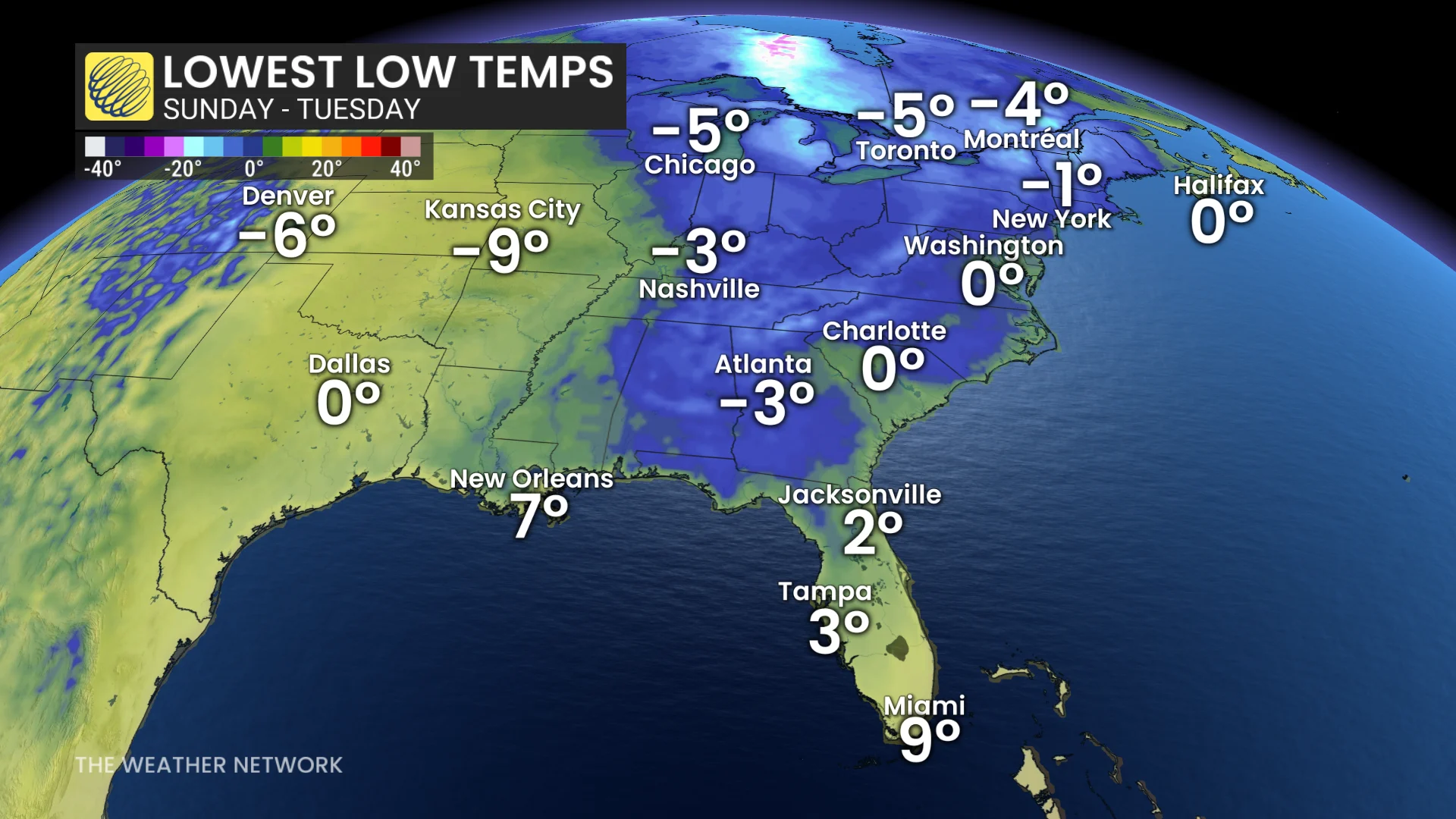
A developing cold front will then drive sub-freezing air into the Deep South, potentially reaching the Florida Panhandle to start the week--bringing temperatures close to the freezing mark.
Stay tuned to The Weather Network for the latest forecast updates for the Prairies, Ontario and Florida.
With files from Kevin MacKay, a meteorologist at The Weather Network, and Nathan Howes, a digital reporter at The Weather Network.