
Expansive winter storm to wallop northern Ontario with snow, many disruptions
A powerful winter storm will ramp up in northern Ontario Thursday, generating 15-40+ cm of snowfall and blustery wind gusts, likely resulting in numerous travel and school disruptions
A strong clipper will continue to impact much of northern Ontario on Thursday, bringing heavy snow and hazardous winter travel.
Snowfall totals of 15-40+ cm are forecast, accompanied by strong winds causing blowing snow and near-zero visibility. Road closures are possible. A flash freeze is also expected as temperatures drop rapidly into the minus teens and even -20s.
DON'T MISS: Simple steps you can take to prepare for a winter storm
Expect disruptions to transportation, services, and utilities, including school closures and bus cancellations, and road closures.
Stay alert to the changing and deteriorating conditions, and monitor the latest weather warnings in your area.
Heavy snow and dangerous winter travel on Thursday
A clipper system will bring widespread snow to northwestern Ontario into Thursday, resulting in hazardous travel conditions.

Wednesday overnight into Thursday, snowfall intensifies from Thunder Bay to Kapuskasing, with rates of 2 cm per hour expected.
By Thursday morning, moisture from the Gulf of Mexico enhances snowfall in northeastern Ontario, increasing totals there.
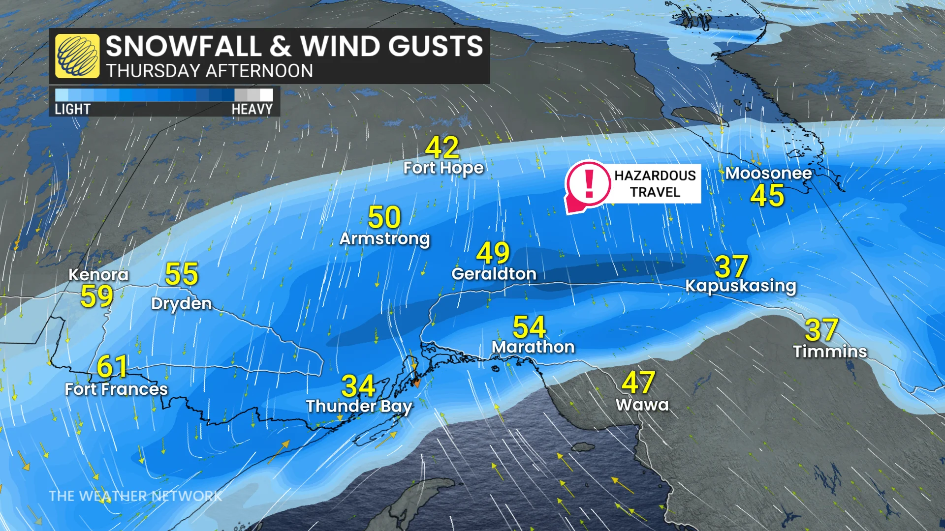
Heavy snow will still continue in Thunder Bay on Thursday, with strong winds through the afternoon. Snow then lightens from west to east in the evening and overnight in northwestern Ontario.
Thunder Bay will continue to see heavy snow and strong winds, with gusts of 40-70 km/h causing blowing snow and poor visibility on the back end of the system.
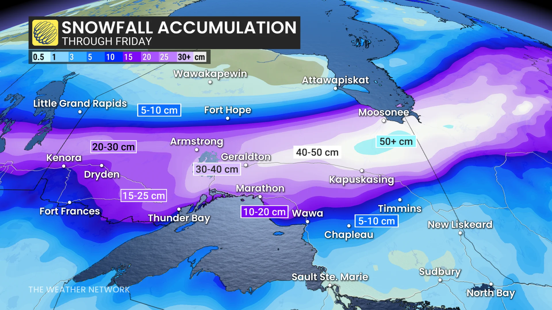
Snow continues into Friday for northeastern Ontario, while northwestern Ontario sees light flurries.
Highway 11 and 17 closures are likely between Nipigon, Kapuskasing, and Marathon.
More widespread snow expected through the weekend
Another strong clipper system is set to move through the region Friday night into Saturday, bringing widespread snowfall, particularly to areas within the Nickel Belt and Sault Ste. Marie.
DON'T MISS: You asked for a white Christmas, and you may just get it!
The system will maintain changeable temperatures and an active weather pattern, which is expected to persist through Christmas and beyond.