Powerful, prolonged Pineapple Express expected in B.C.
The dayslong event will bring a risk for flooding and an elevated avalanche danger
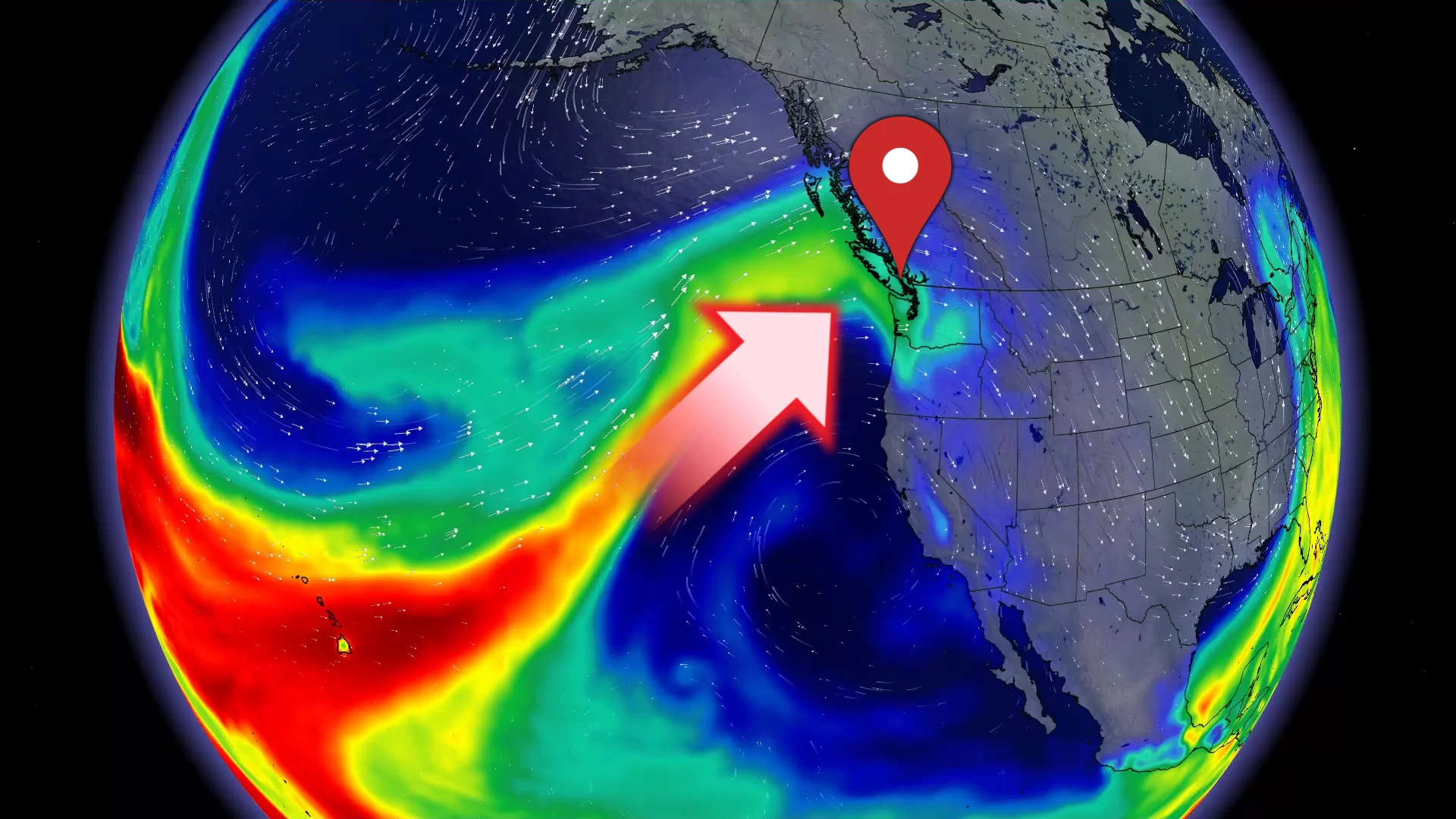
British Columbia is on the lookout for a prolonged Pineapple Express event heading into next week.
This dayslong surge of tropical moisture will bring intense rainfall, an elevated avalanche danger, and a rising flood threat to much of the region.
RELATED: What’s a Pineapple Express? Diving into this robust atmospheric river
Pineapple Express expected through much of next week
A Pineapple Express is an atmospheric river that originates near Hawaii. This deep, rich plume of tropical moisture can fuel heavy rainfall and rising freezing levels across southwestern B.C.

Given its strength and predicted longevity, forecasters anticipate this upcoming Pineapple Express event to rank an AR3 or AR4, which means this type of event is often hazardous with river flooding impacts possible.
This surge of moisture tracking northeast directly from Hawaii will fuel heavy rainfall beginning late Sunday and continuing into next workweek.

DON’T MISS: A potentially strong El Niño will develop by this summer
We’ll see 100-200+ mm of rain across portions of Vancouver Island and the Coast Mountains through next Thursday. Rainfall totals of 75-150 mm are possible across the Lower Mainland.
In addition to the heavy rainfall, we’ll also see freezing levels spike over 2000 m by Monday, a rise that will last through the week. As a result, rain is forecast for alpine regions, which will lead to an elevated avalanche danger in many areas.

Significant snow that fell through the beginning of the month will begin to melt next week with the arrival of warmer temperatures.
The combination of heavy rainfall and snowmelt will likely elevate flood alerts throughout the region. Pay close attention to forecasts and alerts for your area in the coming days.
Stay with The Weather Network for all the latest on conditions across B.C.