Another storm on deck in Atlantic Canada, strong winds, outages remain a concern
Powerful winds will continue across Newfoundland Wednesday, with another quick-moving system following closely behind. Additional winds and rain could hamper clean-up and restoration efforts from this week's historic weather bomb
Weather Highlights:
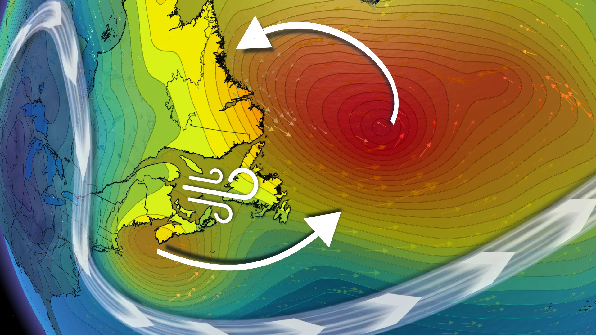
The powerful low continues north of Newfoundland, with 90-110+ km/h winds and high waves. Winds ease below 90 km/h by Wednesday evening
A fast-moving system brings rain, wind, and wet snow to P.E.I., Nova Scotia, and Newfoundland late this week, with 60-90 km/h winds Thursday and heavy rain in southern Nova Scotia
Newfoundland sees 80-90+ km/h winds Thursday night, easing Friday. Rain could change to wet snow on the Burin and Avalon
Cleanup and power restoration may face delays
Travel delays, structural damage, and widespread outages have been reported as a ferocious and historic weather bomb slammed parts of Newfoundland. At the height of the storm, 12,700 customers were without power, down to 3,600 by Wednesday morning.
DON'T MISS: Some residents evacuated in Trepassey, N.L., as heavy winds, rain continue
On Tuesday, peak wind gusts exceeded 170 km/h -- the equivalent of a strong Category 2 hurricane. Monster waves exceeding nine metres, have also been reported. Both wind and coastal flood warnings remained in effect first thing Wednesday morning.
In St. John's, an all-time November record was set with this storm, with sea level pressure dropping below 960 hPa, surpassing the previous 971.4 hPa mark for the month. The 172 km/h wind gust at Cape St. Mary’s is also the strongest since Hurricane Larry's 182 km/h winds in September 2021.

In addition to the damaging wind and waves, the storm has delivered heavy wet snowfall to areas like Corner Brook, Massey Drive, Grand Falls-Windsor, and parts of the Trans-Canada Highway in western Newfoundland. Snow also extended as far east as Gander.
RELATED: Historic 'weather bomb' blasts Newfoundland with 170+km/h winds, massive waves
Wednesday: Powerful low slowly drifts north of Newfoundland, but strong winds still a concern
The powerful low will gradually move north of Newfoundland on Wednesday.
Precipitation will ease, but strong winds and high waves will persist. Winds of 90-110+ km/h are expected, particularly in northeastern Newfoundland.

"Damage to roofs, fences, branches or soft shelters is possible," says Environment and Climate Change Canada (ECCC) in the warning. "Secure loose objects."
DON'T MISS: 'Weather bombs': Explosive storms that create ferocious conditions
Wind speeds will gradually decrease below 90 km/h by Wednesday evening or overnight.
WATCH: 'Weather bomb' brings 170+ km/h wind gusts, and heavy snow to Newfoundland
Thursday: Another system moves in and could impact clean-up, restoration
A fast-moving system will follow closely behind, bringing rain, wind, and wet snow late this week.
SEE ALSO: St. Mary's fish plant destroyed by fire as crews face hurricane-force winds
P.E.I. and Nova Scotia will experience 60-90 km/h winds Thursday morning, with periods of heavy rain in southern regions. The strongest winds are expected in eastern Nova Scotia.

The system will quickly move into Newfoundland by Thursday afternoon.
Its track near or south of the Avalon may lead to a transition from rain to wet snow for parts of the Burin Peninsula and Avalon region.

Winds of 80-90+ km/h are expected Thursday evening into overnight, easing by Friday morning.
Although this late-week system will be weaker than the last, it may still cause impacts, potentially delaying clean-up and power restoration efforts.
WATCH: Worried about a power outage? How to prep ahead of time
Stay tuned to The Weather Network for the latest forecast updates for Atlantic Canada.