Plan ahead: Weekend wintry mess to descend on parts of Ontario, Quebec
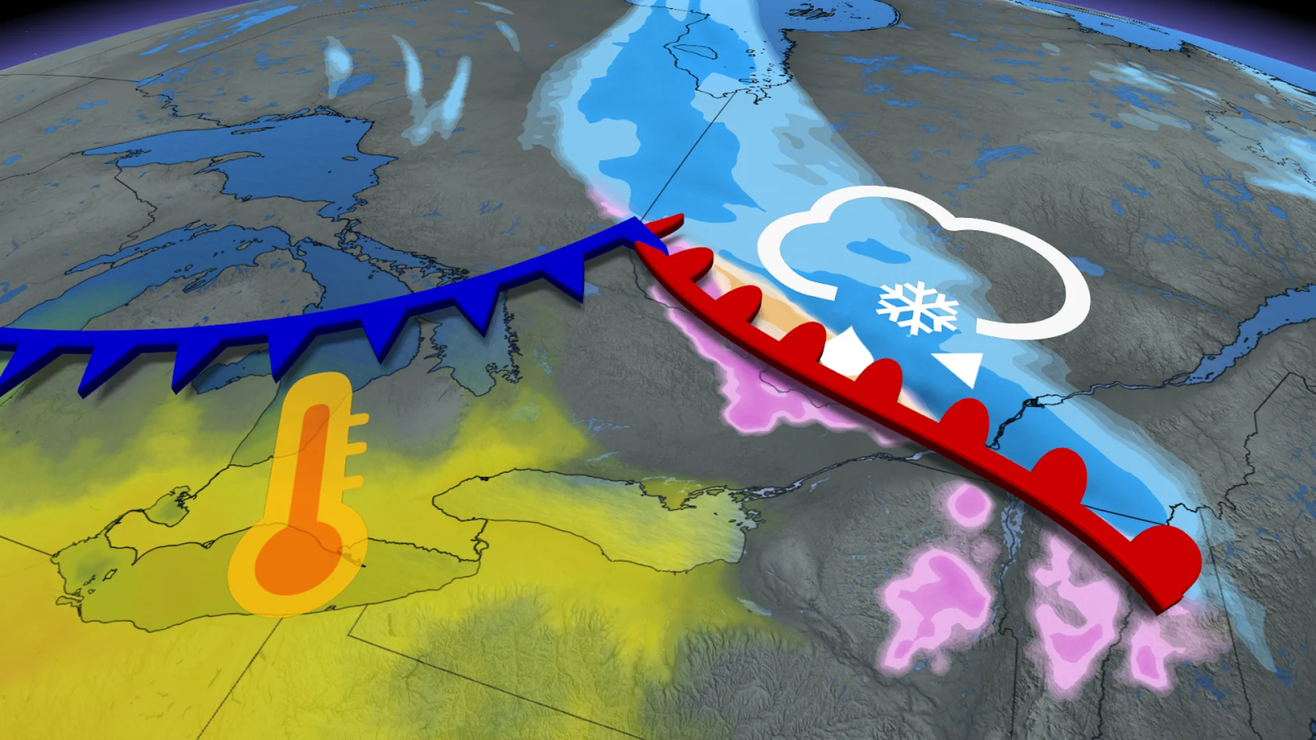
A messy mix of thundery rain, lake-effect snow, and even freezing rain is on the way for parts of Ontario and Quebec this weekend, potentially impacting travel and power for some
A burst of active weather moving across the Prairies will make its way into Ontario and Quebec over the weekend, bringing with it some impactful winter weather.
Rain, freezing rain, and snow are all on the table, but what you get will depend on where you are. Unlike the fall and winter storms we usually see, where the precipitation transitions as the system moves through, this will be more of a story of "what you see is what you get."
SEE ALSO: La Niña continues, but these factors may matter more this winter
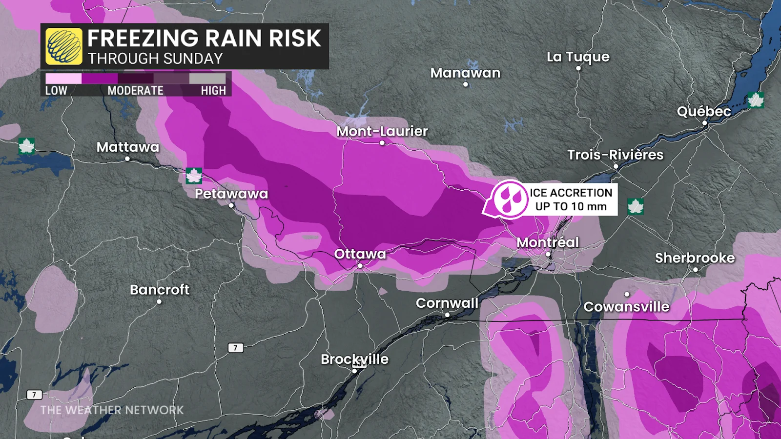
Anticipate some travel delays or impacts on Saturday night through Sunday as the bout of the wintry weather occurs, especially in areas seeing freezing rain and/or snow. Localized power outages and dicey travel are possible where freezing rain occurs.
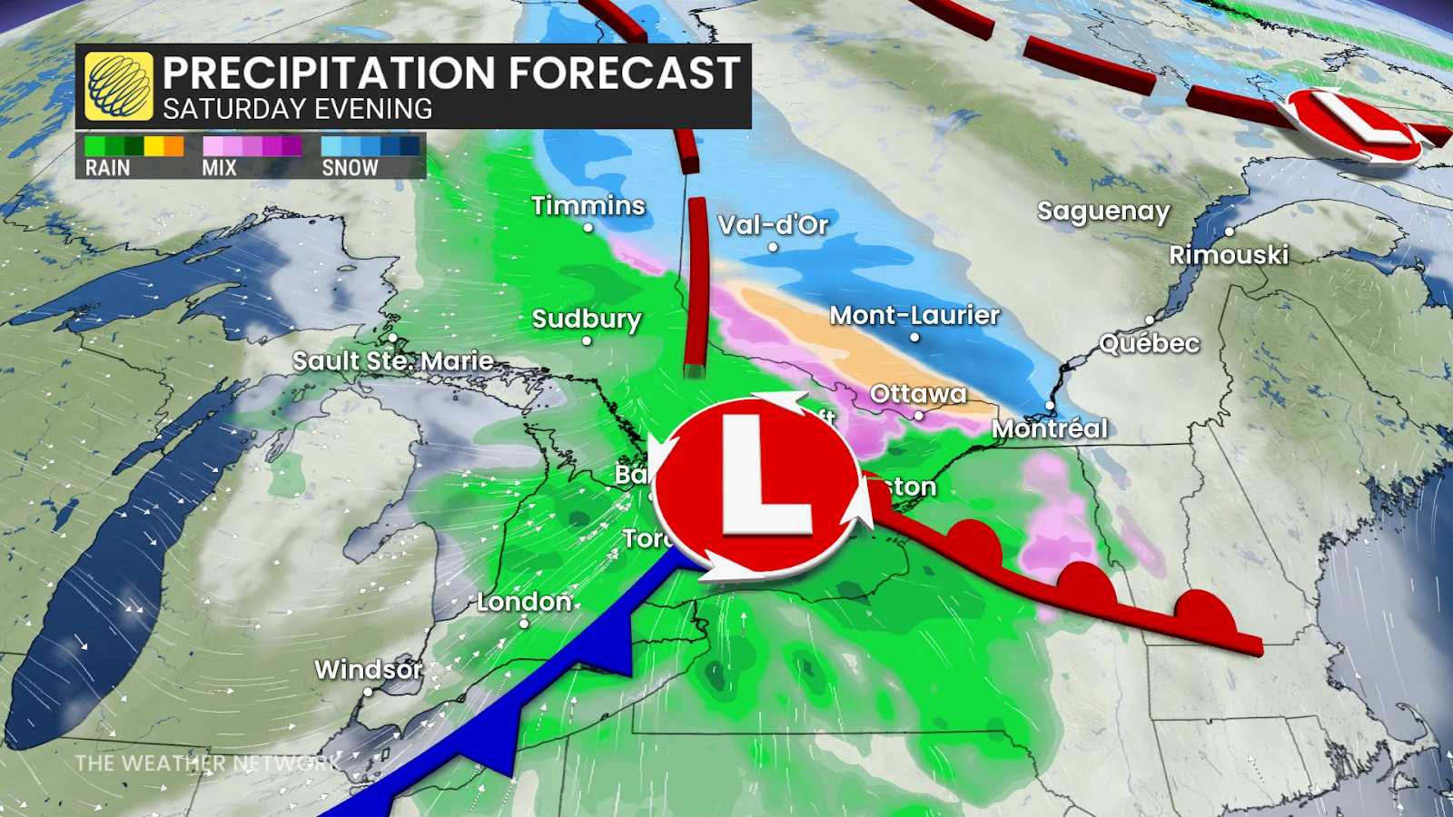
This weekend:
Active weather moving across the northern Prairies will impact Ontario and Quebec this weekend.
Rain will be the main story for most of southern Ontario, but we could hear a few rumbles of thunder on Saturday across parts of the southwest. Lake-effect rain and snow-showers will develop southeast of Lake Huron and Georgian Bay, change to all snow and then continue through most of Monday. Temperatures will be a few degrees colder than normal.
Further north, we will see widespread snow across northern Ontario.

The main story, however, will be in eastern Ontario and Quebec, where we are looking at freezing rain across the Ottawa Valley and southern Quebec. Marginal temperatures in those areas may bring a threat for several hours of freezing rain late Saturday into the early hours on Sunday morning. This will bring trickier, more impactful forecast for the Ottawa Valley and Laurentians, where up to 10 mm of ice accretion is possible.
DON'T MISS: Winter-proof your home with a heat pump that even works in -30°C
Montreal will be sitting on the edge of the snow and freezing rain boundary, but snow from Monday night's storm, which caused thousands to lose power, could cause temperatures to stay cool enough to stave off the freezing rain and keep this a solely snow event.
Looking ahead
A couple of significant systems are expected to approach the region later next week and weekend. The storm track is uncertain and that will be critical to whether we can get a stretch of mild weather versus changeable temperatures, with a risk for messy impacts. At this point, a milder and wetter scenario is favoured, especially for southern and western parts of the region.
However, a very wintry pattern is expected to dominate during December with colder-than-normal temperatures. An active pattern is expected to accompany that transition during the final week of November.
Stay tuned to The Weather Network for the latest forecast updates for Ontario and Quebec.