
Parts of Ontario end the 65-day heat streak as temperatures cool, rain moves in
Some natural air conditioning finally hits southern Ontario as temperatures tumble for the first time since June! Locally heavy downpours threaten some areas through Wednesday
Southern Ontario's hot and humid summer has held steady for much of the season, with persistent warmth and only a few cold fronts moving through the region.
The prolonged heat streak came to an end on Monday, however, as several major cities, including Toronto, recorded daytime highs below 22°C. This marked the first time in 65 days that temperatures in these areas didn't surpass that threshold!
DON’T MISS: An inside look at Hurricane Erin’s astounding rise to Category 5
Downtown Toronto last recorded daytime highs below 22°C on June 14. In Hamilton, Monday's high of 21.4°C marked the first time since June 15 that temperatures stayed below 22°C. Meanwhile, Ottawa reported a high of 21.9°C on Monday, the coolest since July 21.
Some natural air conditioning with cooler temperatures and rain through Wednesday
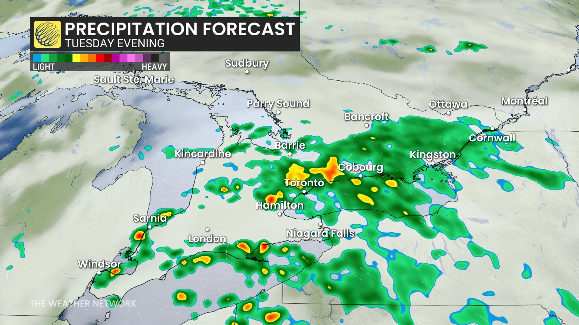
A low pressure system is tracking into southern Ontario from the west, bringing the potential for heavy showers and thunderstorms on Tuesday.

Localized flood threat with potential training thunderstorms
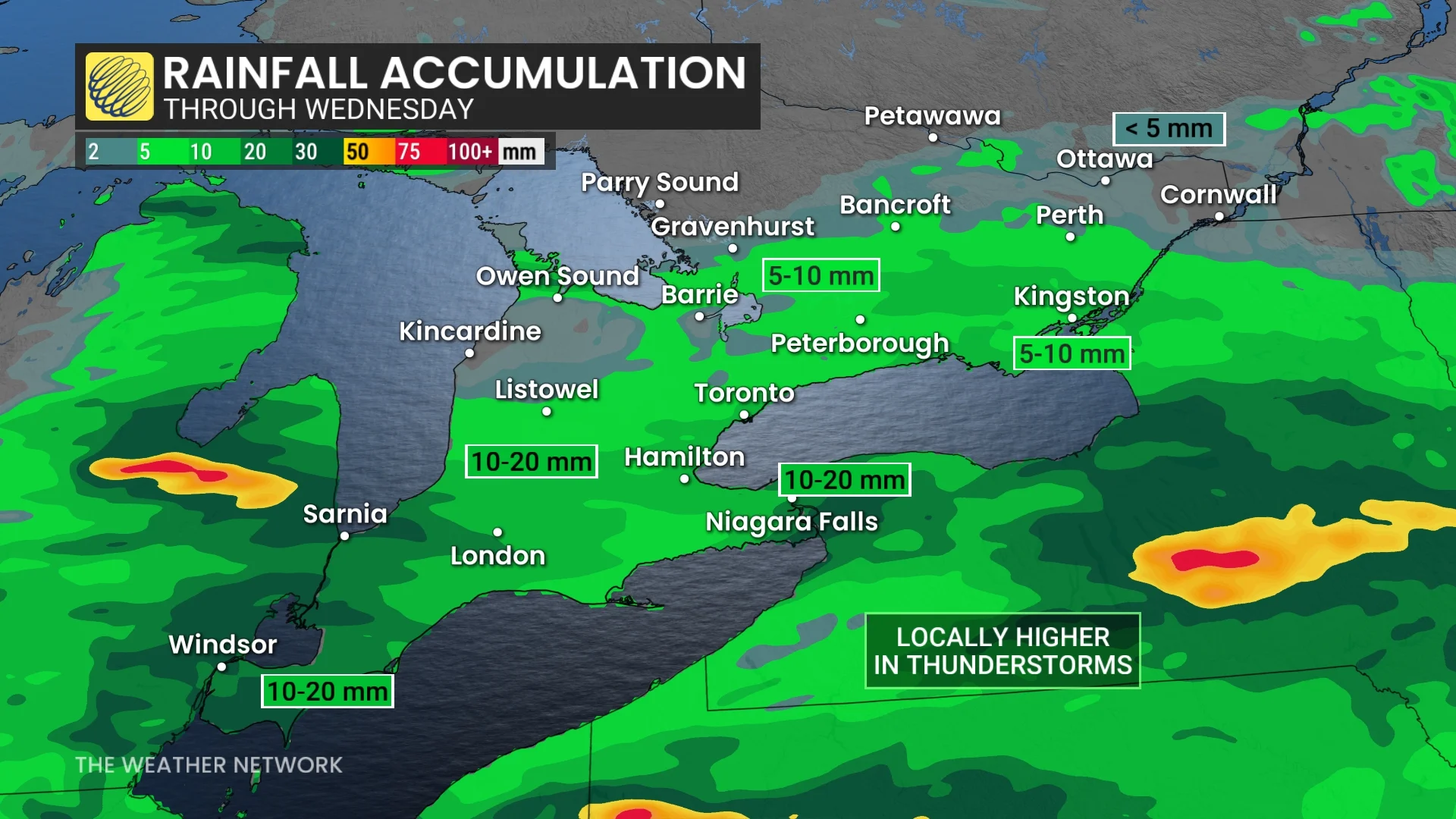
Regions experiencing prolonged showers could see 10-20 mm of rain, but localized amounts exceeding 50 mm remain possible under more intense storm activity.
Rainfall totals will sharply taper off north of Peterborough and along Highway 7.
By early Wednesday, the system will move out, reducing the chance of showers, although lingering clouds and spotty rain may persist.
Temperatures will remain a couple of degrees below seasonal averages in some areas.
By Friday, seasonal warmth will once again return, with daytime highs expected to reach the upper 20s.
WATCH: Is there a fire ban? Here's how to find out
A fever in the lakes
All this summer-time warmth hasn’t just had an effect on humans and infrastructure, either.

The Great Lakes are currently running several degrees above seasonal compared to the 1995-2024 average.
All five bodies of water are running at least 2 degrees above seasonal for the middle of August. Surface temperatures on Lake Erie are hovering around 26°C, while readings on Lake Ontario came in around 25°C on August 17—the latter of which is an impressive 3°C above average.
These unusually toasty lake temperatures have helped keep conditions from cooling off through the overnight hours in recent weeks.