Parts of Atlantic Canada face weekend winter blast before nor'easter
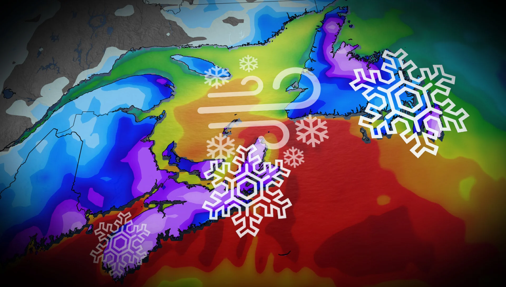
Get ready for a one-two punch of winter weather, Atlantic Canada. Parts of the region will see the wintry impacts of multiple systems, including a nor'easter, through early next week, with heavy snow and blustery winds expected to significantly impact travel
The snow keeps on coming for Atlantic Canada, with a series of systems that will impact into next week, which will include a nor'easter.
Folks across the Maritime provinces and parts of Newfoundland can expect to see some dangerous travel conditions from heavy snowfall and strong winds causing whiteout conditions throughout the coming days. Parts of the region could see 10-30 cm of snow.
SEE ALSO: Beware of carbon monoxide poisoning after a heavy snowfall

Beyond the weekend, forecasters are closely monitoring a nor'easter for more impactful snow and winds. Plan ahead in case schools or scheduled activities are cancelled.
Be sure to stay up-to-date on the forecast and current conditions when making any plans.
Sea-effect snow to bring hefty totals over the weekend
A low-pressure system will clip the Avalon Peninsula and collide with a lingering trough off the north coast of Newfoundland into Sunday morning.
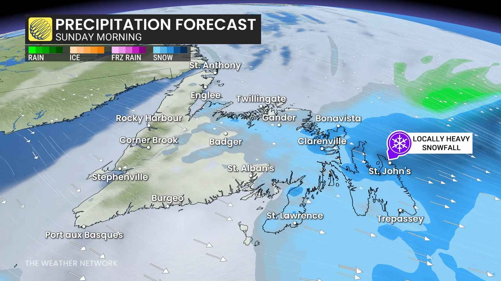
Whiteout conditions are forecast across the Avalon Peninsula during the overnight Saturday and into Sunday afternoon, with wind gusts reaching up to 80 km/h and snowfall totals ranging from 10-20 cm. As much as 20-30 cm is expected across the east coastline of the Avalon.
Along Newfoundland's north coast, snowfall totals will be enhanced due to the trough ushering in heavy, sea-effect snow, with 15-25 cm forecast.
"Conditions will rapidly deteriorate this evening as strong winds combine with fresh snowfall causing widespead reduced visibility in snow and blowing snow," Environment and Climate Change Canada (ECCC) warns.
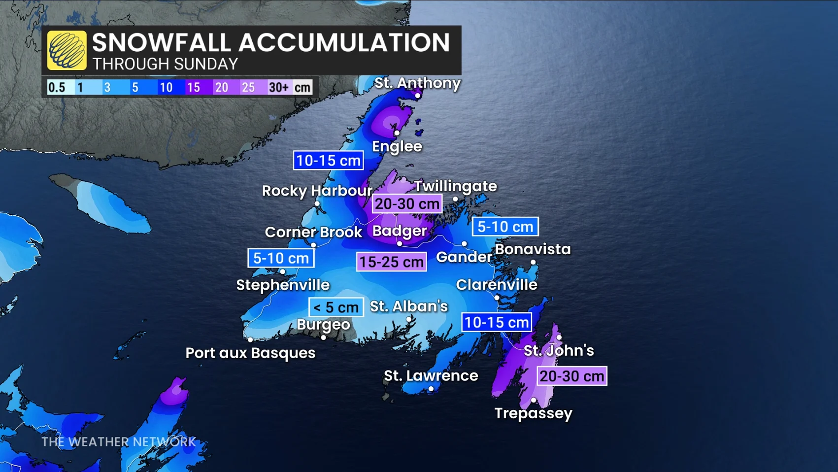
The same trough over northern Newfoundland that the low-pressure system will collide with is also forecast to sink south Saturday evening, bringing sea-effect snow squalls to Prince Edward Island (P.E.I.) and northern Nova Scotia through the evening and into Sunday morning. Some areas could see 10-15+ cm of snow from these squalls.
Forecasters looking at a developing nor'easter to kick off Monday
A strong nor'easter is developing off the United States East Coast and could reach the Maritime provinces by Monday afternoon. The rapidly strengthening storm is also forecast to reach 'weather bomb' status upon its approach.
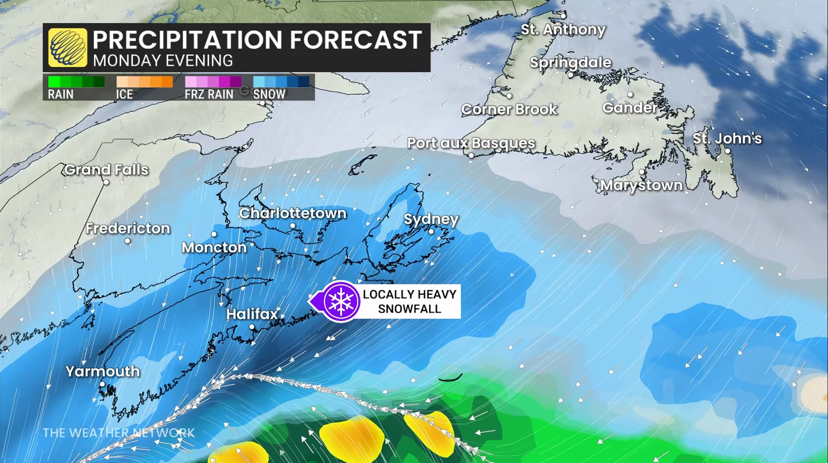
The system has shifted farther to the north, increasing snowfall totals for Nova Scotia and New Brunswick.
Heavy snow will begin across Nova Scotia on Monday afternoon, reaching P.E.I. by the evening, with snowfall rates of 2-3 cm an hour and wind gusts up to 80 km/h km/h.
ECCC has already issued special weather statements and yellow-coded winter storm watches for Nova Scotia, P.E.I. and parts of New Brunswick ahead of this storm.
"Snow accumulation may make travel slow or hazardous. Roads and walkways could become slippery and difficult to navigate," ECCC says in the statement. "Plan ahead in case schools or scheduled activities are cancelled. Make sure snow removal equipment (e.g., shovels or blowers) and supplies are prepared in advance."

In addition to rapidly accumulating snow, we could see conditions vary between whiteout and full-on blizzard through Monday evening, bringing dangerous travel to the evening commute. As well, due to strong winds, high floodwaters are expected.
DON'T MISS: Car stuck in a snow pile? Proceed with caution
As the storm leaves the Maritimes Tuesday morning, it will track straight across Newfoundland. As the storm continues to bring 15-20 cm of snow and whiteout conditions, folks could see widespread school and bus cancellations Tuesday morning.
The snow is forecast to transition over to rain across the Avalon into Tuesday afternoon, bringing the risk of localized flooding as the rain eats away at the snowpack formed from the recent storms to move through the peninsula.
However, if the storm ends up tracking farther offshore than currently predicted, we could see additional heavy snow over the Avalon rather than the transition to rain. Forecasters will continue to watch for this over the coming days.
Stay with The Weather Network for more information and updates on your forecast across Atlantic Canada.