Overnight snow sneaks into southern Ontario, with more winter trouble on the way
A quick burst of snow late Monday into Tuesday will pave the way for a colder, snowier stretch across Ontario this week.
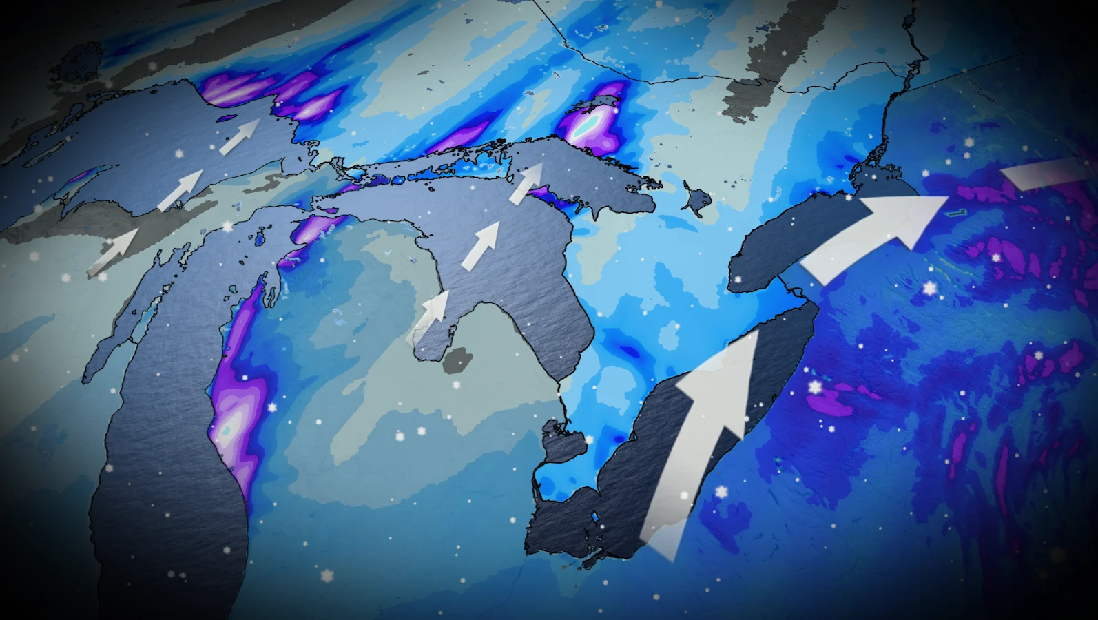
Southern Ontario is in for an unwanted blast of snow overnight, as a strong low over the eastern U.S. approaches close enough to bring flurries to the region.
The system will hit the southwest first, with light snow moving in from Windsor along the Lake Erie shoreline and into Niagara, Hamilton and the western Greater Toronto Area (GTA).
At the same time, lake-effect bands will remain active farther north. Highways 69 and 11 from Parry Sound to North Bay could be the hardest hit, with squalls capable of dumping 20 to 50 cm of snow in the most persistent bands.
DON'T MISS: Early earthquake warning system launched in Quebec, eastern Ontario
Snowy start to Tuesday
By early Tuesday, eastern Ontario will see light snowfall, with most areas receiving 3 to 5 cm. Communities along Lake Erie and near Kingston may see a bit more, thanks from lake enhancement.
Most of the storm's heavier precipitation remains south of the border, but roads here could remain slick. Drivers should prepare for a slower, snowy commute Tuesday morning.

Forecast confidence in exact totals remains low, as the storm continues to shift even as it approaches its arrival. A minor track change could make a significant difference in who receives what.
CHECK OUT: Dream vacation or travel nightmare? Insurance tips for Canadian travellers
Mid-week cold front ushers in deep chill
Another system arrives Wednesday, bringing a sharp cold front, more snow, and an Arctic blast with it. Wind chill values will drop to the -10s in southern Ontario and the -20s in the northern and eastern sections.
But the wintertime trend does not end there. Snow is expected again this weekend, along with even colder temperatures.

Stay with The Weather Network for the latest information across Ontario