Overnight freezing rain threatens Friday commute in southern Ontario
Temperatures continue to climb across southern Ontario, but rain and freezing rain may keep folks prefering the indoors for a bit longer.
As temperatures get continue to get warmer and we move away from the snowy winter weather, forecasters are looking at the threat of freezing rain across southern Ontario on Thursday, as well as incoming rain late Friday and into Saturday.
Luckily, folks will get a taste of the season ahead over the weekend as temperatures continue to climb into the teens on Saturday. Parts of the province could even see the thermometer reach the 20-degree mark by the end of the weekend!
SEE ALSO: Alberta considers scrapping time change, but not Ontario
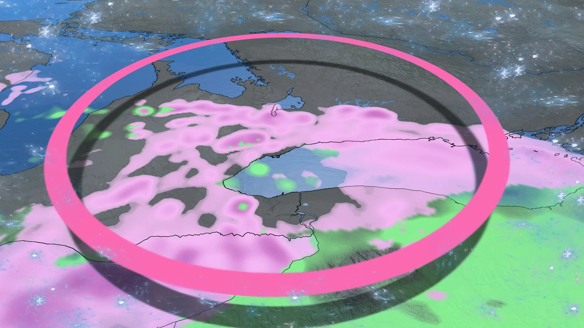
Freezing rain certain, just not how much
Cloudy skies and rain showers will begin to spread across southern Ontario early Thursday, between Windsor and Hamilton. Showers will then spread across the southwest and toward the Greater Toronto Area (GTA) through the afternoon and evening hours.
Some thunderstorms may be embedded in the showers as they move across southern Ontario, but it isn’t guaranteed.

Around the afternoon, the surface temperature will begin to cool, causing the downfall to change from showers into freezing rain. The most likely areas to be hit through the late evening and overnight include Hamilton and the surrounding regions, including the 401 and the GTA, as well as the Prince Edward County region.
There remains a high amount of uncertainty for how far north the freezing rain will move, with a high pressure system from northern Ontario limiting the warm air. This will create a boundary for the freezing rain, cutting off its northward expansion.
Marginal temperatures will also mark the actual impact of the freezing rain and the amount that will be seen. The location and amount of freezing rain could be decided by half a degree. The small temperature difference will drastically change what the expected impacts will be, so it's difficult to give a certain forecast of how much impact the rain will have at this time.

The showers and freezing rain will continue into the overnight, but improve by Friday morning, making for slippery commutes and delays as folks head into work. There is also a chance for black ice to form on roadways, so drivers should exercise extra caution during the morning commute.
Colorado low approaches Friday
A Colorado low is forecast to make its way toward the province from the southwest on Friday, pushing in another round of mild air as well as more widespread rain that will linger through Saturday.
Isolated thunderstorms are also back in the forecast as the warmer air begins to destabilize the atmosphere. Folks across southwestern Ontario are the most likely to hear a few rumbles of thunder on Saturday.

Temperatures across southwestern Ontario will climb throughout the day and continue into Saturday, along with lingering showers. We could even see temperatures reach 20 degrees in Windsor!
DON'T MISS: Two oceans fuel Ontario's thaw, and there's 200 mm of water locked in snow
Meanwhile, easterly winds off Lake Ontario will bring cooler temperatures to the GTA and rest of the Golden Horseshoe. Winds across the rest of the province are forecast to gust between 50 and 70+ km/h. We could see some locally stronger gusts thanks to the low-level jet stream being positioned right over the region.
The winds could result in some ice shoves or jams along Lake Ontario and Lake Erie's shoreline, raising the risk of flooding. In fact, a provincial flood watch has been issued for southern Ontario due to the deeper snowpack this winter and rounds of incoming rain.

We'll see the mild and pleasant weather stick around on Sunday and into Tuesday across central and southern Ontario, but we could see some messy weather move back in for the mid- to late week.
Stay with The Weather Network for more information and updates on your weather across Ontario.