
Hurricane Melissa's transition to bring high winds to Newfoundland
Melissa will undergo a transformation over the next day as it rapidly approaches Newfoundland, threatening high winds and heavy rain
Weather Highlights
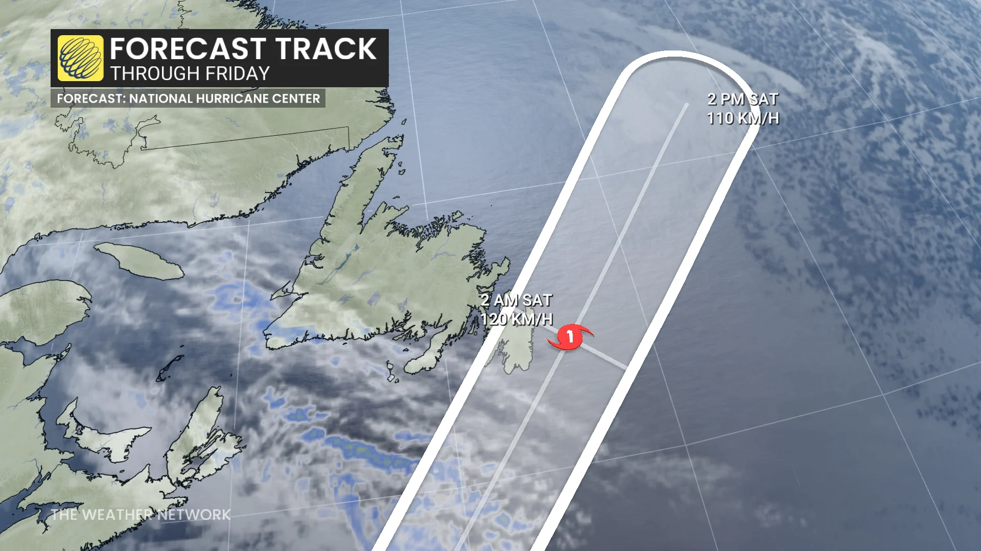
Hurricane Melissa is expected to transition to a post-tropical cyclone on Friday and swipe Newfoundland’s Avalon Peninsula on Friday evening into Saturday
Melissa’s wind field will expand as it approaches Newfoundland as a result of this transition
100-130 km/h winds are possible if the centre tracks onshore
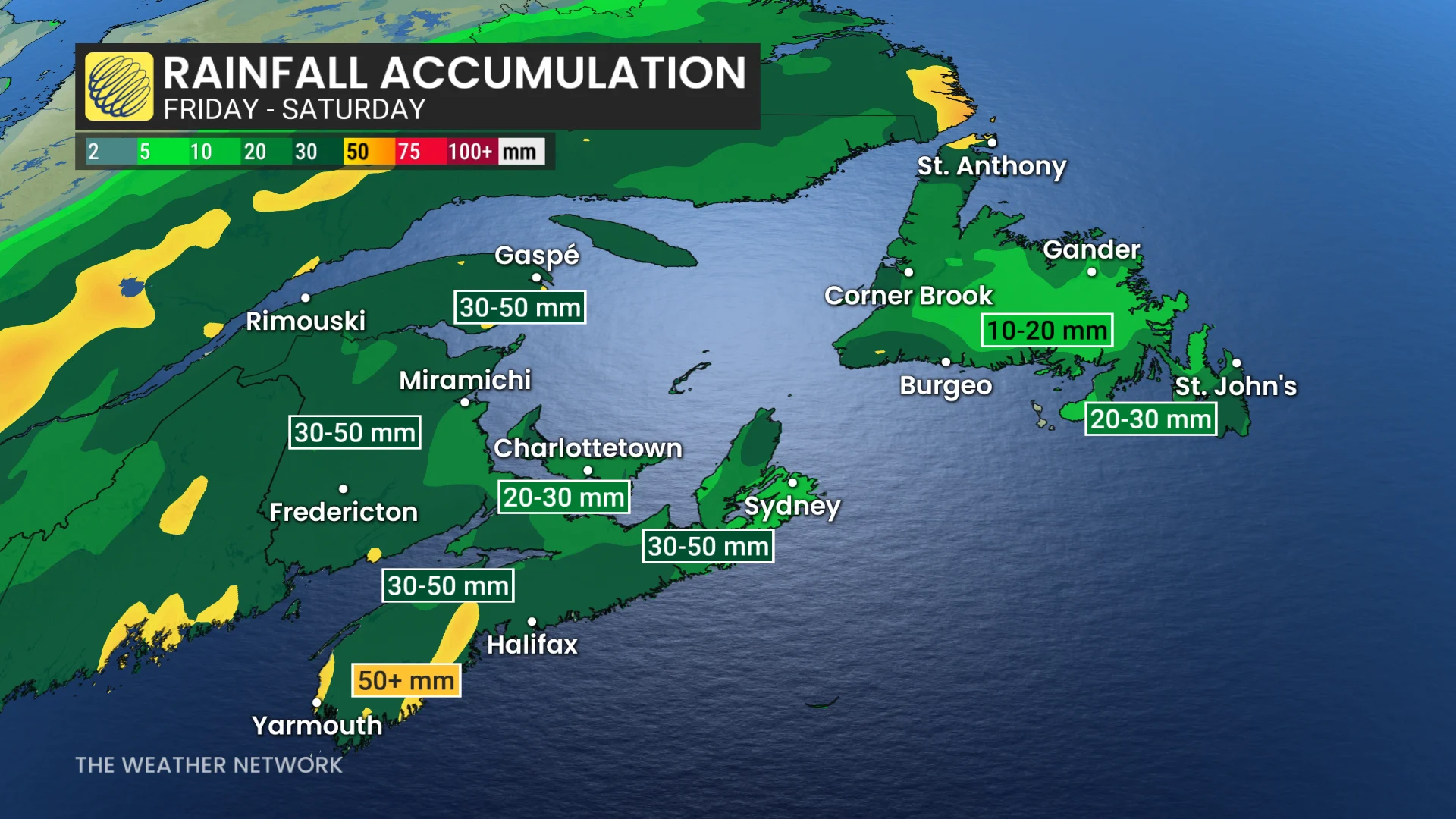
The storm will fuel 30-50+ mm of heavy rainfall across Atlantic Canada
Rough seas are expected across the East Coast as the storm passes the region
Melissa threatens Bermuda, then sets eyes on Newfoundland
After devastating parts of Jamaica on Wednesday, forecasters continue to watch Hurricane Melissa as the storm races through the western Atlantic Ocean.
The system is following a track that will bring the centre of the storm close to Bermuda on Thursday night, where a hurricane warning is currently in effect.
Newfoundland is next in line for the storm’s effects on Friday evening and into the overnight hours. High winds, heavy rainfall, and rough seas are expected as the storm passes through the region.
The hurricane will slowly lose tropical characteristics heading into Friday. This transition means that the hurricane will become a post-tropical cyclone, fuelled by upper-level winds rather than thunderstorms around the centre of the storm.
Post-tropical cyclones expand their footprint during and after this transition, potentially exposing more of southeastern Newfoundland to high winds late on Friday.
Heavy rain picks up through the Maritimes on Friday (Halloween)
Melissa will feed moisture to a second low-pressure system located onshore, prompting widespread rain across the Maritimes.
Widespread rainfall amounts of 30-50+ mm are anticipated, with Halifax seeing heavier rainfall by Friday afternoon.
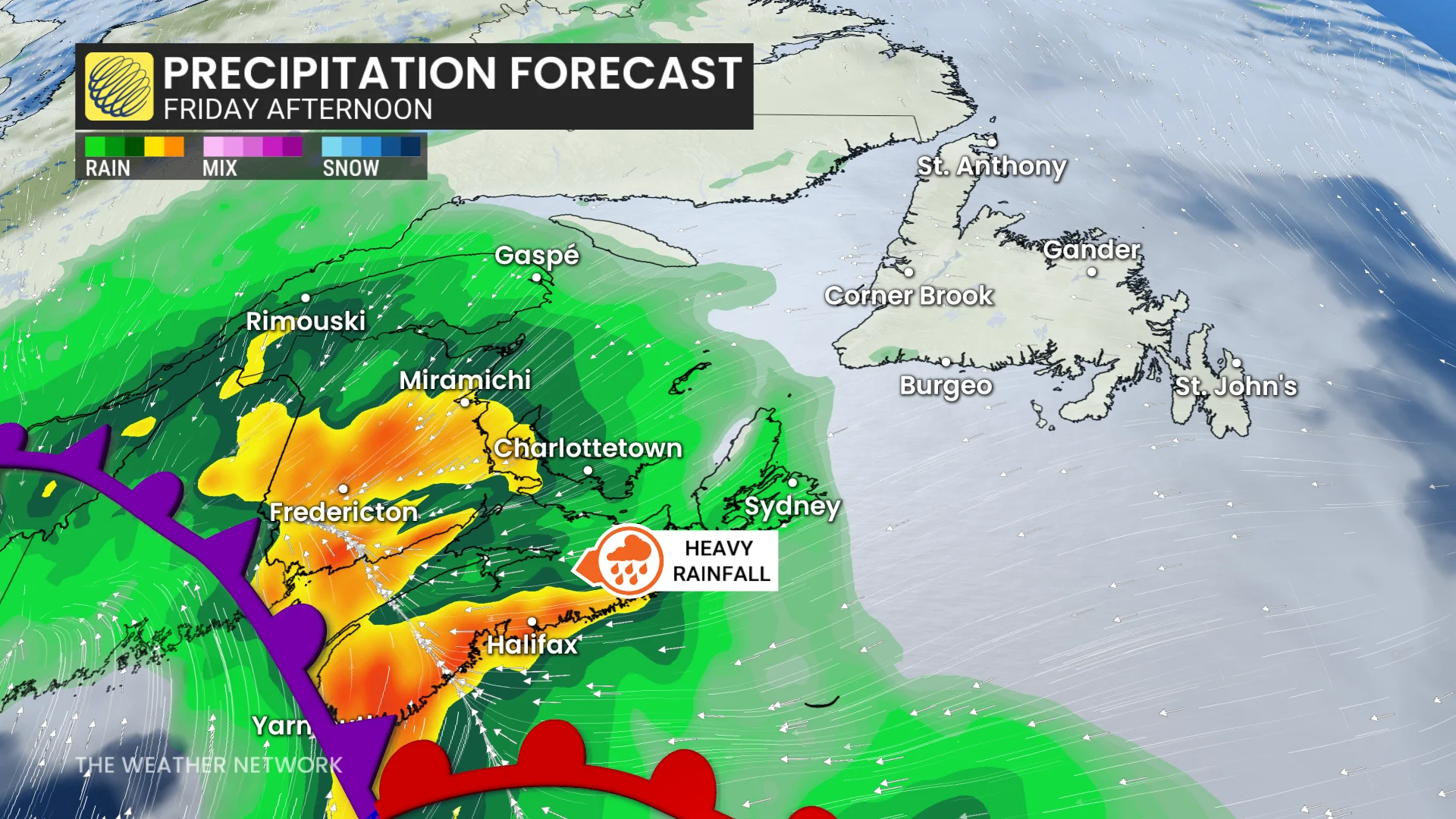
Rain will persist in the eastern Maritimes through Friday evening. Rainfall warnings are in effect for parts of southeastern Nova Scotia and New Brunswick.
"Clear storm drains and gutters of leaves and other debris prior to the rainfall to help reduce flooding," says Environment and Climate Change Canada (ECCC) in the warning.
Parents and trick-or-treaters are advised to monitor the forecast closely, as this system has potential to impact plans on Halloween. More on that in the video below.
WATCH: Postpone trick-or-treating? Atlantic Canada faces soggy dilemma
Winds of 50-70+ km/h are likely across the Maritimes by Friday. A northwest flow behind Melissa will maintain gusty conditions on Saturday, with winds reaching 60-90+ km/h.
Wave heights are expected to rise, reaching 5-8 m off the coast of Nova Scotia and 3-5 m in the Bay of Fundy.
It will be important to stay up-to-date for further developments on Melissa’s track and impacts.