Outages possible as strong winds wallop Ontario, snow creeps in next
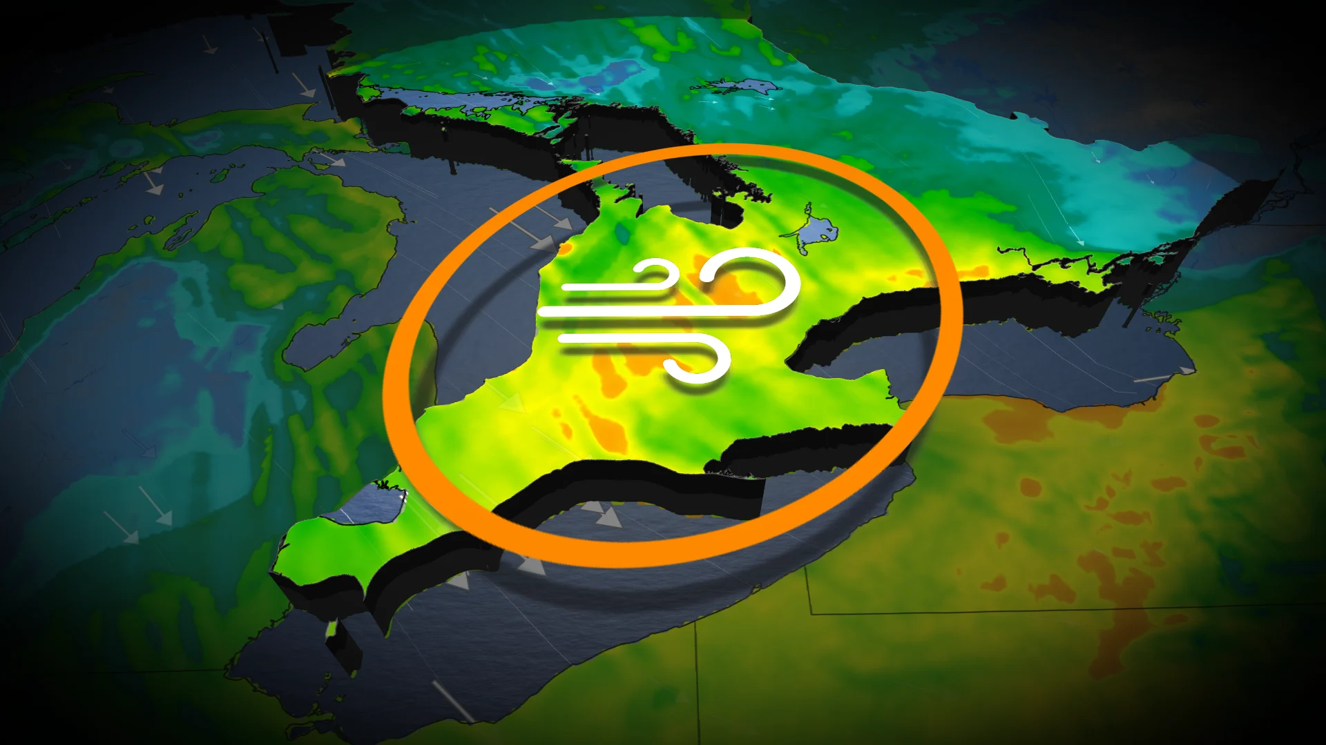
Widespread special weather statements in effect for Wednesday's wicked winds that could knock out power
Ontario will experience an active weather pattern into the weekend, with multiple systems moving through, and the threat for powerful winds, thunderstorms and even the first accumulating snow.
DON'T MISS: Canada’s November features extended fall, but winter lurks on the sidelines
The first will move across the region on Wednesday, bringing some rain showers and very windy conditions. Widespread special weather statements are in effect warning of potential downed trees and power outages.
Another system passing to the north on Friday will result in some heavier rainfall totals. Looking ahead to Sunday, a system tracking through Ontario may bring rain or a mix of rain and wet snow, depending on location. Areas of higher terrain in the northern region, away from the Great Lakes, have the highest potential for accumulating snow.
You'll want to stay up-to-date on weather advisories and prepare for possible weather impacts as systems continue to track across the province.
Wicked winds hit Wednesday
The first system arrives Wednesday, bringing light shower activity along the leading warm front. Parts of the region can expect locally heavier showers late Wednesday afternoon and evening, especially downwind of Lake Huron and Georgian Bay. Isolated thunderstorms and lightning strikes remain possible near these lakes.
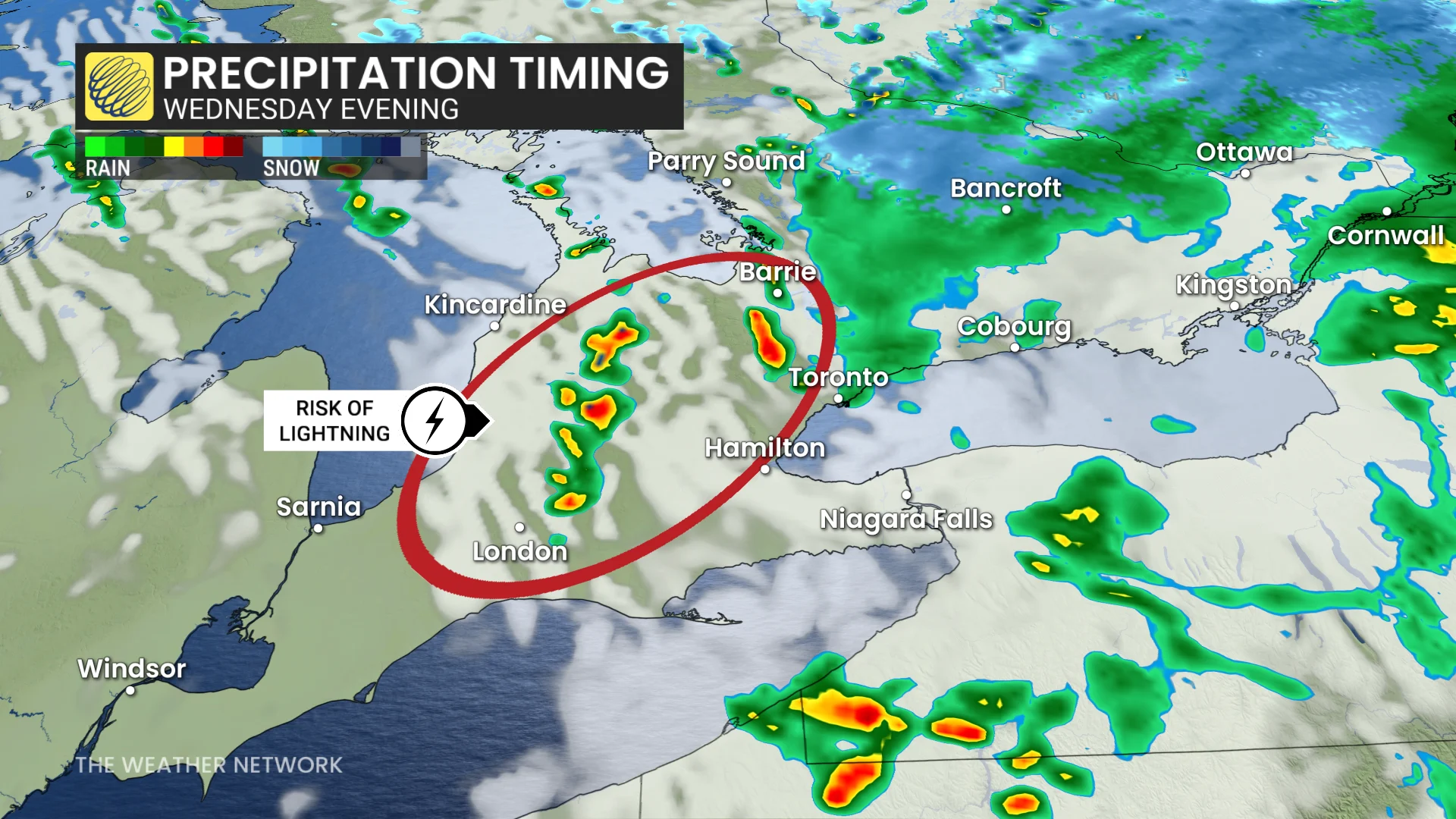
Strong winds are also forecast, with southwest gusts of 60-80 km/h in Niagara, shifting to northwest winds by evening.
RELATED: Staying safe during a power outage: infographic
Northwesterly gusts of 60-70+ km/h will affect the Greater Toronto Area (GTA), Hamilton, London, and areas downwind of Lake Huron and Georgian Bay.
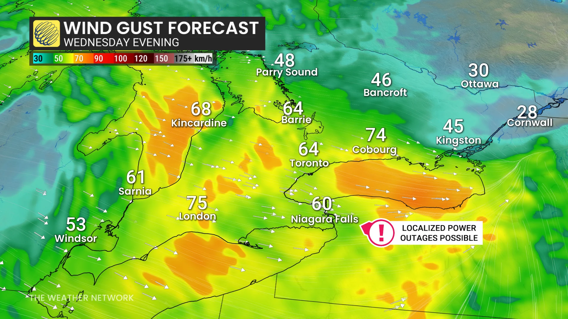
"Strong wind gusts can toss loose objects and cause tree branches to break," warns Environment and Climate Change Canada (ECCC) in the special weather statement. "Power outages are possible."
Overnight, lake-effect showers are likely near Barrie, with brief wet snowflakes possible in the Dundalk Highlands and snowbelts near Lake Huron and Georgian Bay.
In eastern Ontario, including Ottawa, rain will intensify Wednesday afternoon. Meanwhile, Algonquin Provincial Park's higher elevations could see accumulating snow.
Clipper system to bring rain, gusty winds, and cooler temperatures Friday
A clipper system from the Prairies will track across Ontario on Friday, bringing widespread impacts.
A cold front will move west to east, delivering rainfall to central regions, including the GTA, by Friday afternoon. Gusty southwest winds are expected alongside the rain.
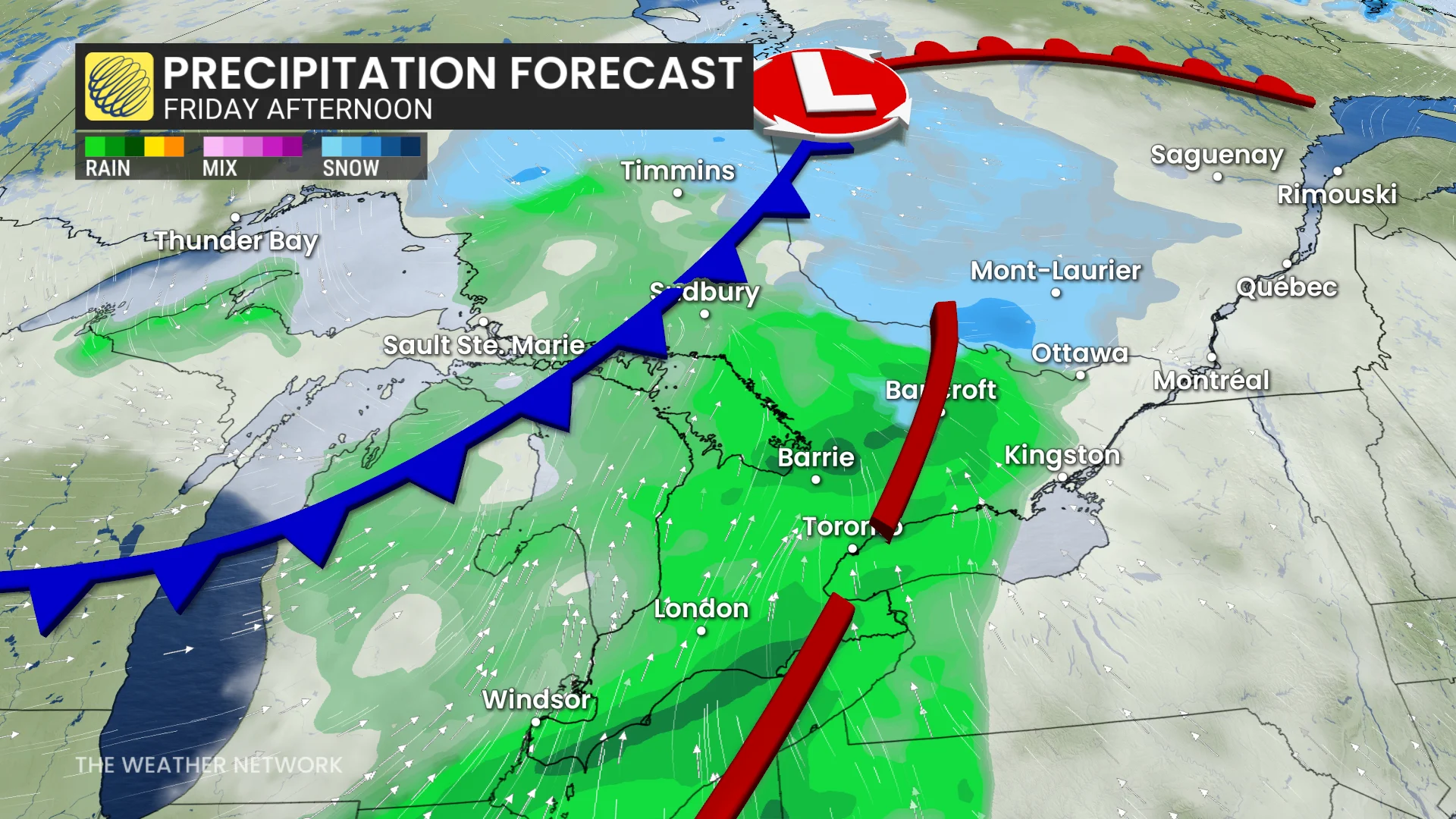
Northwestern and eastern Ontario may see wet snowfall accompanying the system, with conditions varying by elevation and region.
This system will usher in a significant cooldown for the weekend, with daytime highs forecast to reach only 5-6°C on both Saturday and Sunday as a chilly trough settles south over the province.
Third system on Sunday could bring wintry weather to southern Ontario
A third weather system is being monitored for Sunday, with the potential to bring wintry impacts to parts of southern Ontario. However, there remains significant uncertainty regarding the exact storm track and its effects.
DON'T MISS: Snowy surprises can blanket Canada during a typical November
There is a chance that areas within snowbelt regions could see their first accumulating snowfall of the season, depending on the system's progression.

Residents in affected areas should stay informed as forecasts are refined over the coming days.
Signs of lake-effect snow ahead of a mid-November warm-up
Chilly weather is anticipated early next week, bringing the potential for significant lake-effect snow in traditional snowbelt regions. However, temperatures are forecast to rebound later in the week, with above-seasonal temperatures likely by mid-November and into the latter half of the month.
More consistent winter weather should arrive before the beginning of December.
WATCH: Will intense lake-effect snow result from warmer Great Lakes?
Be sure to check back for the latest weather updates across Ontario.