Ontario set for dramatic weather shift with temperature swings and thunderstorms
Powerful storm to hit Ontario with snow up north, rain, and severe storms in the south. A sharp cold front will bring a significant temperature drop from Thursday into Friday
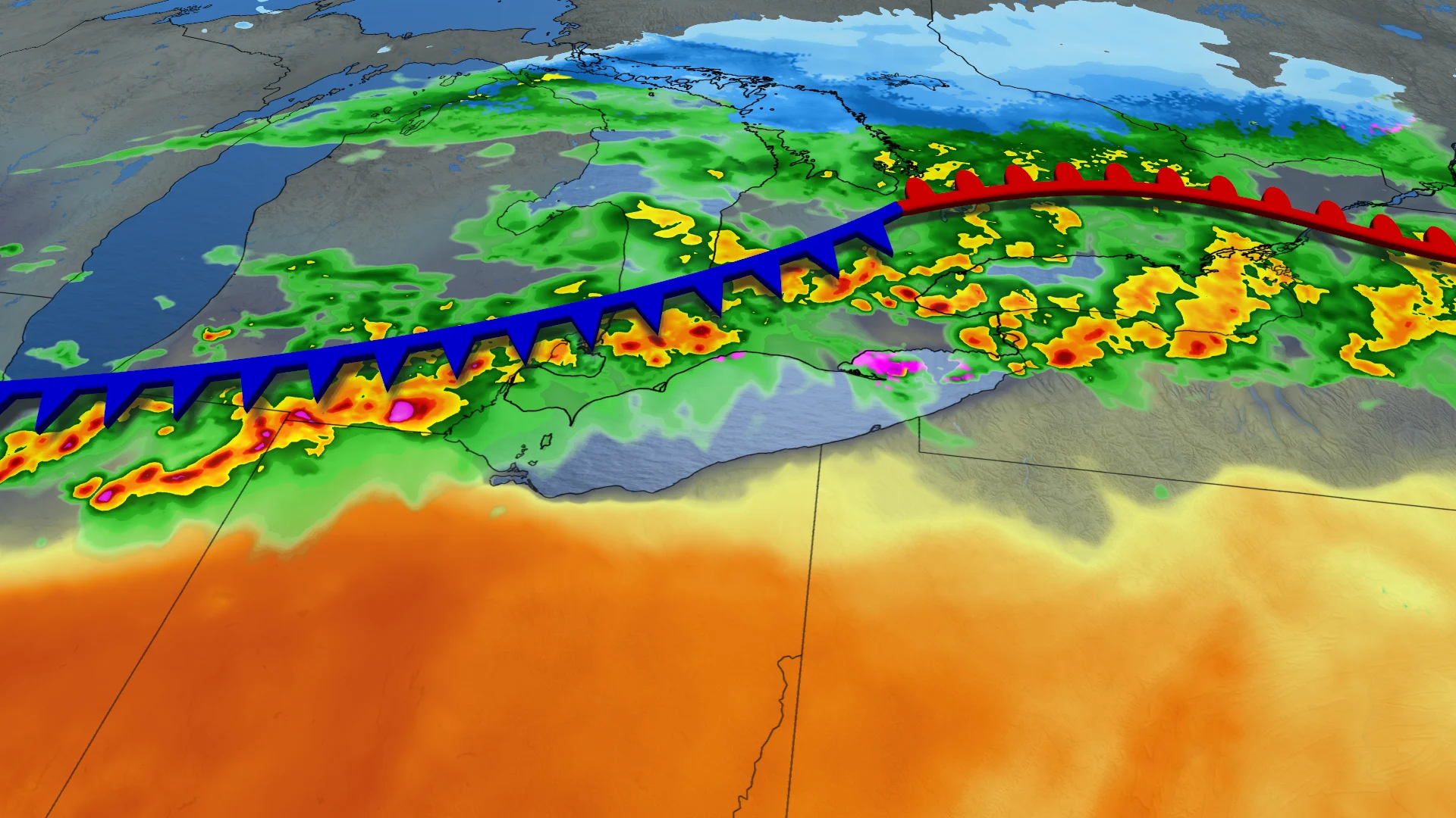
A significant storm tracking across Canada, which began with snow and strong winds in Western Canada, is set to impact southern Ontario.
The system is riding north of a second heat dome over the central U.S., leading to milder conditions for parts of Ontario. However, the warm-up will be short-lived and also geographically limited.
DON'T MISS: Blazing hot: 1,000+ records fall in brutal March heat wave
The freezing line will reach the Nickel Belt, but temperatures in the teens will mainly be confined to the Greater Toronto Area (GTA) and southwestern Ontario.

While temperatures in Northern Ohio may climb into the mid-20s, Lake Erie’s cooling effect will prevent similar warmth over Ontario.
Windsor could be the only location in the province to reach 20°C on Thursday afternoon.

A cold front linked to the clipper system will sweep across southern Ontario from Thursday evening into the overnight hours. Afternoon cloud cover, weak storm circulation, and cool lake temperatures are expected to limit storm severity, with heavier rainfall staying north of the GTA.
SEE ALSO: Storm cleanup: Some Sudbury school bus routes finally rolling again
Storm development is possible from Kitchener to Windsor before the front moves over Lake Erie.

Temperatures will drop significantly behind the cold front, falling 15°C to 20°C by Friday morning.

Any April warm spell is likely to be short-lived
Early April is expected to be warmer than late March, but the extent of the warmth remains uncertain. A warm pattern is set to develop in the Great Lakes region, with temperatures reaching the 20s in southwestern Ontario for several days. However, the warmth may struggle to extend into the GTA. Any warm spell is likely to be short-lived.