
Ontario braces for sharp cooldown as storms sweep in
Temperatures could plummet 5 to 10 degrees below average, with some areas approaching freezing point.
A severe cold front will sweep across Ontario this week, bringing widespread showers, gusty winds and a noticeable chill, breaking the province's streak of pleasant summer days.
Daytime temperatures in several areas may struggle to exceed 20ºC, a remarkable dip for late August.
Forecasters say the shift will be particularly noticeable in southern and eastern Ontario, where thunderstorms are predicted to strike Thursday afternoon and evening.
Some storms may intensify if they feed on strong lake breezes. Winds of 40-60 km/h behind the front will intensify the sensation of chilly air.

MUST SEE: We're losing late sunsets, Toronto, with summer drawing to a close
Big drop in temperatures
By Friday, temperatures in much of Ontario will be five to 10 degrees below seasonal averages.
In Toronto and Ottawa, highs may reach 19ºC — a level not seen since mid-June. Windsor might drop into the upper teens, while Sudbury could reach just under 20ºC.
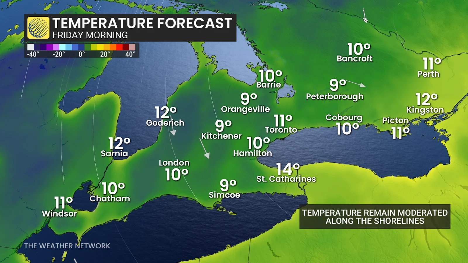
Overnight lows will fall much more dramatically. Parts of southern Ontario are expected to be in the single digits by late Thursday and Friday night.
Water along the Great Lakes will help to keep temperatures in the double digits. But farther inland, areas in northeastern Ontario may get their first frost, with some forecasts suggesting temperatures near freezing.
Looking ahead
SEE ALSO: A hidden 'Black Moon' rises this weekend. Here's what that is
The chill will not stay forever. High pressure is expected to return next week, bringing temperatures closer to seasonal norms.
However, the rapid swing serves as a reminder that September is approaching — and that summer's grip on Ontario is beginning to fade.

Stay with The Weather Network for more information and updates on your weather across Ontario.