The East Coast faces more disruptions as major nor'easter continues
Expect more travel disruptions, closures and cancellations in Atlantic Canada Tuesday as a powerful nor'easter continues to bring impactful snow and winds
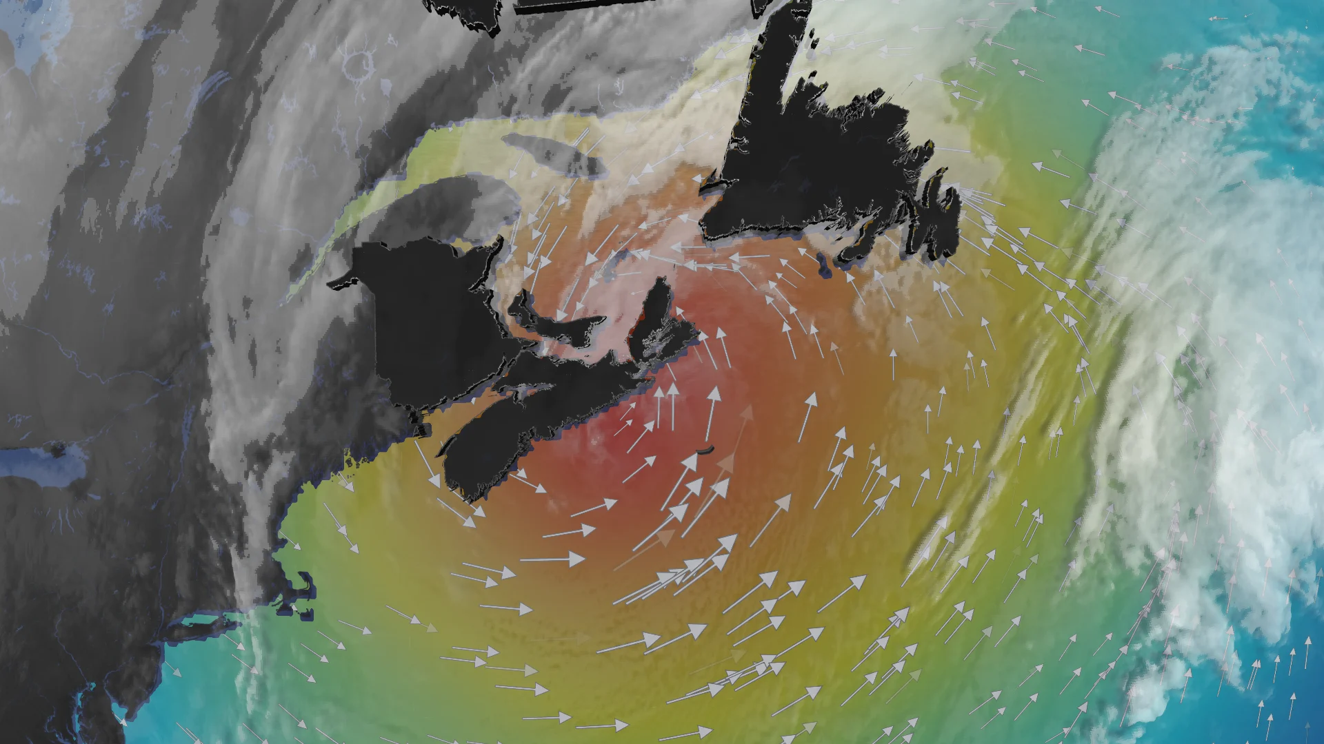
Atlantic Canada had a rough start to the week as a powerful nor'easter pushed across the region with hefty amounts of snow, blustery winds and blizzard conditions for some.
The storm impacts have continued into Tuesday for many in the region as the nor'easter reaches farther into Newfoundland with heavy snow and strong winds. It will likely be one of the most impactful storms of the season for Nova Scotia, or the Maritimes as a whole.
DON’T MISS: A winter storm’s track can make or break your forecast
Prepare for tough to impossible travel again on Tuesday with snow lingering for many, and brace for more school and business closures, as well as possible power outages.
Major nor’easter continues its Tuesday trek across Atlantic Canada
Snow and blowing snow persisted into Tuesday across Atlantic Canada, but there has been some easing in the intensity in the snowfall.
Some of the snowfall totals recorded so far as of Tuesday morning local time:

Halifax airport: 32.8 cm
Charlottetown airport: 17 cm
Moncton airport: 15 cm
Saint John airport: 16.9 cm
RELATED: What is a 'weather bomb'?
After heavy overnight snowfall, northern Nova Scotia can expect snow to continue into the early morning on Tuesday. At the same time, a wintry mix will limit totals along the province’s southeastern coastline.
Throughout Tuesday, snow is expected to ease, but will linger in some parts, while 50-70 km/h winds could allow blowing snow to stay persistent across the Maritime province.
Overall, an additional 5-15 cm of snow is forecast across Nova Scotia.

The southern parts of the province will see around 5-10 cm of snow, while further north, Sydney is forecast to see between 10-20 cm. Around Charlottetown, Moncton and Truro, snow is forecasted at 10-15 cm, with the area between them within that 10-20 cm range.
Prince Edward Island and New Brunswick are also forecast to receive an additional 10-15 cm of snow through Tuesday morning.
While bursts of snow continue near and surrounding the Northumberland Strait. Blowing snow risk continues along the exposed coastal areas.

More snow is forecasted for Newfoundland, with similar heavy snow and strong wind impacts to continue across Tuesday. Some areas are predicted to be hit with upwards of 20-30 cm just on Tuesday alone.
Whiteout conditions and school and flight cancellations are likely to continue.
A transition into rain is expected across the Avalon Peninsula on Tuesday afternoon, with 10-15 cm of snow forecast through Wednesday. Some additional snowfall can be expected due to a lingering trough.

Dangerous travel is expected for the evening commute. Prepare for more school and business closures on Tuesday. Flight cancellations are almost certain. Power outages are possible. High winds paired with high tides may also lead to coastal flooding in some locations.
So far, this has been St. John's snowiest February since 2006.
SEE ALSO: Car stuck in a snow pile? Proceed with caution
St. John’s snowiest month on record is currently 173.4 cm, recorded in December 2000, and is likely to break that over the coming 24 hours. With 376.4 cm of snowfall, St. John’s has passed the average annual snowfall (approximately 360 cm).
Major U.S. impacts could affect Canadian travellers
South of the border, this is likely going to be the largest snowstorm in Philadelphia and New York City since the nor’easter of January 2016.
According to the U.S. National Weather Service's Weather Prediction Center, the following snowfall totals have been recorded as of Tuesday morning:
New York City
Central Park: 50 cm
LaGuardia Airport: 57 cm
Newark, N.J.
69 cm
Philadelphia, Pa.
36 cm
Extreme totals
Warwick, R.I.: 92 cm
North Kingstown, R.I.: 89 cm
T.F. Green Airport, R.I.: 96 cm
Berkley, Mass: 79 cm
Central Islip, N.Y.: 79 cm
Stateside flight cancellations will likely have big impacts for Canadian travellers. New York’s LaGuardia and Newark airports rank among the busiest airline routes from Toronto, Montreal, and Halifax.
Stay with The Weather Network for all the latest on your forecast across Atlantic Canada.