Nor’easter threatens up to 40 cm snow, blizzard conditions in Atlantic Canada
Prepare for tough to impossible travel Monday as a major winter storm sweeps into Atlantic Canada
A powerful nor’easter developing off the U.S. East Coast has reached Atlantic Canada, and is bringing yet another round of widespread, heavy snowfall and gusty winds.
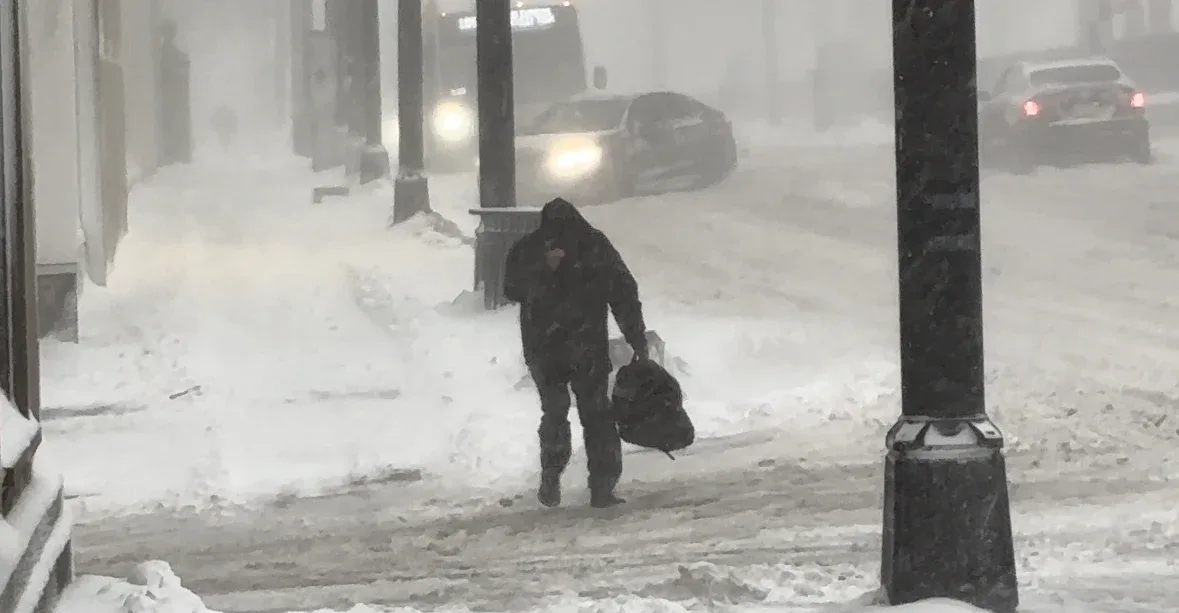
Whiteout to blizzard conditions are expected during the peak of the storm. Prepare for tough to impossible travel, school and business closures, as well as possible power outages.
DON’T MISS: A winter storm’s track can make or break your forecast
Major nor’easter makes its way into Atlantic Canada
Ample moisture from the south, plenty of cold air over land, and intense storm dynamics will create widespread heavy snowfall and strong winds from Philadelphia to Halifax. Stateside, blizzard warnings span from Virginia to the Canadian border, including major cities like New Jersey, New York City, and Boston. More than 8,000 flights also been cancelled as the storm creates near impossible travel.
Forecasters have seen the system moving faster and a little farther north, which has sped up the timeline of hazardous conditions and likely exposed more communities to bountiful snows.
RELATED: What is a 'weather bomb'?
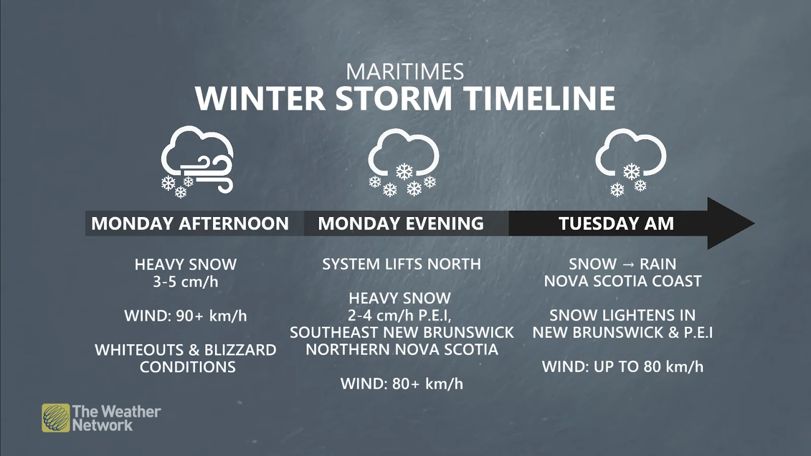
In Atlantic Canada, the impactful system moved into southwest Nova Scotia on Monday morning, then lifted north into the Halifax area by the early afternoon.
The heaviest snowfall will spread over Nova Scotia through the afternoon hours. The snow will also begin to fall around the Bay of Fundy in the afternoon, but the heaviest snow will sweep into Prince Edward Island and southeast New Brunswick through the evening hours.
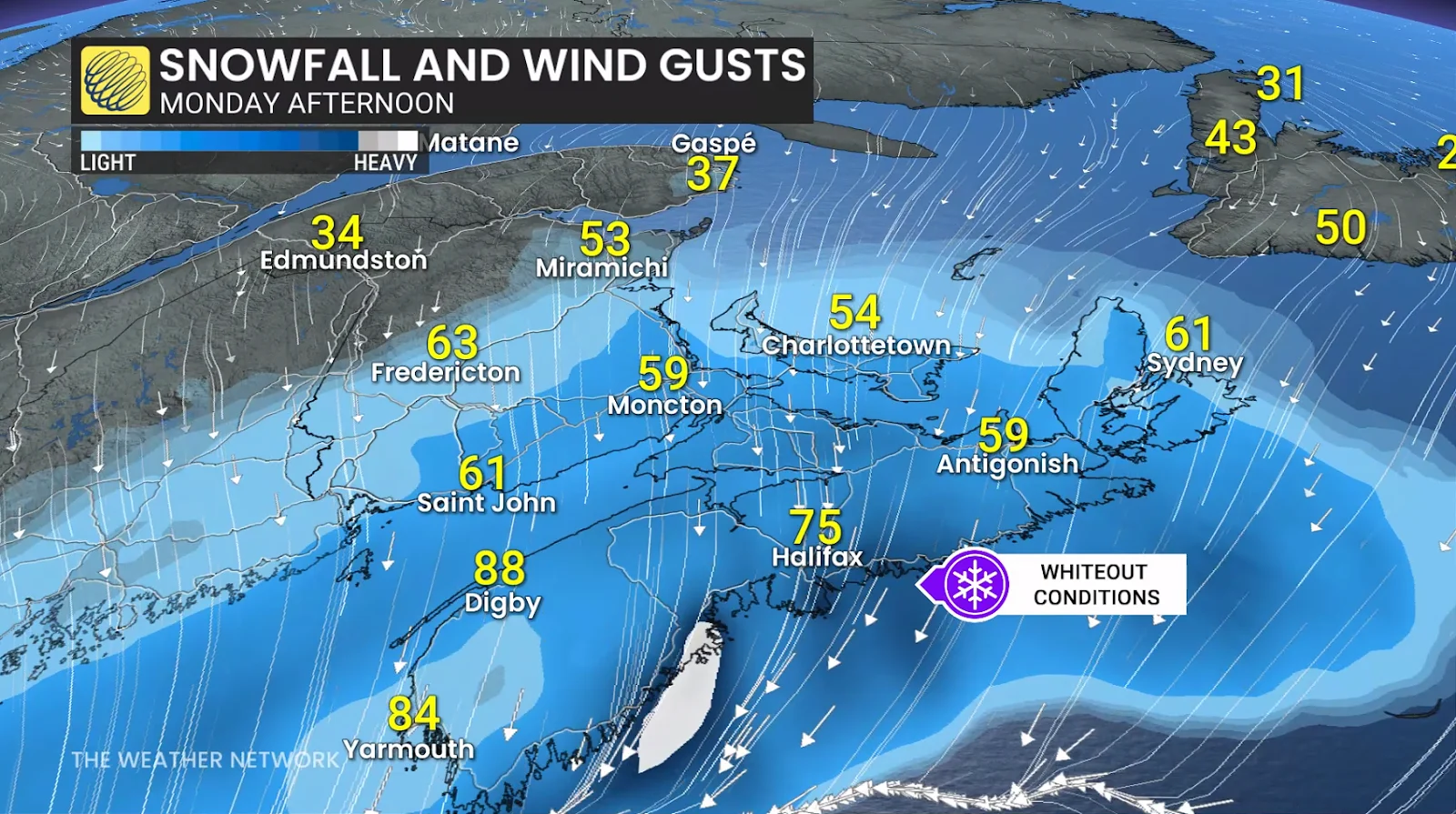
Snowfall rates as high as 5 cm per hour are possible along the eastern shores of Nova Scotia through Monday afternoon, leading to fast accumulations.
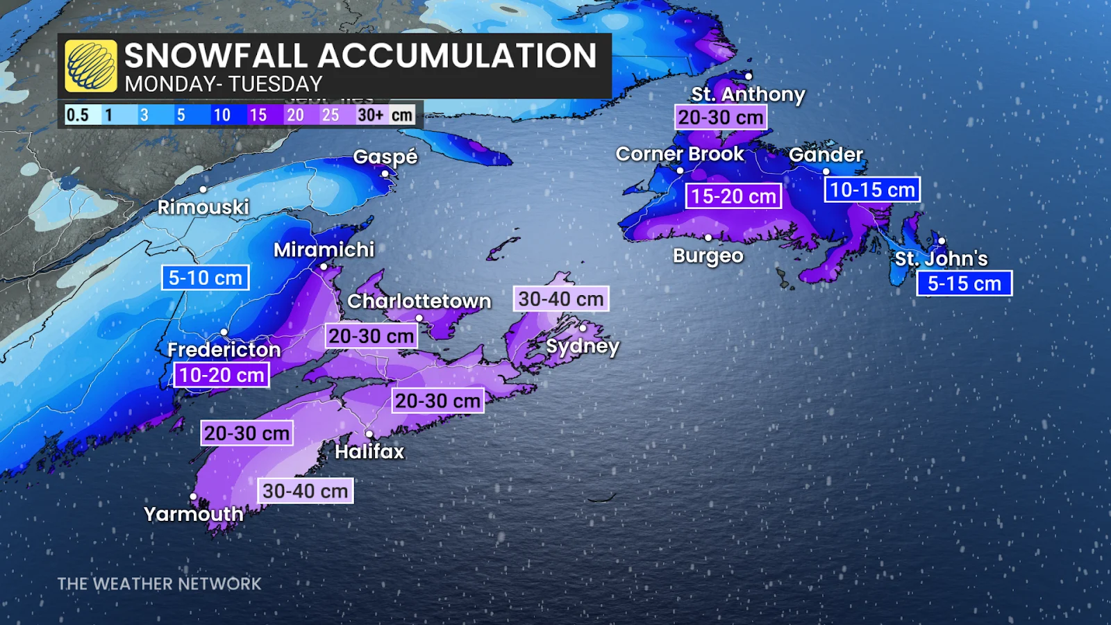
Overall, a widespread 20-40 cm of snow is forecast across Nova Scotia through Monday, with the higher totals more likely across the southwest. To the northeast, we could see some offshore rain mix in with the snow, lowering the snow totals. Downtown Halifax is forecast to see about 25 cm of snow, while the Halifax Stanfield International Airport is forecast to see 30 cm.
High winds are likely for the duration of the storm, with gusts up to 90+km/h for exposed, coastal areas. The combination of heavy snow and high winds will lead to whiteouts and potential periods of blizzard conditions for portions of Nova Scotia, Prince Edward Island, and New Brunswick.
Dangerous travel is expected for the evening commute. Prepare for school and business closures on Monday and Tuesday. Flight cancellations are almost certain. Power outages are possible. High winds paired with high tides may also lead to coastal flooding in some locations.
The storm will lift toward Newfoundland overnight Monday and into Tuesday morning, bringing significant winter weather impacts to central portions of the island. Whiteout conditions and school cancellations are likely here, as well.

A transition over to rain is expected across the Avalon Peninsula into Tuesday afternoon, limiting snow totals to 5-15 cm. Central Newfoundland is forecast to receive heavier snow, with 15-30 cm possible.
So far, this has been St. John's snowiest February since 2006, and the city's snowiest winter since 2002-03. The event could easily be the tipping point to make this the snowiest February so far this century, as the next snowiest February on record was in 1921.
SEE ALSO: Car stuck in a snow pile? Proceed with caution
Major U.S. impacts could affect Canadian travellers
South of the border, blizzard warnings are in effect along the entire coast from Maryland to Maine, covering the cities of Wilmington, Philadelphia, New York, Boston, and Portland, and including large swaths of the Interstate 95 and Route 1 corridors.
This is likely going to be the largest snowstorm in Philadelphia and New York City since the nor’easter of January 2016. The U.S. National Weather Service calls for 40 cm of accumulation in Philadelphia and 50 cm in New York City.
New York City's mayor, Zohran Mamdani, issued a travel ban across the metropolis on Sunday night, lasting until noon Monday.
Stateside flight cancellations will likely have big impacts for Canadian travellers. New York’s LaGuardia and Newark airports rank among the busiest airline routes from Toronto, Montreal, and Halifax.
Stay with The Weather Network for all the latest on your forecast across Atlantic Canada.