Newfoundland in the crosshairs of another intense, impactful storm
Localized flooding, tree damage, and power issues are possible again as another storm sweeps into Newfoundland this week, with threats of 90-110+ km/h winds and 30-100 mm of rainfall
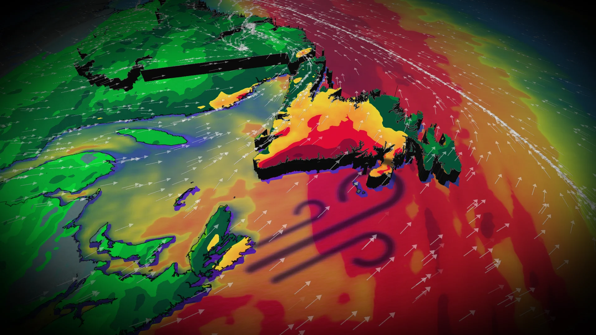
Another disruptive storm is tracking toward Atlantic Canada this week as an active pattern continues across the eastern half of the country.
Newfoundland will once again be on the receiving end of the worst of the impacts, with a threat of damaging winds of 90-110+ km/h and soaking rains since the low will deepen before it reaches the province. As a result of the impending storm, some outdoor Remembrance Day parades in Newfoundland on Tuesday have been cancelled.
RELATED: 'Weather bombs’ are explosive storms that create ferocious conditions
Beware the risk for localized flooding due to heavy rain, as well as isolated tree damage and power outages amid high wind gusts. Ensure devices are charged.
WATCH BELOW: Nova Scotia looks into AI to help combat future power outages
Tuesday sees storm ramp up for Newfoundland impact
We’ll see a coastal low-pressure system quickly develop this week. The storm’s rapid deepening, combined with a steady flow of moisture from the south, will combine to create a period of heavy rain and high winds throughout portions of the region.

A centre of high pressure over Greenland will allow our low-pressure system to intensify near Newfoundland into Tuesday.
SEE ALSO: Winter-proof your home with a heat pump that even works in -30°C
Heavy rain for Newfoundland will intensify through the day on Tuesday. The Avalon Peninsula will see rain begin late Tuesday morning, with totals of 30-50 mm possible.

For Burgeo the southwestern coast, there are concerns for heavy rain amounts of 50-100 mm, elevating the risk of localized flooding.
Winds, from the southwest, will be strongest along the southern coast and Avalon, with gusts reaching between 90-110+ km/h.
The strongest winds occur Tuesday overnight, lingering into Wednesday morning. Folks should brace for potential power outages and tree limb damage, and ensure all devices are charged.

Forecasters will keep an eye out for the potential for strong winds to develop across the Avalon by the pre-dawn hours Wednesday, associated with a rapidly developing surface low.
Expect the system to clear out of the region by Wednesday afternoon, triggering sea-effect snow for western Newfoundland and Nova Scotia, north of Halifax.
Stay with The Weather Network for all the latest on conditions across Atlantic Canada.