Newfoundland braces for significant snow after short-lived warm break
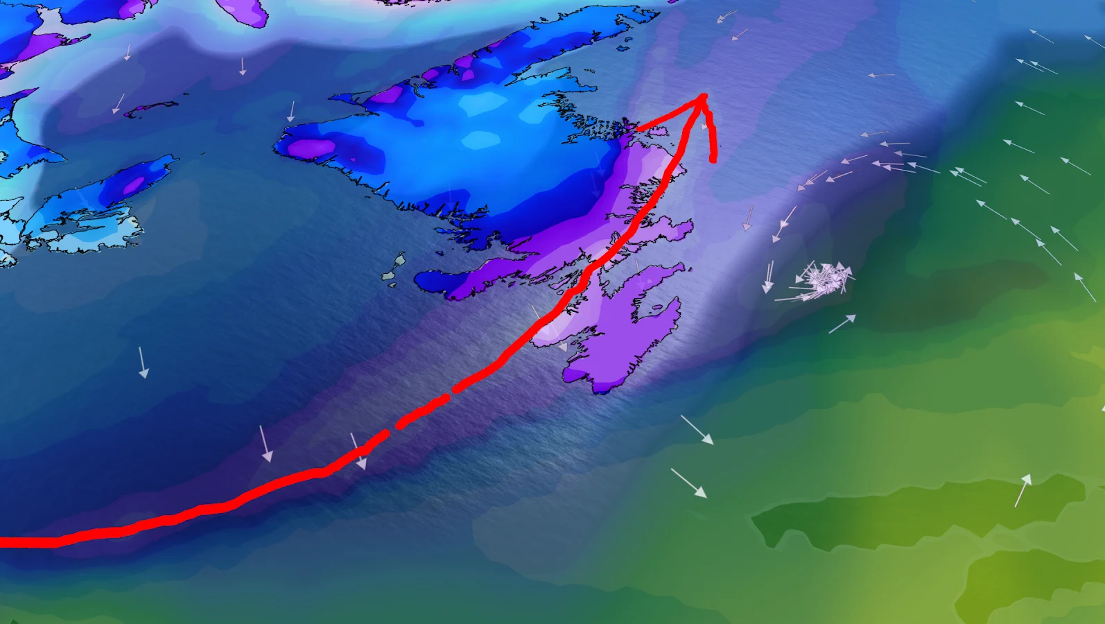
A brief warm spell makes way to a multi-round snow threat, with a powerful system aimed at eastern Newfoundland late Sunday into Monday.
A surge of milder air will keep most of Newfoundland relatively calm on Friday, giving some relief from snowfall and difficult travel conditions. For many areas, it will feel like a reset button — but it won't last long.
The focus then shifts to the Maritimes, where a pool of arctic air will help steer the next weather system. Instead of moving north, the following wave of moisture will be forced south and east, with its sights set on eastern Newfoundland as early as Saturday.
This first round isn't the major event, but it's an important introduction to what follows next.

CHECK OUT: Did a water main break near your home? Here's what happens next
Saturday snow sets the stage
Snow is projected to drop on the Avalon Peninsula on Saturday, but its impact on St. John's should be limited. Heavier snowfall is anticipated in northeastern Newfoundland, with 10-15 cm possible in areas such as Bonavista and Clarenville.
While manageable on its own, this system will be helpful in bringing colder air back into the province from the Maritimes. That colder air is important because it lays the groundwork for a much stronger storm in the following half of the weekend.

DON'T MISS: Is warming up your car in winter a smart move?
Major storm possible Sunday into Monday
The most significant snowfall is expected to fall late Sunday and continue into Monday, with conditions rapidly deteriorating overnight.
Before landing in Newfoundland, the system will briefly clip southern Nova Scotia, causing less than 5 cm of snowfall. As it moves over colder air and draws on Atlantic moisture, snowfall rates may increase as it expands across Newfoundland.
Current forecasts show that 30-40 cm could fall from St. John's westward to Gander, though confidence is still building. Warm air remains close offshore, but current guidance suggests keeping it far enough away to avoid a changeover to rain.

The biggest wildcard isn't temperature, it's moisture. Forecast models remain divided on how much moisture the storm can bring in, leading to a wide range of snowfall amounts. The projections for the Avalon Peninsula alone range from 20 to 40 cm by Monday.
Folks should expect rapidly changing conditions late Sunday, such as difficult travel, reduced visibility and potential disruptions. Forecast confidence will rise as the system approaches, but one thing is certain, Newfoundland's quiet period will be very brief.
Stay with The Weather Network for the latest updates across Newfoundland
