Multiple systems fuel consecutive days of Prairies' severe storm risk
A multi-day risk of severe storms will be present on the Prairies once again, with the most concerning threat occurring on Friday--with supercells on the table for parts of Manitoba and northwestern Ontario
A renewed thunderstorm threat will take shape on the Prairies as the region sees a couple of systems push through a favourable environment.
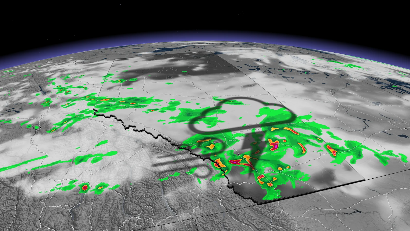
The storm risk will persist through much of this week across the Prairies as multiple low-pressure systems track through the region. Wednesday's risk will be prominent across southern Alberta and Manitoba, with large hail and strong winds being the dominant risks.
SEE ALSO: Jasper rising from the ashes: A journey of recovery one year later
Friday, however, will be the day to watch closely as a higher risk of severe weather will be featured. The potential will include the chance of supercells, in addition to large hail and strong wind gusts, for southern Manitoba and northwestern Ontario.
You'll want to stay updated on the weather alerts in your area as conditions can change quickly when severe weather hits.
Wednesday to Friday: Severe storm setup favourable, with supercell chance late week
A couple of low-pressure systems will track across the region this week, setting off the chance of severe weather over multiple days.
DON'T MISS: Why nocturnal thunderstorms can be particularly dangerous

On Wednesday, a low-pressure system forms over central Alberta to bring some severe storms. Thunderstorms are expected along the stationary boundary through the evening hours.
The ample amount of moisture, combined with the daytime heating, will be the initially fuel. The boundary will be the trigger for development.
The main risks include heavy downpours and the possibility of large hail.
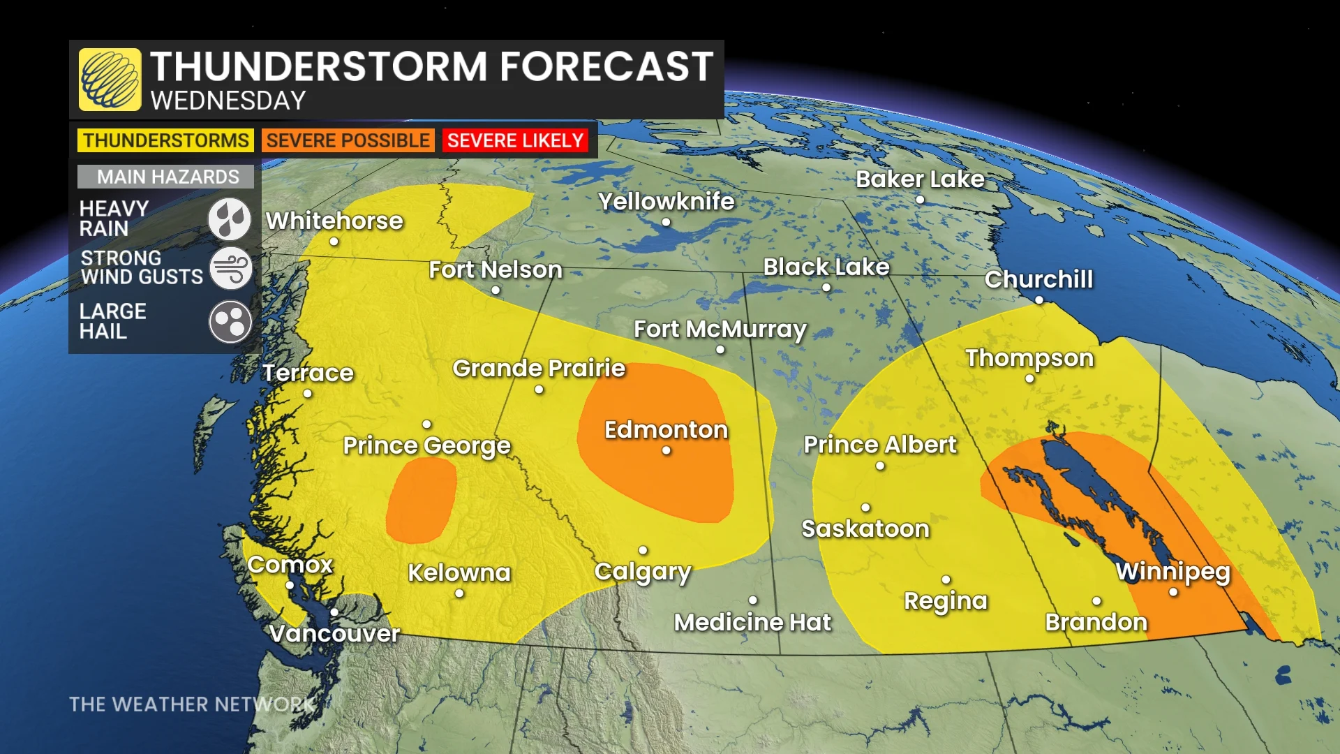
Meanwhile, in Manitoba, a low pressure sweeping across Manitoba is being fuelled by the ample moisture. As the warm fronts lift into southern Manitoba through the morning, it will start out as rain and embedded thunderstorms ahead of the warm front.
Into the evening, the cold front cuts through the moisture-rich area, triggering some of the severe storms, which are expected to remain quite isolated in nature with some along the Interlake region lining out. The main hazard will be large, loonie-sized hail, strong winds and heavy rainfall.
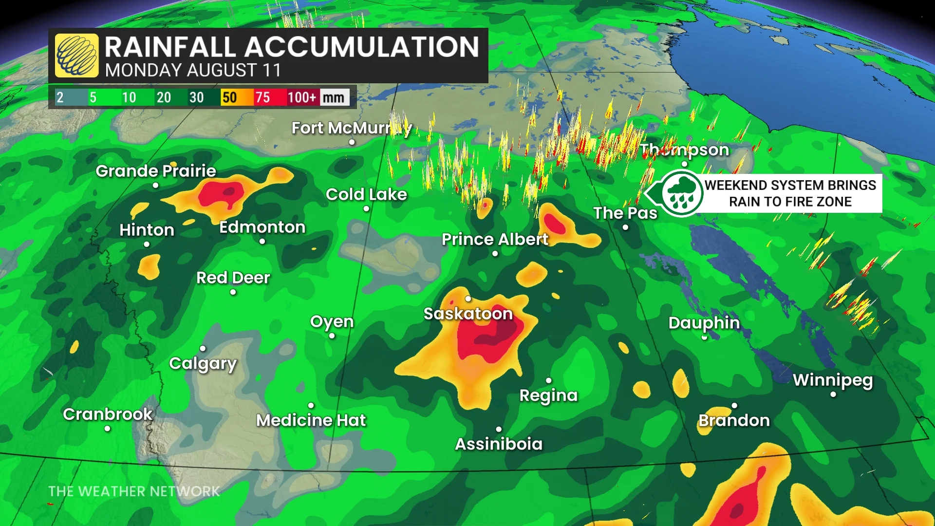
The threat will pop up on Thursday once again, with strong to severe storms possible across southern Saskatchewan and Manitoba into the late evening and overnight periods. Heavy rain will persist on the back end of the low pressure through Thursday and into Friday.
Some of the rain totals by Saturday may top 50 mm.
For both systems, the timing of the cold front will be a crucial role in the intensity of the storms.
A higher risk for strong to severe storms will occur Friday across southern Manitoba and into northwestern Ontario, including a risk for supercells with large hail and severe wind gusts.
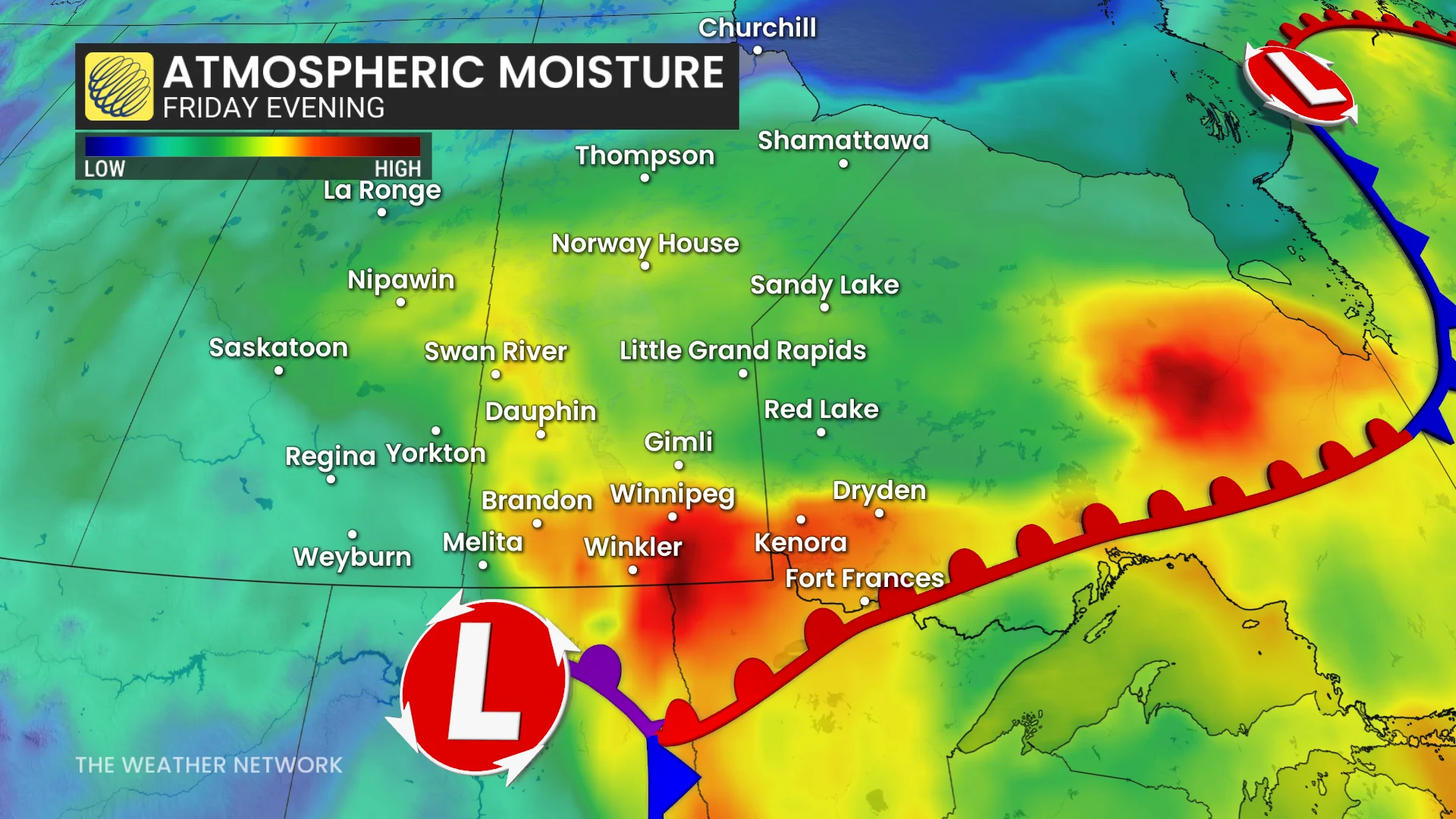
A moisture-rich air mass sitting over the Northern Plains of the U.S. pushes into southern Manitoba and northwestern Ontario. The combination of the air mass and daytime heating is expected to set up strong instability over the international border.
Aside from the storm potential, some relief is on the way for parts of the wildfire areas across northern Saskatchewan and Manitoba as a much wetter pattern is expected with above-normal precipitation, beginning late week and lasting through next week. However, the more northern fires could miss out on the substantial rain.
Stay tuned to The Weather Network for the latest forecast updates for the Prairies.