
Multi-day, wet weather stretch in Ontario is welcome news for drought
Southern Ontario will see three more days of wet weather this week, most welcoming after a considerably long period without rainfall for many locales
To say it's been dry in southern Ontario lately is a bit of an understatement. In fact, some areas have gone 13-16 days without rain.
Thankfully, there was some relief Sunday and Monday, and there is plenty more of it to come this week, especially on Thursday.
MUST SEE: Ontario's fall colours hang in the balance: Brilliant or browning?
However, the rainfall will come with thunderstorm risks on Tuesday and Wednesday, with the former featuring a better chance of severe storms for some locales.
It is important to remain weather-aware, and stay up-to-date on all of the latest watches and warnings as conditions change.
Ontario to see more wet weather this week, with thunderstorm risk
On Tuesday, a slow-moving, active weather boundary will trigger thunderstorms, with some possibly reaching severe limits, across southern Ontario.
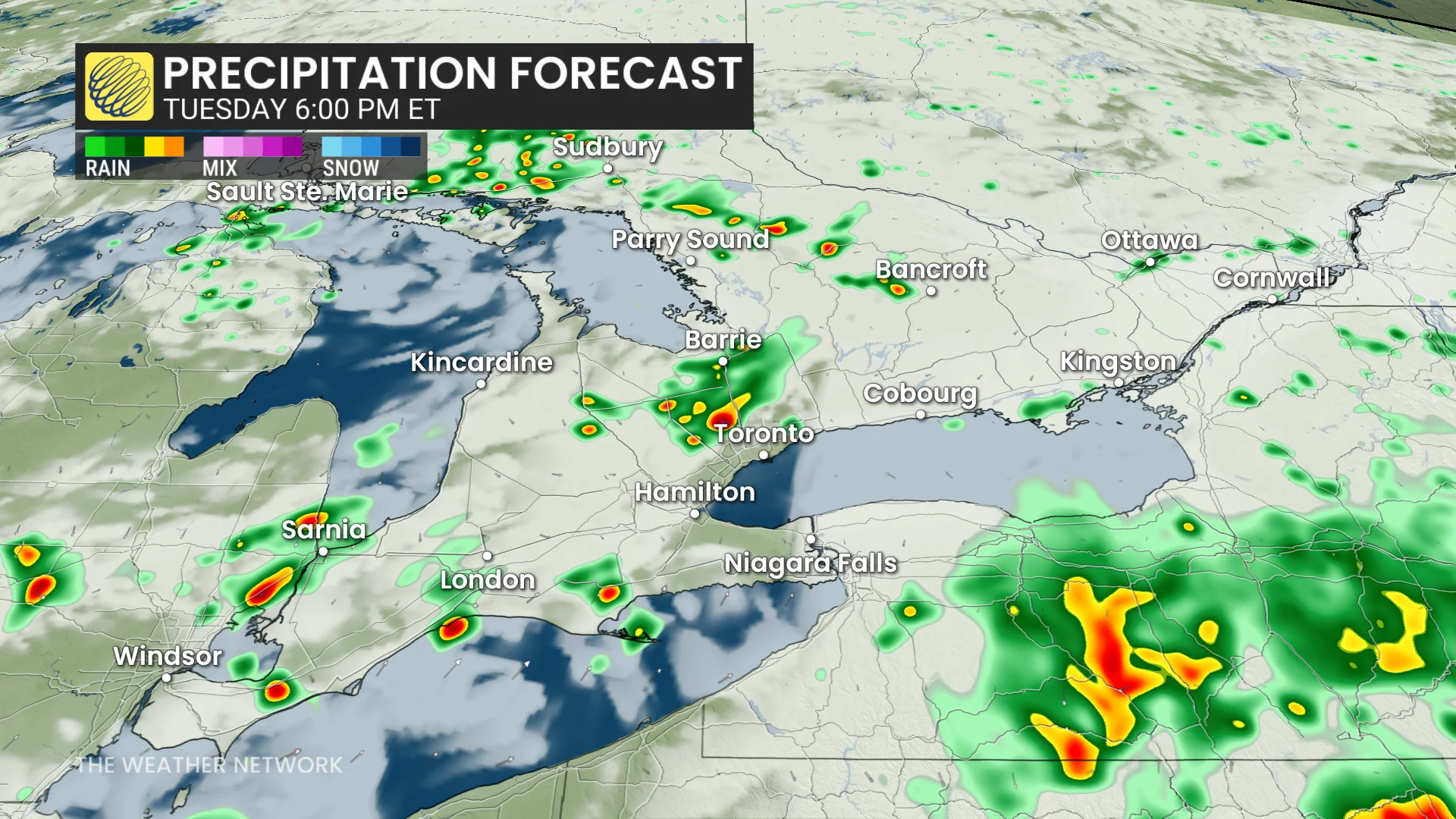
By the late afternoon, thunderstorm energy will be maximized, raising the threat. Pop-up thunderstorms are possible over Bancroft, the Greater Toronto Area (GTA) and across the southwest by the late afternoon through the evening hours.
Afternoon and evening commutes could be impacted by heavy rain and localized flooding, so expect slowdowns on the 400- and 401-series highways. In the south, severe thunderstorms are possible for Windsor, London and regions north of the GTA.

On Wednesday, expect more unpleasant weather with weak forcing in play that could lead to pop-up, isolated thunderstorms. Most of them should remain non-severe, and they will be very hit-and-miss in nature.
On Thursday, a more solid soaking is expected for some areas as a low-pressure system moves northwards from the states.

DON’T MISS: More dangerous than snow: Why driving in the rain can be a bigger hazard
Widespread, heavy rain and embedded thunderstorms are possible. The heaviest rain could total 30-50 mm but the locations at risk are uncertain at this time. Moderate to high PWATs increase rainfall rates and totals.

Models are favouring eastern Ontario at the moment, stretching from Peterborough to Ottawa.
Models also have much uncertainty in the timing and track of the storm, with the potential for the heaviest rain to stay stateside.
Stay with The Weather Network for all the latest on conditions across Ontario.